Winkelwagen
Geen items in winkelwagen
Ga naar winkelwagen
Kaarten
De beste wegenkaarten, routekaarten, fiets- of wandelkaarten en topografische kaarten vindt u hier!
Gaat u wandelen, met de auto toeren of op andere manier de omgeving op uw vakantiebestemming verkennen? Onze tip: neem een goede kaart mee! Er zijn speciale kaarten beschikbaar voor campervakanties, fietsroutes, pelgrimsroutes, wandeltochten en veel meer. Ook wegenatlassen en wegenkaarten kunnen handig zijn onderweg.
 Wandelkaart - Topografische kaart 1614 SB - Serie Bleue Falaise | IGN - Institut Géographique National
 Wandelkaart - Topografische kaart 1615 SB - Serie Bleue Argentan - Putanges-Pont-Ecrepin | IGN - Institut Géographique National
 Wandelkaart - Topografische kaart 1616 SB - Serie Bleue La Ferté-Macé, Pré-en-Pail, Carrouges | IGN - Institut Géographique National
 Wandelkaart - Topografische kaart 1617 SB - Serie Bleue Villaines-la-Juhel, St-Pierre-des-Nids, Alpes Mancelles | IGN - Institut Géographique National
 Wandelkaart - Topografische kaart 1619 SB - Serie Bleue Loué - Brûlon, Noyen-sur-Sarthe | IGN - Institut Géographique National
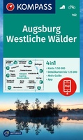 Wandelkaart 162 Augsburg - Westliche Wälder | Kompass
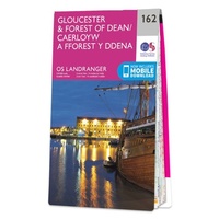 Wandelkaart - Topografische kaart 162 Landranger Gloucester & Forest of Dean - Wales | Ordnance Survey
 Wandelkaart - Fietskaart 162 Jalhay | NGI - Nationaal Geografisch Instituut
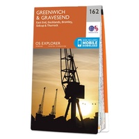 Wandelkaart - Topografische kaart 162 OS Explorer Map Greenwich, Gravesend | Ordnance Survey
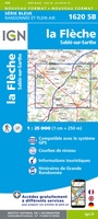 Topografische kaart - Wandelkaart 1620 SB - Serie Bleue La Flèche | IGN - Institut Géographique National
 Topografische kaart - Wandelkaart 1622 Longué-Jumelles, Beaufort-en-Vallée | IGN - Institut Géographique National
 Wandelkaart 1623 SB - Serie Bleue Saumur / Doué-la-Fontaine | IGN - Institut Géographique National
 Wandelkaart 1623ET Saumur / Bourgueil / Fontevraud-l'Abbaye | IGN - Institut Géographique National
 Topografische kaart - Wandelkaart 1624 SB - Serie Bleue Thouars | IGN - Institut Géographique National
 Topografische kaart - Wandelkaart 1625 SB - Serie Bleue Thouars | IGN - Institut Géographique National
 Wandelkaart - Topografische kaart 1626 SB - Serie Bleue Parthenay - Thenezay | IGN - Institut Géographique National
 Wandelkaart - Topografische kaart 1627 SB - Serie Bleue Mazieres-en-Gatine, Vasles | IGN - Institut Géographique National
 Wandelkaart - Topografische kaart 1628 SB - Serie Bleue St-Maixent-l'Ecole, Lezay | IGN - Institut Géographique National
 Wandelkaart - Topografische kaart 1629 Melle | IGN - Institut Géographique National
 Wandelkaart - Topografische kaart 116 Landranger Denbigh & Colwyn Bay | Ordnance Survey★★★★★
Laatste reviews

Mooie kaart
Mooi papier, super veel details. Mooie kleuren. Lang, maar dat is het land. Heb hem opgehangen met een latten systeem. Heel tof!
★★★★★ door Jaline 21 januari 2026 | Heeft dit artikel gekocht
eindelijk een mooie relief kaart
Ik was er lang naar op zoek, blij dat k hem heb. Hij werd snel en goed verpakt geleverd.
★★★★★ door erik 21 januari 2026 | Heeft dit artikel gekocht
Goede service
Na het bestellen van de kaarten krijg ik een bericht dat sommige kaarten niet op voorraad waren. Daarbij werd me netjes de vraag gesteld of …
★★★★★ door Bart 21 januari 2026 | Heeft dit artikel gekocht
Nuttig voor wie nog nooit in Denemarken is geweest
Boekje met nuttige tips over vervoer ter plekke maar ook hoe er te komen, overnachten, betalen etc. etc. Kaartjes met de route zijn wel wat …
★★★★★ door I. Eleveld 19 januari 2026 | Heeft dit artikel gekocht