Ierland
 Wandelgids The Kerry Way | The Collins Press
Handzame kleine gids van de Kerry Way. Vereenvoudigd kaartmateriaal maakt het makkelijk om te gebruiken, goede tekst. The Kerry Way is Ireland's longest marked trail and one of the most …
 Reisgids Wild Atlantic Way - Where to eat and stay | Collins
Een handzame gids met de beste plekken om te eten en overnachten langs de Wild Atlantic Way in Ierland. A guide to the best places to enjoy the local Irish …
 Wandelgids 5988 Wanderführer Irland und Nordirland - Ierland en Noord Ierland | Kompass
Goede Duitstalige wandelgids met heldere beschrijvingen van de wandeltochten. Met hoogteprofiel, kaartje en de benodigde praktische informatie als bijvoorbeeld de startlocatie met GPS coordinaten. De wandelingen zijn ingedeeld in zwaarte …
 Reisgids Road Trips Galway & the West of Ireland | Lonely Planet
Handige kleine reisgids over dit specifieke deel waarbij je allerlei suggesties krijgt om naast en bij de hoofdroute leuke dingen te doen. Goede kaartjes, veel praktische informatie. Whether exploring …
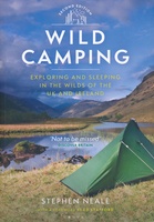 Campinggids Wild Camping UK and Ireland | Conway
Als je echt op zoek bent naar bijzondere kampeerplekken in Engeland, Schotland en Ierland dan is dit je boek: het beschijft de meest afgelegen plekkenin het wild waar je je …
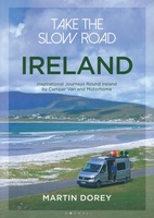 Campergids Take the Slow Road: Ireland - Ierland | Bloomsbury
The ultimate guide to the very best scenic and fun routes for camper vans and motorhomes around the valleys, mountains and coastlines of beautiful Ireland. Forget hurrying. Forget putting your …
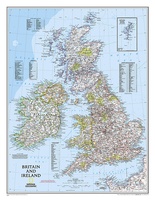 Wandkaart Britain and Ireland - Groot Brittannië en Ierland, 60 x 76 cm | National Geographic
This classic-style map of England and Wales shows political boundaries, major highways and roads, cities and towns, airports, and other geographic details. Thousands of place-names and exact borders are carefully …
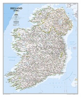 Wandkaart Ireland – Ierland, 76 x 91 cm | National Geographic
National Geographic Maps' new Ireland wall map is one of the most authoritative maps yet published of the Emerald Isle. Of the nearly 1,000 place-names shown on this map, all …
 Reisgids Road Trips Ireland - Ierland | Dorling Kindersley
Take your time with Road Trips Great Ireland and discover 25 leisurely drives through the island’s brooding hills, tranquil loughs and emerald-green fields. Driving through Ireland is the perfect …
 Wandelgids The Comeragh, Galtee, Knockmealdown & Slieve Bloom Mountains | The Collins Press
The Comeragh, Galtee, Knockmealdown & Slieve Bloom Mountains : A Walking Guide John G. O’Dwyer’s comprehensive guide to the best walks in Tipperary and Waterford has now been updated and …
 Fietsgids Cols and Passes of the British Isles
A col is the lowest point on the saddle between two mountains. Graham Robb has spent years uncovering and cataloguing the 2,002 cols and 105 passes scattered across the British …
 Wegenatlas The Wild Atlantic Way Ierland | Xploreit Maps
Yvonne Gordon provides an essential guide to Ireland's epic coastal driving route - the Wild Atlantic Way. In this newly revised and updated edition she divides the route into 16 …
★★★★★★★★★★ Reisgids Insight Guide Ierland | Uitgeverij Cambium
Een rijk geillustreerde reisgids met diepgaande teksten: één van de beste reisgidsen die er bestaan. Eerste deel bestaat uit een beschrijving van de unieke aspecten van de regio, daarna een …
★★★★★ Reisverhaal Vijftig tinten groen - Langs de Ierse westkust | Gerrit Jan Zwier
Na veertig jaar schoffelen en snoeien in de tuin der letteren keert Gerrit Jan Zwier terug naar een van zijn oudste liefdes: Ierland. In zijn eerste boek daarover, 'Mijn Ierland', …
 Reisgids Marco Polo NL Ierland | 62Damrak
Marco Polo reisgids voor Ierland. Handig pocketformaat, boordevol informatie, met uitneembare kaart achter in het boek en atlas-pagina's. Met Insider Tips om het échte Ierland te ontdekken en de TOP …
 Wegenkaart - landkaart Pocket Map Wild Atlantic Way | Collins
Handy full-colour map of Ireland’s Wild Atlantic Way with a high level of detail. Clear mapping of the full 2500 km (over 1500 miles) route, showing the road network and …
★★★★★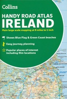 Wegenatlas Handy Road Atlas Ireland - Ierland | Collins
Handzame wegenatlas op A5 formaat van Ierland. Vrij grove schaal maar heel handig door formaat en goed kaartbeeld. Met enkele stadsplattegronden en een paar pagina's met hoogtepunten van het land. …
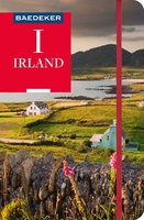 Reisgids Irland - Ierland | Baedeker Reisgidsen
Een van de beste en meest complete reisgidsen van het land. Een klassieker in het Duits! Met heel veel informatie over alles wat je maar kunt bedenken, inclusief een losse …
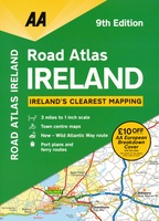 Wegenatlas Road Atlas Ireland - Ierland | AA Publishing
Handige wegenatlas van Ierland en Noord-Ierland, schaal 1:200.000. Met 10 stadsplattegronden: Belfast, Cork, Londonderry, Dublin, Galway, Killarney, Kilkenny, Limerick, Sligo and Waterford. Created from brand new mapping data, this atlas …
★★★★★ Reisverhaal Ierland - mijn Ierland | Adriaan Bekman
Laatste reviews

Niet echt voor beginners. Ook zijn de routes soms moeilijk qua logistiek. Weer terugkomen aan het eind bv. En in voorseizoen (mei) blijft er niet …
★★★★★ door Tjeerd 17 mei 2024 | Heeft dit artikel gekocht
Van te voren had ik een andere kaart op het oog. Toen ik in de winkel was adviseerde zij mij deze kaart. Op hun verzoek …
★★★★★ door Koen 17 mei 2024 | Heeft dit artikel gekocht
Ideale schaal waar ook de kleinere wegen duidelijk zijn aangegeven. Beschrijving op website is correct.
★★★★★ door Peter 16 mei 2024 | Heeft dit artikel gekocht
Overzichtelijke kaart. Niks op aan te merken.
★★★★★ door Bastiaan de Leeuw 16 mei 2024 | Heeft dit artikel gekocht