Ierland
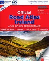 Wegenatlas Official Roadatlas of Ireland - Ierland | Ordnance Survey Ireland
Mooie atlas met bijzonder kleurgebruik. Hoogte wordt hierdoor zeer duidelijk weergegeven. Met alle noodzakelijke en toeristische informatie, afstandentabel, stadsplattegronden en register . In ringband uitgevoerd tussen A4 en A5 qua …
★★★★★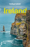 Reisgids Ireland - Ierland | Lonely Planet
De perfecte reisgids voor zowel de georganiseerde als de zelfstandige reiziger. Naast een algemene inleiding van het land / streek vol met praktische informatie over hoe je er het beste …
★★★★★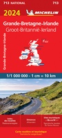 Wegenkaart - landkaart 713 Groot-Brittannië & Ierland 2024 Great Britain | Michelin
Zoals je van Michelin mag verwachten is deze kaart zeer overzichtelijk en heeft een duidelijk helder kaartbeeld. De kaart geeft uitgebreid toeristische informatie weer. Met stadsplattegrond van de hoofdstad. This …
★★★★★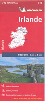 Wegenkaart - landkaart 712 Ierland | Michelin
Zoals je van Michelin mag verwachten is deze kaart zeer overzichtelijk en heeft een duidelijk helder kaartbeeld. De kaart geeft uitgebreid toeristische informatie weer. Met register, afstanden en reistijden. Wegen …
★★★★★ Reisverhaal Connemara, listening to the wind | Tim Robinson
Een geweldig boek met prachtige sfeerbeelden in het verhaal. Heerlijk om te lezen voor iedereen met een hart voor Ierland en Connemara in het bijzonder. The first volume in Tim …
 Wegenatlas Great Britain and Ireland 2024 - Main Roads Atlas (A4-Spiral) | Michelin
Full of practical features, the Michelin Great Britain & Ireland 2024 - Main Roads Atlas (A4-Spiral) is the perfect companion for your everyday journey and holiday planning. Updated every year, …
★★★★★ Fotoboek Ireland's Islands | O'Brien Press
Hardcover fotoboek met mooie foto's en begeleidende teksten van de beeldschone Ierse eilanden. Take a photographic journey around Ireland's coast and explore the landscape, history, heritage and wildlife of the …
 Fotoboek Ireland's Wild Atlantic Way | O'Brien Press
Take a photographic journey down Ireland's Atlantic coast from Donegal in the north to Cork in the south. This beautiful book showcases the west coast in all its wild beauty: …
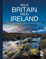 Fotoboek Wild Britain - Wild Ireland | Monaco Books
* Atmospheric mountain photography and panoramic fold-out pages* Special features on flora and fauna* Information and web addresses on protected areas and regions Britain and Ireland have so much to …
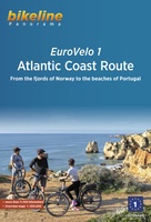 Fietsgids Bikeline Eurovelo 1 - Atlantic Coast Route | Esterbauer
Fantastische route van 11.150 km! For decades, thousands of vacationers have enjoyed cycling tours as the optimal travel method, and their numbers are growing daily. There are countless long-distance routes and …
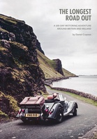 Reisverhaal The Longest Road Out | Daniel Craanen
The Longest Road Out is the road trip of a lifetime. Driving it gave us, without doubt, some of our favourite memories: from sampling succulent oysters on a sun-drenched Guernsey …
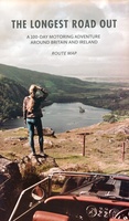 Wegenkaart - landkaart Routemap The Longest Road Out | Longestroadout
Deze kaart hoort bij het boek The Longest Road Out
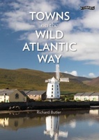 Reisgids Towns on the Wild Atlantic Way | O'Brien Press
From the drama of Donegal to the beauty of west Cork, the 2,500km Wild Atlantic Way is one of the world's greatest tourist routes. The unique towns along the way …
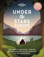 Reisinspiratieboek Under the Stars - Europe | Lonely Planet
From wild camping to curling up in a cabin, discover 200 amazing places to sleep under the stars in Europe. Lonely Planet's experts have scoured the continent to recommend the …
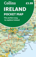 Wegenkaart - landkaart Pocket Map Ireland pocket map - Ierland | Collins
Kleine handzame kaart van Ierland. Explore Ireland with this handy, full colour map. Handy little full colour map of Ireland at an excellent price. It is double-sided, with the …
★★★★★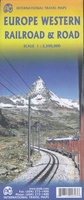 Spoorwegenkaart Europe Western Railroad & Road | ITMB
Spoorwegen kaart van West Europa in kleur. Schaal 1:2,500,000. Toont spoorlijnen, snelwegen, secundaire wegen en andere wegen, veerboten en belangrijke scheepvaartdiensten; internationale grenzen, de grenzen van de gebieden met reisbeperkingen; …
★★★★★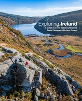 Reisgids Exploring Ireland | Three Rock Books
Exploring Ireland is essential reading for anyone with an interest in the outdoors, from families looking for gentle Sunday strolls to experienced adventurers seeking out challenging hikes, paddles and cycles. …
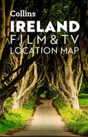 Wegenkaart - landkaart Pocket Map Ireland Film and TV Location Map | Collins
Full-colour, handy guide to more than 50 of the most popular film and TV locations in Ireland. Striking images and detailed descriptions allow for a comprehensive guide to Ireland's most …
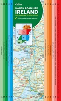 Wegenkaart - landkaart Map of Ireland Handy | Collins
Explore new places with this comprehensive map of Ireland from Collins. An easy-to-use route-planning map covering the whole of Ireland. It has the convenience of an atlas with all the …
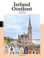 Reisgids PassePartout Ierland Oostkust | Edicola
Als tegenhanger van de toeristische ontplooiing van de Ierse zuid- en westkust ging men het oostelijk deel van Ierland promoten onder de slogan ’The Ancient East’. Hiermee wordt de regio …
★★★★★
- 1
- 2
- 3
- Volgende >>
- 11
Laatste reviews

Ik ben zeer tevreden over mijn aankoop. Ik heb de kaarten elke dag van de vakantie gebruikt en ze waren voor mij duidelijk en waardevol. …
★★★★★ door Jeanne Melters 30 april 2024 | Heeft dit artikel gekocht
De kaart was bijzonder goed en zeer gedetaildeerd. Wij hebben er als wandelaars veel plezier van gehad. Ook met het rijden was de kaart , …
★★★★★ door Albert Abbink 30 april 2024 | Heeft dit artikel gekocht
Snel en goed geleverd Klopt precies zoals vermeld op site 👍👍
★★★★★ door Jan Schreutelkamp 30 april 2024 | Heeft dit artikel gekocht
Fijne gids met leuke wandelingen. Afstanden en hoogten zijn niet nauwkeurig. Je kunt er gerust wat kilometers en hoogtemeters bijtellen.
★★★★★ door wijnand 30 april 2024 | Heeft dit artikel gekocht