Kaarten - Schotland
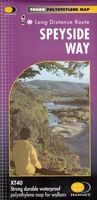 Wandelkaart Speyside Walk (Schotland) | Harvey Maps
Een bijzonder handige kaart van dit lange-afstands-wandelpad van 144 km. Op waterafstotend papier met veel details, uitstekend en voldoende voor deze route. A leap forward in technical excellence: Tough, durable …
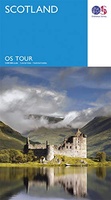 Wegenkaart - landkaart 12 Tour Map Scotland | Ordnance Survey
If you are on holiday and looking for a simple map containing all the information you need to make the most of your visit, the Tour maps are for you. …
★★★★★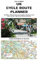 Fietskaart The Ultimate UK Cycle Route Planner | Excellent Books
Fully updated and revised 4th edition for 2022 with an increased sheet size. One of the best selling UK cycle publications giving an overview of all the main signed UK …
★★★★★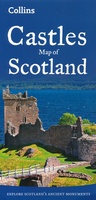 Wegenkaart - landkaart Castles map of Scotland - Schotland kastelen | Collins
Kaart waarop meer dan 700 kastelen in Schotland staan aangegeven. Explore Scotland’s ancient monuments with this pictorial map featuring over 700 castles and fortified houses. Includes an easy-to-use index listing …
★★★★★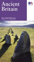 Wegenkaart - landkaart Ancient Britain | Ordnance Survey
The Ordnance Survey Ancient Britain map is a comprehensive guide to the most important archaeological sites of early English, Welsh and Scottish history. Ordnance Survey's Ancient Britain map shows Neolithic, …
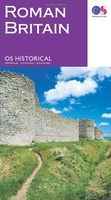 Wegenkaart - landkaart Roman Britain | Ordnance Survey
An informative map showing the location of the most important ancient monuments of Roman Britain. The map has been produced by Ordnance Survey in collaboration with the Ancient Monument Trusts …
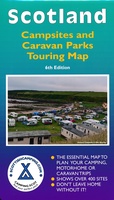 Camperkaart - Campinggids Scotland Campsites and Caravan Parks - Touring map | Scottishcamping.com
Dit soort kaarten zouden ze voor elk land moeten maken: heel duidelijk weergegeven vind je hier alle campings in Schotland op de voorzijde en op de achterzijde de adressen en …
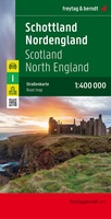 Wegenkaart - landkaart Schotland en Noord Engeland | Freytag & Berndt
Goede tweezijdige wegenkaart van het Noord Engeland en Schotland. Met register en enkele stadsplattegronden. De berijdbare wegen zijn goed weergeven, zowel de hoofdwegen als provinciale en lokale wegen; wegnummers worden …
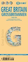
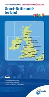 Wegenkaart - landkaart Groot-Brittanië en Ierland | ANWB Media
De ANWB heeft een grote serie wegenkaarten van de belangrijkste landen en streken. Het zijn echte overzichtskaarten van vaak een wat groter gebied. Deze keuze zorgt er voor dat de …
★★★★★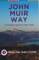 Wandelkaart John Muir Way | SNH
Geplastificeerde kaart van de John Muir Way in Schotland, 215 km van Helensburg naar Dunbar. De route staat goed ingetekend op deze kaart.
★★★★★ Wegenkaart - landkaart Great Britain & Ireland - Groot Brittannië & Ierland | Marco Polo
Duidelijke wegenkaart van Marco Polo: alle wegen, zowel de verharde als belangrijke onverharde wegen zijn weergegeven. Mooie toeristisch interessante wegen die de moeite waard zijn, zijn groen gearceerd. Veel toeristische …
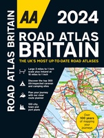 Wegenatlas Road Atlas Britain 2024 - A4 | AA Publishing
Wegenatlas, met spiraal, van Groot-Brittannie, Engeland, Wales en Schotland, met toeristische informatie This top-selling road atlas showcases Britain’s clearest mapping from the experts from the AA. Each page has been …
★★★★★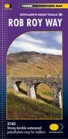 Wandelkaart Rob Roy Way | Harvey Maps
Mooie, duidelijke kaart van de Rob Roy Way in Schotland. Geplastificeerd met veel extra informatie en uitsnedes van de route. One of Scotland's Great Trails Rob Roy Way …
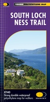 Wandelkaart South Loch Ness Trail | Harvey Maps
Mooie, duidelijke kaart van de South Loch Ness Trail in Schotland. Geplastificeerd met veel extra informatie en uitsnedes van de route. This map has been produced in association with …
★★★★★ Wegenkaart - landkaart Scotland - Schotland | ITMB
Anyone who has been in this business for a few years remembers Ordnance Survey and their brilliantly detailed artwork. They should also remember that OS guarded this artwork religiously. That …
★★★★★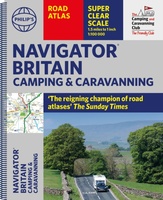 Wegenatlas Navigator Camping and Caravanning – Atlas of Britain | Philip's Maps
THE MUST-HAVE ATLAS OF BRITAIN FOR CAMPING, CARAVANNING AND MOTORHOMES'A map that beats all others' - The Daily Telegraph'Scale, accuracy and clarity are without parallel' - Driving Magazine'No. 1 in …
★★★★★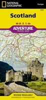 Wegenkaart - landkaart 3326 Adventure Map Scotland - Schotland | National Geographic
Wegenkaart van Schotland met vermelding van veel bezienswaardigheden, nationale parken en attrakties. Watervast en scheurvast. Juist door deze vermeldingen onderscheidt de kaart zich van andere wegenkaarten. National Geographic's Scotland AdventureMapis …
★★★★★★★★★★ Wegenkaart - landkaart Groot - Brittannië | Borch
Mooie geplasticieerde kaart van Groot - Brittanië. Deze kaart biedt een goed overzicht van het land met detailkaarten. Our soft-laminated folded map of Great Britain shows: Scotland and Northern …
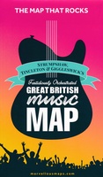 Wegenkaart - landkaart Great British Music Map | Strumpshaw, Tincleton & Giggleswick's Marvellous Maps
When it comes to music, Britain calls the tune on the world stage, playing second fiddle to nobody. This new and unique fold-out map celebrates Britain’s globe-straddling musical prowess, featuring …
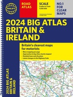 Wegenatlas Big Atlas Britain & Ireland 2023 A3-Formaat | Philip's Maps
Goede gedetailleerde wegenatlas van Groot-Brittannië, schaal 1:200.000 met een overzichtskaart van Ierland, schaal 1:1.000.000. Groot formaat, A3, en in ringband. Philip's is No. 1 in the UK for clear maps …
★★★★★
- 1
- 2
- 3
- Volgende >>
- 4
Laatste reviews

het is heel goed
★★★★★ door Marc 11 mei 2024 | Heeft dit artikel gekocht
Hallo, metrokaart van Delft gekocht. Die bestaat natuurlijk niet, maar wel heel leuk bedacht met de gekste steenkolen Engelse termen als haltes. Hilarisch. Ik hen …
★★★★★ door Nellie 10 mei 2024 | Heeft dit artikel gekocht
We hebben het boekje alleen gebruikt om wandelingen uit te halen. I.v.m. kleine kinderen hebben we vooral de 'short walks for motorists' gelopen, die echter …
★★★★★ door Jochem 10 mei 2024 | Heeft dit artikel gekocht
Prima. Wel erg gefocust op jonge mensen die geïnteresseerd zouden zijn in hippe winkeltjes en cafeetjes.
★★★★★ door Miquel 10 mei 2024 | Heeft dit artikel gekocht