Winkelwagen
Geen items in winkelwagen
Ga naar winkelwagen
Kaarten - Normandië
 Wandelkaart - Topografische kaart 1710ET Le Havre, Etretat, PNR des Boucles Seine Normandie | IGN - Institut Géographique National★★★★★
 Wandelkaart - Topografische kaart 1811OT Pont Audemer Tancarville | IGN - Institut Géographique National★★★★★
 Wandelkaart - Topografische kaart 1911OT Forets De Brotonne | IGN - Institut Géographique National
 Wandelkaart - Topografische kaart 1911ET Rouen, Forets Rouennaises, PNR | IGN - Institut Géographique National
 Wandelkaart - Topografische kaart 1711OT Honfleur Deauville | IGN - Institut Géographique National★★★★★
 Wandelkaart - Topografische kaart 1612OT Caen - Ouistreham , Normandië | IGN - Institut Géographique National
 Wandelkaart - Topografische kaart 1512OT Bayeux Arromanches Les Bains Plages - Normandië | IGN - Institut Géographique National★★★★★
 Wandelkaart - Topografische kaart 1412OT Pointe Du Hoc - Omaha Beach | IGN - Institut Géographique National★★★★★
 Wandelkaart - Topografische kaart 1310OT Cherbourg, Pointe de Barfleur | IGN - Institut Géographique National
 Wandelkaart - Topografische kaart 1210OT Cherbourg-en-Cotentin, Cap de la Hague | IGN - Institut Géographique National
 Wegenkaart - landkaart 117 Côte Normande | Michelin★★★★★★★★★★
 Wegenkaart - landkaart Normandie D Day, june 6, 1944 | IGN - Institut Géographique National★★★★★★★★★★
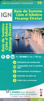 Fietskaart - Wandelkaart 36 Baie De Somme - Cote d'Albatre - Fecamp - Etretat - Normandië | IGN - Institut Géographique National★★★★★★★★★★
 Wandelkaart - Topografische kaart 1211OT Les Pieux, Barneville, Carteret | IGN - Institut Géographique National
 Wandelkaart - Topografische kaart 1212ET La Haye-du-Puits Lessay | IGN - Institut Géographique National
 Wandelkaart - Topografische kaart 1214ET Granville, Coutances, Iles Chausey | IGN - Institut Géographique National
 Wandelkaart - Topografische kaart 1215ET Avranches, Granville, Le Mont Saint Michel | IGN - Institut Géographique National
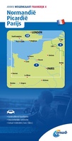 Wegenkaart - landkaart 4 Normandië - Picardië - Parijs | ANWB Media
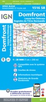 Wandelkaart - Topografische kaart 1516SB Domfront | IGN - Institut Géographique National
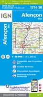 Wandelkaart - Topografische kaart 1716SB Alençon - Sées | IGN - Institut Géographique National
Laatste reviews

handige kaart
Vorig jaar al stuk in Denemarken gefietst. Dat smaakte naar meer. Dus nu de nog ontbrekende kaart aangeschaft. Dit zijn perfecte kaarten om op te …
★★★★★ door Nicolette Kroon 14 mei 2024 | Heeft dit artikel gekocht
geweldig ook voor de fietser duidelijk leesbaar
kaart voldoet aaan hetgeen we nodig hebben . goeed overzicht door de kleuren en hoogte meters en vooral tekst groote voor onze aankomende fietsreis
★★★★★ door marc verschueren 13 mei 2024 | Heeft dit artikel gekocht
Uitstekende gedetailleerde kaart
Mooie gedetailleerde kaart, duidelijk leesbaar, stevig, met handig plastic hoesje en extra boekje met tips en tochten.
★★★★★ door Chris 13 mei 2024 | Heeft dit artikel gekocht
Uitstekende gedetailleerde kaart
Handige kaart, duidelijk leesbaar en up-to-date. Stevig en met mooi plastic hoesje en extra boekje met tips.
★★★★★ door Chris 13 mei 2024 | Heeft dit artikel gekocht