Winkelwagen
Geen items in winkelwagen
Ga naar winkelwagen
Kaarten - Centre - Val de Loire
 Wandelkaart - Topografische kaart 2221SB Lamotte-Beuvron | IGN - Institut Géographique National
 Topografische kaart - Wandelkaart 2321SB Argent-sur-Sauldre | IGN - Institut Géographique National
 Wandelkaart - Topografische kaart 1822SB Tours - Langeais | IGN - Institut Géographique National
 Wandelkaart - Topografische kaart 1922SB Amboise, Montlouis-sur-Loire | IGN - Institut Géographique National
 Topografische kaart - Wandelkaart 2222SB Salbris | IGN - Institut Géographique National
 Topografische kaart - Wandelkaart 2322SB Aubigny-sur-Nère | IGN - Institut Géographique National
 Topografische kaart - Wandelkaart 1823SB Chambray-les-Tours | IGN - Institut Géographique National
 Wandelkaart - Topografische kaart 2323SB St-Martin-d'Auxigny, Foëcy | IGN - Institut Géographique National
 Wandelkaart - Topografische kaart 1724SB Loudun – Richelieu | IGN - Institut Géographique National★★★★★
 Wandelkaart - Topografische kaart 2324SB Bourges, Mehun-sur-Yèvre | IGN - Institut Géographique National
 Wandelkaart - Topografische kaart 1925SB Preuilly-sur-Claise, le Grand-Pressigny | IGN - Institut Géographique National
 Wandelkaart - Topografische kaart 2025SB Buzançais, Mézières-en-Brenne | IGN - Institut Géographique National
 Wandelkaart - Topografische kaart 2125SB Châteauroux, Levroux, Villedieu-sur-Indre | IGN - Institut Géographique National
 Wandelkaart - Topografische kaart 2225SB Issoudun, Neuvy-Paillouxt | IGN - Institut Géographique National
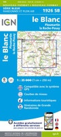 Wandelkaart - Topografische kaart 1926SB Le Blanc, Pleumartin, La Roche-Posay | IGN - Institut Géographique National
 Wandelkaart - Topografische kaart 2026SB St-Gaultier, Rosney | IGN - Institut Géographique National
 Wandelkaart - Topografische kaart 2126SB Le Poinçonnet, Velles, Luant | IGN - Institut Géographique National
 Wandelkaart - Topografische kaart 2226SB Ardentes - La Berthenoux | IGN - Institut Géographique National
 Wandelkaart - Topografische kaart 1520SB Château-Gontier | IGN - Institut Géographique National
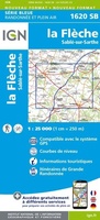 Topografische kaart - Wandelkaart 1620SB La Flèche | IGN - Institut Géographique National
Laatste reviews

Beetje lastige routes
Niet echt voor beginners. Ook zijn de routes soms moeilijk qua logistiek. Weer terugkomen aan het eind bv. En in voorseizoen (mei) blijft er niet …
★★★★★ door Tjeerd 17 mei 2024 | Heeft dit artikel gekocht
Goede service
Van te voren had ik een andere kaart op het oog. Toen ik in de winkel was adviseerde zij mij deze kaart. Op hun verzoek …
★★★★★ door Koen 17 mei 2024 | Heeft dit artikel gekocht
Goede kaart op fijne schaal
Ideale schaal waar ook de kleinere wegen duidelijk zijn aangegeven. Beschrijving op website is correct.
★★★★★ door Peter 16 mei 2024 | Heeft dit artikel gekocht
Fijne kaart
Overzichtelijke kaart. Niks op aan te merken.
★★★★★ door Bastiaan de Leeuw 16 mei 2024 | Heeft dit artikel gekocht