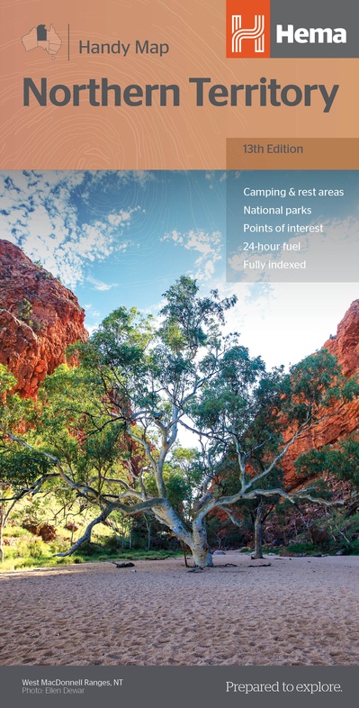
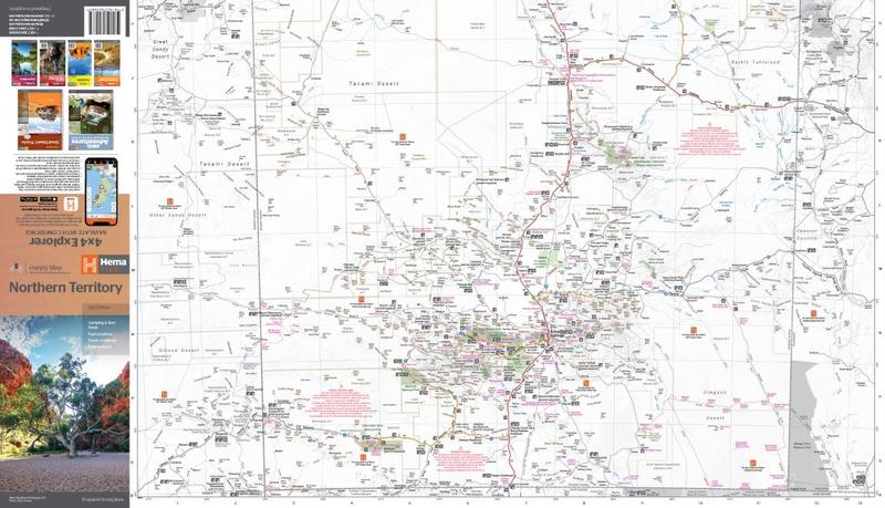
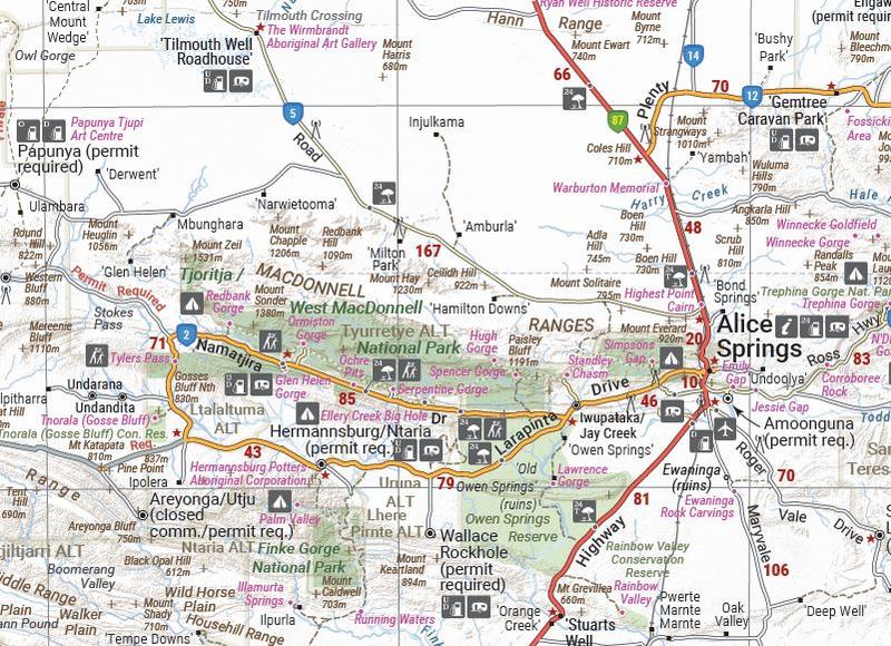
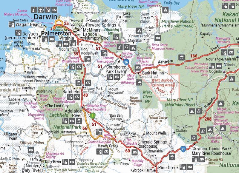
Wegenkaart - landkaart Northern Territory handy map - tweezijdig | Hema Maps (9781925625684)
- ISBN / CODE: 9781925625684
- Schaal: 1:1680000
- Uitgever: Hema Maps
- Soort: Wegenkaart
- Serie: handy map
- Taal: Engels
- Uitvoering: Papier
- Bindwijze: -
- Schrijf als eerste een review
-
€ 11,50
Op voorraad. Voor 17.00 uur op werkdagen besteld, morgen in huis in Nederland Levertijd Belgie
Gratis verzending in Nederland vanaf €35,-


Beschrijving
Duidelijke, handzame kaart van de Northern Territory.
- GPS surveyed roads and tracks
- Fuel stops
- 4WD tracks
- Camping areas
- Historic sites
- Detailed inset maps
Reviews
Geen reviews gevonden voor dit product.
Schrijf een review
Graag horen wij wat u van dit artikel vindt. Vindt u het goed, leuk, mooi, slecht, lelijk, onbruikbaar of erg handig: schrijf gerust alles op! Het is niet alleen leuk om te doen maar u informeert andere klanten er ook nog mee!
Ook interessant voor oceanie/australie/northernterritoriesnoordaustralie
-

Reisgids Trotter Australië - de oost
€ 22,99Reisgidsen Northern Territories - Noord Australië -

Reisgids South Australia & Northern
€ 22,50Reisgidsen Northern Territories - Noord Australië -

Wegenkaart - landkaart Iconic Map Th
€ 15,95Wegenkaarten Northern Territories - Noord Australië -

Wegenatlas The Kimberley Atlas & Gui
€ 47,50Wegenatlassen Northern Territories - Noord Australië -

Stadsplattegrond Darwin en omgeving
€ 11,50Stadsplattegronden Northern Territories - Noord Australië