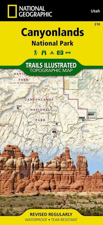
Wandelkaart - Topografische kaart 210 Canyonlands National Park | National Geographic (9781566953269)
Utah
- ISBN / CODE: 9781566953269
- Schaal: 1:70000
- Uitgever: National Geographic
- Soort: Topografische kaart, Wandelkaart
- Taal: Engels
- Schrijf als eerste een review
-
€ 16,95
Leverbaar in 3 - 5 werkdagen in huis in Nederland Levertijd Belgie
Gratis verzending in Nederland vanaf €35,-
.jpg)
-
Overzicht Wandelkaarten Utah Trails Illustrated National Geographic

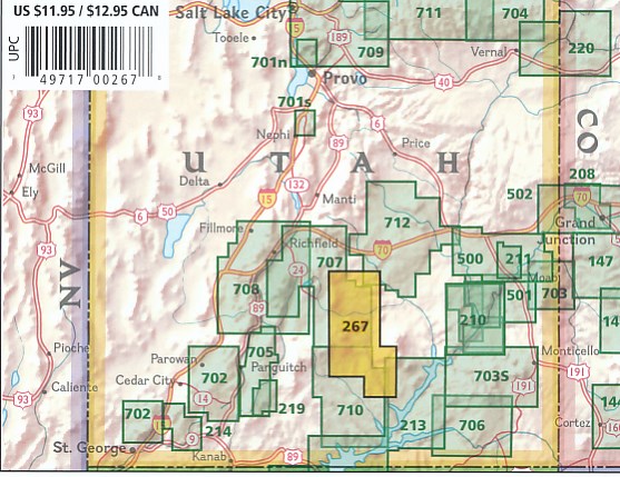
Producten op deze overzichtskaart:
Klik op een product om naar de pagina van dat product te gaan.
- Wandelkaart - Topografische kaart 210 Canyonlands National Park | National Geographic
- Wandelkaart - Topografische kaart 211 Arches National Park | National Geographic
- Wandelkaart - Topografische kaart 214 Zion National Park | National Geographic
- Wandelkaart - Topografische kaart 219 Bryce Canyon National Park | National Geographic
- Wandelkaart - Topografische kaart 220 Dinosaur National Monument | National Geographic
- Wandelkaart 267 Capitol Reef National Park | National Geographic
- Wandelkaart - Topografische kaart 310 Island in the Sky District - Canyonlands National Park | National Geographic
- Wandelkaart - Topografische kaart 311 Needles District - Canyonlands National Park | National Geographic
- Wandelkaart - Topografische kaart 312 Maze District - Canyonlands National Park | National Geographic
- Wandelkaart - Topografische kaart 501 Moab South | National Geographic
- Wandelkaart - Topografische kaart 702 Cedar Mountain - Pine Valley Mountain - Dixie National Forest | National Geographic
- Wandelkaart - Topografische kaart 703 Manti La-Sal National Forest | National Geographic
- Wandelkaart - Topografische kaart 704 Flaming Gorge National Recreation Area | National Geographic
- Wandelkaart - Topografische kaart 705 Paunsaugunt Plateau - Mount Dutton - Bryce Canyon | National Geographic
- Wandelkaart - Topografische kaart 710 Canyons of the Escalante - Grand Staircase-Escalante National Monument | National Geographic
Overzichtskaarten
Beschrijving
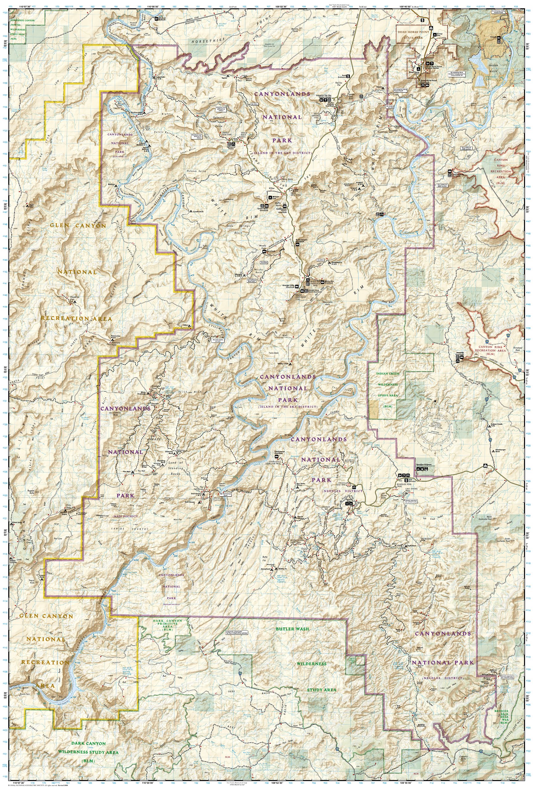
Prachtige geplastificeerde kaart van het nationaal park. Met alle recreatieve voorzieningen als campsites, maar ook met topografische details en wandelroutes ed. Door uitgekiend kleurgebruik zeer prettig in gebruik. Scheur en watervast!
Trails Illustrated maps are the most trusted and popular recreation maps available. Continually setting the standard for accuracy, each map is crafted in conjunction with local land managers, and undergoes rigorous review and enhancement before being printed on waterproof, tear-resistant material.
Each Trails Illustrated map contains detailed topographic information, clearly marked and named trails, recreational points of interest, and navigational aids. National Park series maps contain useful details for planning your visit. State series titles cover popular recreation areas, ideal for done-in-a-day activities.
Included on the map are Canyonlands National Park, the Island in the Sky district, the Needles district, and the Maze district. The map also includes the Colorado River, the Green River, Indian Creek Wilderness, Bridger Jack Mesa Wilderness, Butler Wash Wilderness, Canyon Rims Recreation Area, and fascinating information about the park's archaeology. (Utah)
Reviews
Geen reviews gevonden voor dit product.
Schrijf een review
Graag horen wij wat u van dit artikel vindt. Vindt u het goed, leuk, mooi, slecht, lelijk, onbruikbaar of erg handig: schrijf gerust alles op! Het is niet alleen leuk om te doen maar u informeert andere klanten er ook nog mee!
Ook interessant voor noord-amerika/verenigde-staten-van-amerika/nationale-parken
-

Vogelgids Sibley Field Guide to Bird
€ 25,95Vogelgidsen Alberta -

Wandelkaart - Topografische kaart 20
€ 16,95Topografische kaarten Nationale Parken Verenigde Staten van Amerika -

Reisgids Best of Zion and Bryce Nati
€ 20,95Reisgidsen Nationale Parken Verenigde Staten van Amerika -

Wandelkaart - Topografische kaart 22
€ 16,95Topografische kaarten Nationale Parken Verenigde Staten van Amerika -

Wegenkaart - landkaart Guide Map Uta
€ 12,95Wegenkaarten Zuidwest USA