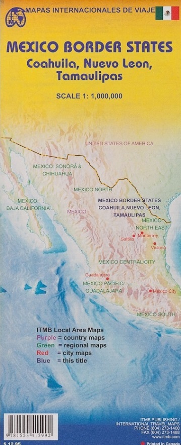
Wegenkaart - landkaart Mexico Border States Northeast Coahuila, Nuevo Leon, Tamaulipas | ITMB (9781553415992)

- ISBN / CODE: 9781553415992
- Schaal: 1:1000000
- Uitgever: ITMB
- Soort: Wegenkaart
- Taal: Engels
- Schrijf als eerste een review
-
€ 13,95
Op voorraad. Voor 17.00 uur op werkdagen besteld, morgen in huis in Nederland Levertijd Belgie
Gratis verzending in Nederland vanaf €35,-
-
Overzicht ITMB deelkaarten Mexico

Producten op deze overzichtskaart:
Klik op een product om naar de pagina van dat product te gaan.
- Wegenkaart - landkaart Baja California - Mexico | ITMB
- Wegenkaart - landkaart Mexico Central & Mexico City | ITMB
- Wegenkaart - landkaart Mexico Pacific Coast en Guadalajara | ITMB
- Wegenkaart - landkaart Mexico Sonora & Chihuahua | ITMB
- Wegenkaart - landkaart Mexico South | ITMB
- Wegenkaart - landkaart Mexico Border States Northeast Coahuila, Nuevo Leon, Tamaulipas | ITMB
- Wegenkaart - landkaart Mexico North East | ITMB
- Wegenkaart - landkaart Mexico Oaxaca & Chiapas & Guerrero | ITMB
- Wegenkaart - landkaart Mexico Yucatan Peninsula | ITMB
Overzichtskaarten
Beschrijving
Een degelijke kaart met aanduidingen van o.a. nationale parken, vliegvelden en grote wegen. Als overzichtskaart goed te gebruiken. Tweezijdig.
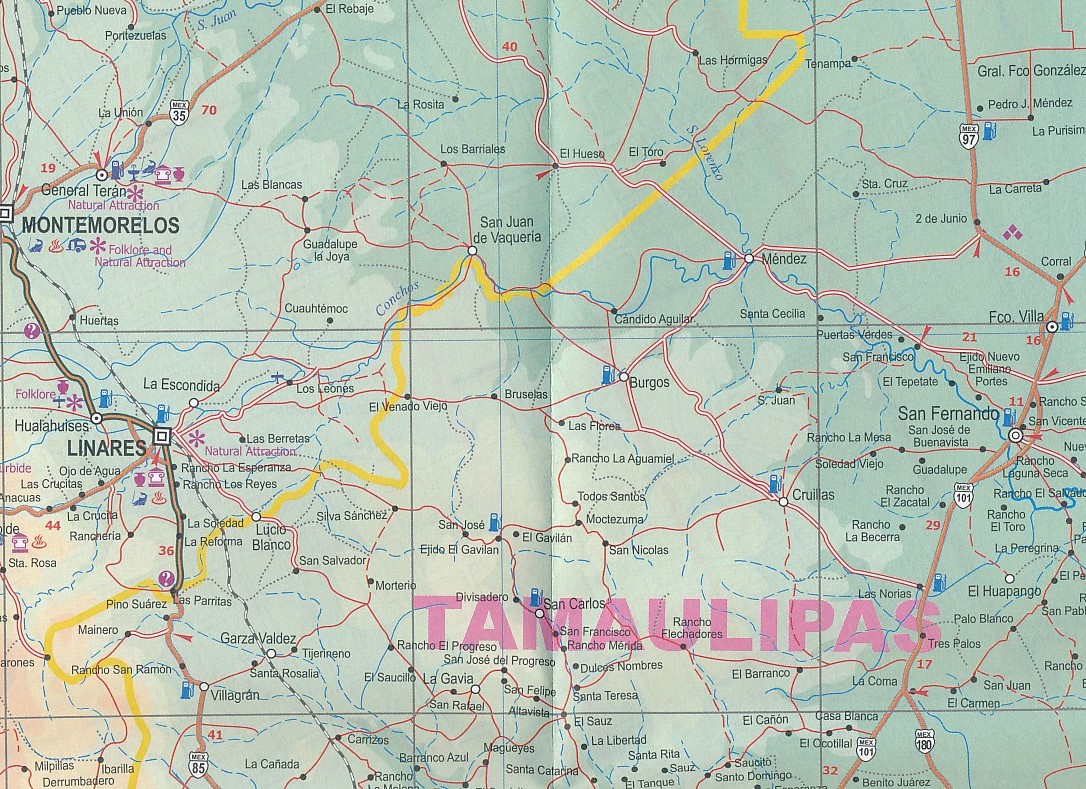
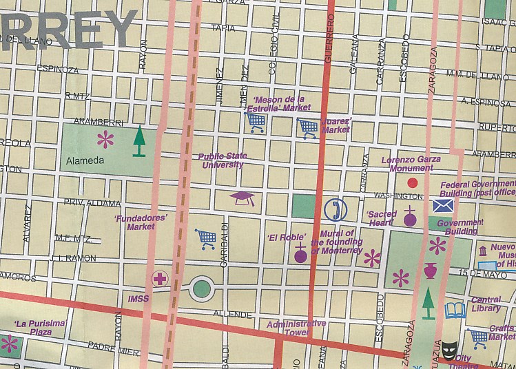
The Rio Grande dips south after curving around Big Bend, to flow into the Gulf of Mexico just east of Brownsville, Texas, and its sister city of Matamores, in Tamaulipas State of Mexico. This map covers Coahuila, Nuevo Leon, and Tamaulipas states, with a bit of Zacatecas thrown in for flavour. (This description will mean absolutely nothing to Europeans). The other side of the map contains detailed city maps of Monterrey (Mexico’s second largest city), Saltillo, and Victoria. Just think of this as being Mexico south of Texas, from Matamores west to Torreon and from Del Rio/Acuna all the way south to historic San Luis Potosi. This map will appeal to the American market primarily, but is a very detailed map of a part of Mexico that has largely been ignored until now.
Legend Includes:
International and provincial borders, roads by classification, road distances, parks, lakes, rivers, contours, airports, places of interest, historic sites, and other information.
Reviews
Geen reviews gevonden voor dit product.
Schrijf een review
Graag horen wij wat u van dit artikel vindt. Vindt u het goed, leuk, mooi, slecht, lelijk, onbruikbaar of erg handig: schrijf gerust alles op! Het is niet alleen leuk om te doen maar u informeert andere klanten er ook nog mee!
Ook interessant voor midden-amerika/mexico/meer-streken
-

Reisgids Oaxaca | Moon Travel Guides
€ 20,95Reisgidsen Meer streken -

Wegenkaart - landkaart Mexico Border
€ 13,95Wegenkaarten Meer streken -
 | Moon")
Reisgids Baja (Mexico) | Moon
€ 23,95Reisgidsen Meer streken -

Wegenkaart - landkaart Mexico Gulf C
€ 13,95Wegenkaarten Meer streken -

Reisgids Puerto Vallarta | Moon Trav
€ 22,50Reisgidsen Meer streken