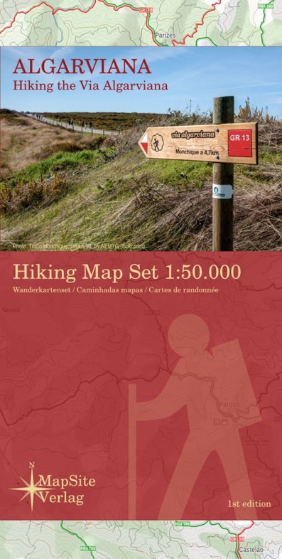
Wandelkaart Algarviana - Hiking the Via Algarviana | MapSite Verlag (9783981721638)
Hiking Map Set 1:50.000
- ISBN / CODE: 9783981721638
- Editie: 2017
- Schaal: 1:50000
- Auteur(s): Martin Höpke
- Uitgever: MapSite Verlag
- Soort: Wandelkaart
- Taal: Engels
- Bindwijze: -
- Uitvoering: Papier
- Beoordeling: 4,0 ★★★★★ (3 reviews) Schrijf een review
-
€ 18,95
Op voorraad. Voor 17.00 uur op werkdagen besteld, morgen in huis in Nederland Levertijd Belgie
Gratis verzending in Nederland vanaf €35,-
.jpg)
.jpg)
.jpg)
Beschrijving
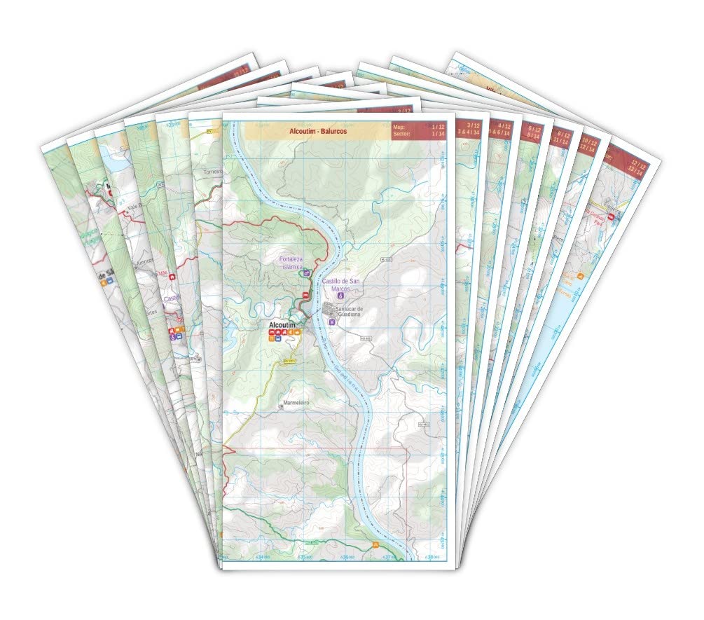
Wandelkaartset van 6 kaarten van de Via Algarviana.
The Via Algarviana (GR13) is a long distance trail in Portugal, running 300 km from Alcoutim at the Spanish border across the entire length of the Algarve to Cape St. Vincent at the Atlantic Ocean.
A scale of 1:50.000, accurate relief presentation, 25-m contours, UTM-grid and -projection (for GPS-usage) location information about accomodation, amenity and attracttion etc makes this set of maps to the ideal companion of those, who walk the via Algarviana.
Reviews
Fijn om bij een speciaalzaak te winkelen en dan alles snel thuis gestuurd
★★★★★ door Nienke 30 december 2022 | Heeft dit artikel gekochtVond u dit een nuttige review? (login om te beoordelen)
I am not convinced that the format of the map (a set of A4 sheets) is as convenient as promoted. Indeed, you manipulate them even more than a usual map and after one week of use those maps got scratches and corners went damaged. From a data perspective, I found the map's quality rather poor. For instance, villages are simple grey areas and large buildings used for orientation purposes such as churches and secondary aerial electric lines were not mentioned on the map. This lack of information made it more difficult to use the map and I had to turn on my GPS to fix orientation issues or to validate path choices where the map could not do the job. In conclusion, certainly not the best map I used, especially in villages where the map does not help much when you can't find the red-white signs on the field. This said, the seller's service is very fast.
★★★★★ door G Dem 31 oktober 2018 | Heeft dit artikel gekochtVond u dit een nuttige review? (login om te beoordelen)
Losbladige kaartenmap van alle sectoren van deze 301km lange route. Handzaam en overzichtelijk; niet meer nodig dan de sectoren die op je dagprogramma staan. Aanrader.
★★★★★ door Jos Oonincx 14 februari 2018 | Heeft dit artikel gekochtVond u dit een nuttige review? (login om te beoordelen)
Schrijf een review
Graag horen wij wat u van dit artikel vindt. Vindt u het goed, leuk, mooi, slecht, lelijk, onbruikbaar of erg handig: schrijf gerust alles op! Het is niet alleen leuk om te doen maar u informeert andere klanten er ook nog mee!
Ook interessant voor europa/portugal/algarve
-

Wandelkaart Parque Natural do Sudoes
€ 23,50Wandelkaarten Alentejo - Valle do Tajo -

Stadsplattegrond Cascais - Estoril |
€ 11,50Stadsplattegronden Algarve -

Wandelgids Voetwijzer Algarve - 28 w
€ 15,45Wandelgidsen Algarve -

Reisgids Algarve | Michael Müller Ve
€ 21,50Reisgidsen Algarve -

Wegenkaart - landkaart 5 Algarve | T
€ 11,50Wegenkaarten Alentejo - Valle do Tajo