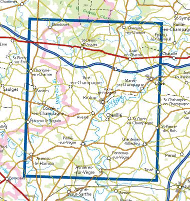
Wandelkaart - Topografische kaart 1619O Loué | IGN - Institut Géographique National (3282111619150)
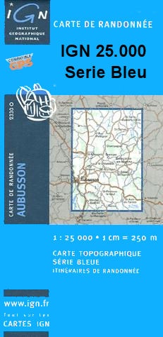
- ISBN / CODE: 3282111619150
- Editie: meest recente versie
- Schaal: 1:25000
- Uitgever: IGN - Institut Géographique National
- Soort: Topografische kaart, Wandelkaart
- Serie: Serie bleue
- Taal: Frans
- Schrijf als eerste een review
-
€ 16,95
Uitverkocht, nooit meer leverbaar

-
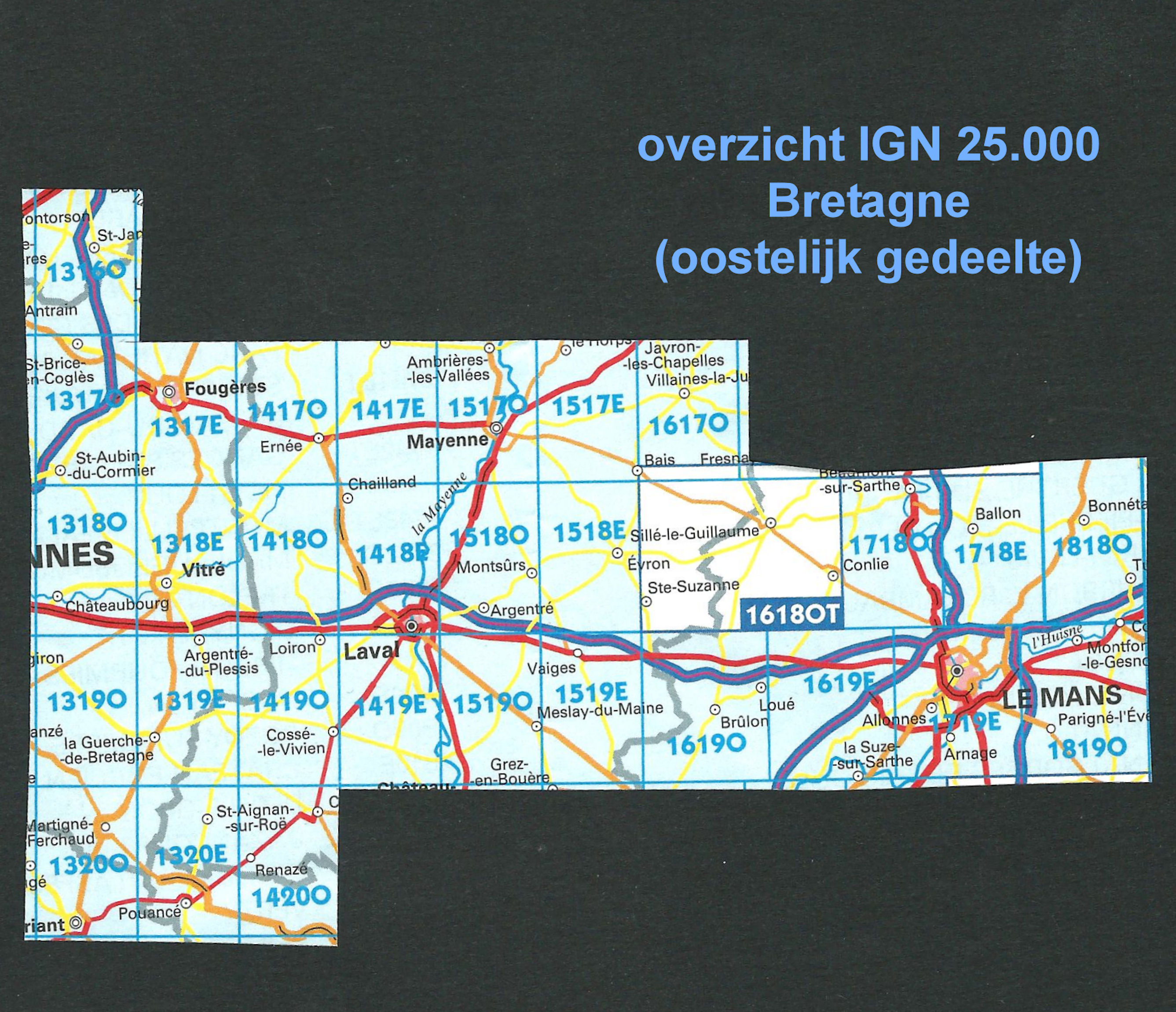
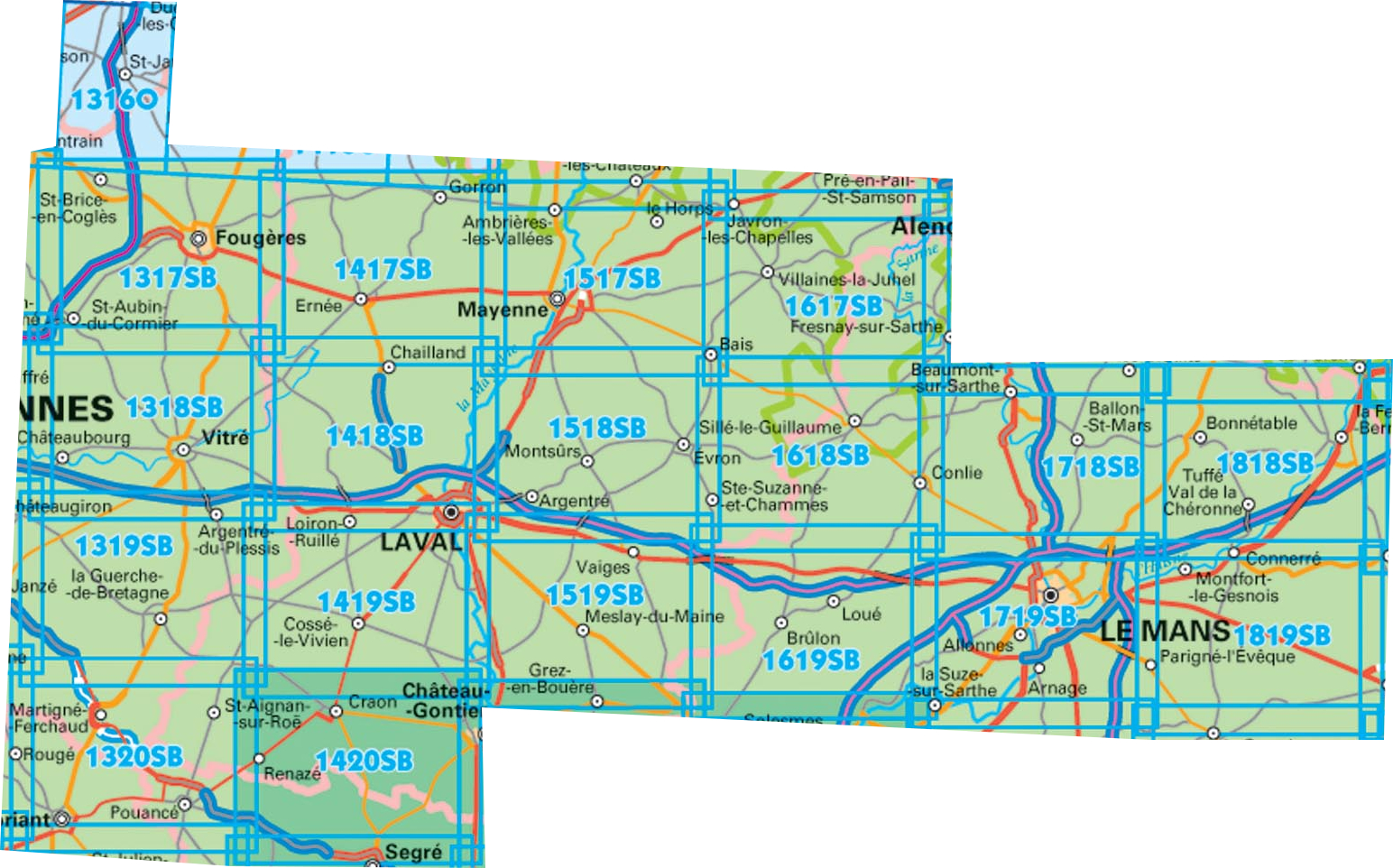
Topografische kaart IGN 25.000 Bretagne OOSTELIJK GEDEELTE


Producten op deze overzichtskaart:
Klik op een product om naar de pagina van dat product te gaan.
- Wandelkaart - Topografische kaart 1316SB St-Hilaire-du-Harcouët | IGN - Institut Géographique National
- Wandelkaart 1317SB Fougères – St-Brice-en-Coglès | IGN - Institut Géographique National
- Wandelkaart - Topografische kaart 1318SB Vitré - Châteaubourg | IGN - Institut Géographique National
- Wandelkaart - Topografische kaart 1319SB La Guerche-de-Bretagne – Retiers | IGN - Institut Géographique National
- Wandelkaart - Topografische kaart 1320SB Châteaubriant - Pouancé | IGN - Institut Géographique National
- Wandelkaart - Topografische kaart 1417SB Ernée - Gorron | IGN - Institut Géographique National
- Wandelkaart - Topografische kaart 1418SB Laval - Port-Brillet | IGN - Institut Géographique National
- Wandelkaart - Topografische kaart 1419SB Cossé-le-Vivien - L'Huisserie | IGN - Institut Géographique National
- Wandelkaart - Topografische kaart 1420SB Craon | IGN - Institut Géographique National
- Wandelkaart - Topografische kaart 1517SB Mayenne - Le Horps | IGN - Institut Géographique National
- Wandelkaart - Topografische kaart 1518SB Evron - Montsûrs | IGN - Institut Géographique National
- Wandelkaart - Topografische kaart 1519SB Meslay-du-Maine, Vaiges | IGN - Institut Géographique National
- Wandelkaart - Topografische kaart 1617SB Villaines-la-Juhel, St-Pierre-des-Nids, Alpes Mancelles | IGN - Institut Géographique National
- Wandelkaart - Topografische kaart 1618SB Sillé-le-Guillaum, Conlie Ste-Suzanne | IGN - Institut Géographique National
- Wandelkaart - Topografische kaart 1619SB Loué - Brûlon, Noyen-sur-Sarthe | IGN - Institut Géographique National
- Wandelkaart - Topografische kaart 1718SB Beaumont-sur-Sarthe - Ballon | IGN - Institut Géographique National
- Wandelkaart - Topografische kaart 1719SB Le Mans - La Suze-sur-Sarthe | IGN - Institut Géographique National
- Wandelkaart - Topografische kaart 1818SB La Ferté-Bernard | IGN - Institut Géographique National
-
Wandelkaart IGN 25.000 Bretagne OOSTELIJK GEDEELTE
Producten op deze overzichtskaart:
Klik op een product om naar de pagina van dat product te gaan.
- Wandelkaart - Topografische kaart 1316SB St-Hilaire-du-Harcouët | IGN - Institut Géographique National
- Wandelkaart 1317SB Fougères – St-Brice-en-Coglès | IGN - Institut Géographique National
- Wandelkaart - Topografische kaart 1318SB Vitré - Châteaubourg | IGN - Institut Géographique National
- Wandelkaart - Topografische kaart 1319SB La Guerche-de-Bretagne – Retiers | IGN - Institut Géographique National
- Wandelkaart - Topografische kaart 1320SB Châteaubriant - Pouancé | IGN - Institut Géographique National
- Wandelkaart - Topografische kaart 1417SB Ernée - Gorron | IGN - Institut Géographique National
- Wandelkaart - Topografische kaart 1418SB Laval - Port-Brillet | IGN - Institut Géographique National
- Wandelkaart - Topografische kaart 1419SB Cossé-le-Vivien - L'Huisserie | IGN - Institut Géographique National
- Wandelkaart - Topografische kaart 1420SB Craon | IGN - Institut Géographique National
- Wandelkaart - Topografische kaart 1517SB Mayenne - Le Horps | IGN - Institut Géographique National
- Wandelkaart - Topografische kaart 1518SB Evron - Montsûrs | IGN - Institut Géographique National
- Wandelkaart - Topografische kaart 1519SB Meslay-du-Maine, Vaiges | IGN - Institut Géographique National
- Wandelkaart - Topografische kaart 1617SB Villaines-la-Juhel, St-Pierre-des-Nids, Alpes Mancelles | IGN - Institut Géographique National
- Wandelkaart - Topografische kaart 1618SB Sillé-le-Guillaum, Conlie Ste-Suzanne | IGN - Institut Géographique National
- Wandelkaart - Topografische kaart 1619SB Loué - Brûlon, Noyen-sur-Sarthe | IGN - Institut Géographique National
- Wandelkaart - Topografische kaart 1718SB Beaumont-sur-Sarthe - Ballon | IGN - Institut Géographique National
- Wandelkaart - Topografische kaart 1719SB Le Mans - La Suze-sur-Sarthe | IGN - Institut Géographique National
- Wandelkaart - Topografische kaart 1818SB La Ferté-Bernard | IGN - Institut Géographique National
Overzichtskaarten
Beschrijving
Let op: deze kaartenserie (de O en E versies) wijkt af van de OT en ET versie, het zijn zuiver topografische kaarten zonder ingetekende wandelroutes of GR paden. Ook andere toeristische aspecten staan niet als zodanig ingetekend. Wel zijn ze bijzonder goed en gedetaileerd. Een gemiddeld kaartlezer kan hier zonder meer de weg op vinden. Van dit gebied zijn op deze schaal geen andere kaarten beschikbaar
Reviews
Geen reviews gevonden voor dit product.
Schrijf een review
Graag horen wij wat u van dit artikel vindt. Vindt u het goed, leuk, mooi, slecht, lelijk, onbruikbaar of erg handig: schrijf gerust alles op! Het is niet alleen leuk om te doen maar u informeert andere klanten er ook nog mee!
Ook interessant voor europa/frankrijk/bretagne
-

Reisgids Michelin groene gids Bretag
€ 25,99Reisgidsen Bretagne -

Wandelkaart - Topografische kaart 05
€ 16,95Topografische kaarten Bretagne -

Campergids 10 Mit dem Wohnmobil in d
€ 26,50Campergidsen Bretagne -

Wandelgids D056 Morbihan a Pied | FF
€ 18,95Wandelgidsen Bretagne -

Fietskaart - Wegenkaart - landkaart
€ 10,95Fietskaarten Bretagne