Categorieën
- Nieuwe artikelen
- Boeken
-
Kaarten
- Camperkaarten
- Fietskaarten
- Fietsknooppuntenkaarten
- Historische Kaarten
- Pelgrimsroutes (kaarten)
- Spoorwegenkaarten
- Stadsplattegronden
- Topografische kaarten
- Wandelatlassen
- Wandelkaarten
- Wandelknooppuntenkaarten
- Waterkaarten
- Wegenatlassen
-
Wegenkaarten
- Afrika
- Azië
-
Europa
- Albanië
- Andorra
- Armenië
- Azerbeidzjan
- Belarus - Witrusland
- België
- Bosnië - Hercegovina
- Bulgarije
- Cyprus
- Denemarken
- Duitsland
-
Engeland
- North East England
- ♦ Northumberland National Park
- Yorkshire and the Humber
- ♦ Yorkshire Dales Nationaal Park
- ♦ North York Moors Nationaal Park
- North West England
- ♦ Lake District Nationaal Park
- ♦ North Pennines AONB
- East Midlands
- West Midlands
- ♦ Peak District Nationaal Park
- Wales
- ♦ Pembrokeshire Coast National Park
- ♦ Snowdonia Nationaal Park
- ♦ Brecon Beacons Nationaal Park
- East of England - East Anglia
- South West England
- ♦ Cotswolds AONB
- ♦ Devon - Cornwall
- ♦ New Forrest National Park
- ♦ Dartmoor National Park
- South East England
- ♦ Kent
- ♦ South Downs Nationaal Park
- ♦ Isle of Wight
- Kanaaleilanden
- Londen
- Oxford
- Estland
- Faroer
- Finland
- Frankrijk
- Georgië
- Griekenland
- Groenland
- Hongarije
- IJsland
- Ierland
- Italië
- Kosovo
- Kroatië
- Letland
- Liechtenstein
- Litouwen
- Luxemburg
- Malta
- Moldavië
- Monaco
- Montenegro
- Nederland
- Noord-Ierland
- Noord-Macedonië
- Noorwegen
- Oekraïne
- Oostenrijk
- Polen
- Portugal
- Roemenië
- Rusland
- Scandinavië
- Schotland
- Servië
- Slovenië
- Slowakije
- Spanje
- Tsjechië
- Turkije
- Zweden
- Zwitserland
- Midden-Amerika
- Midden-Oosten
- Noord-Amerika
- Oceanië
- Wereld
- Zuid-Amerika
- Opruiming
- Puzzels
- Travel Gadgets
- Wandkaarten
- Wereldbollen
Veilig online betalen
Betaal veilig via uw eigen bankomgeving
- U bent hier:
- Home
- Europa
- Engeland
- Midden Engeland
- Kaarten
- Wegenkaarten
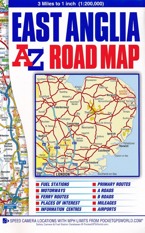
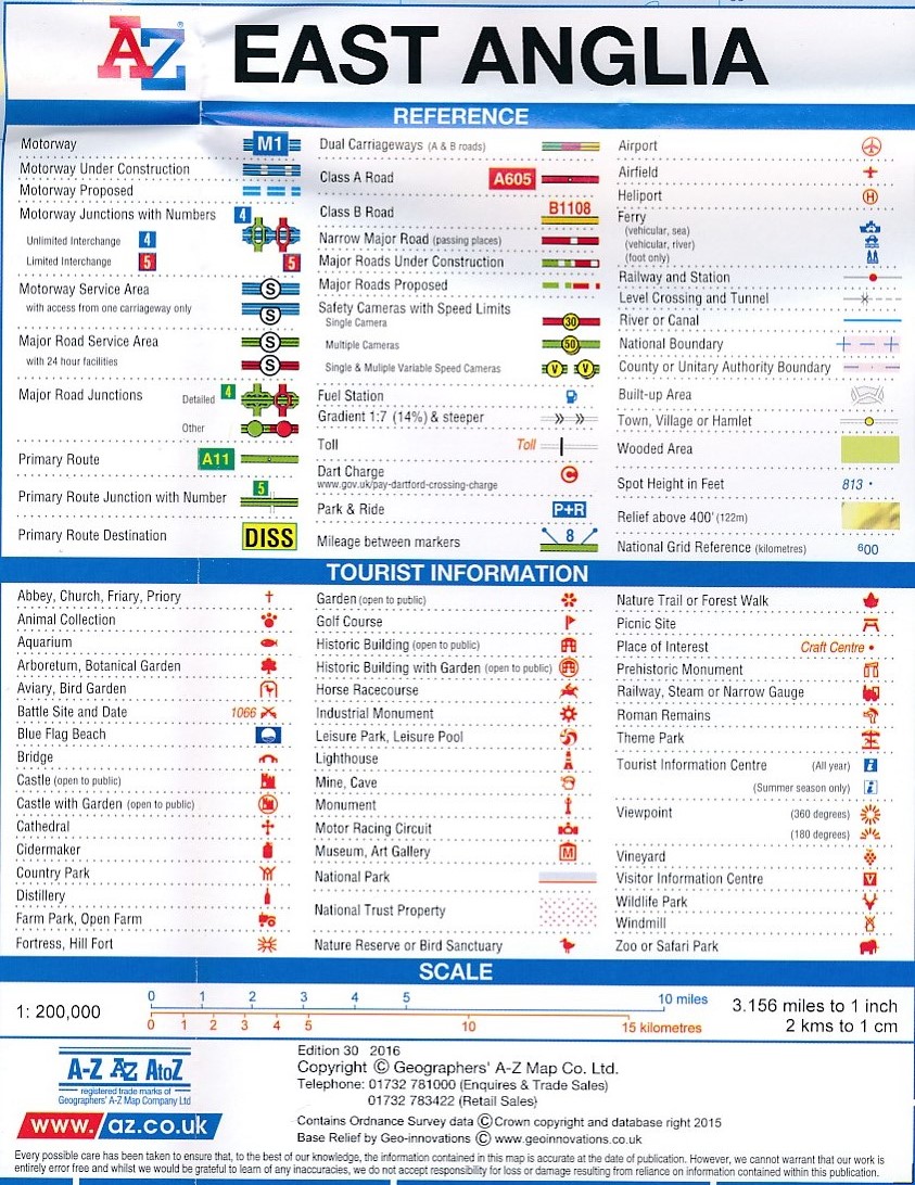
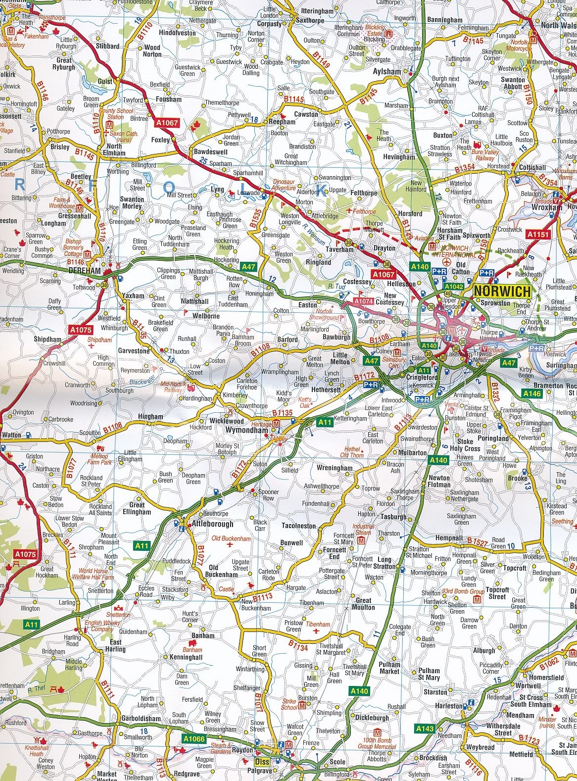
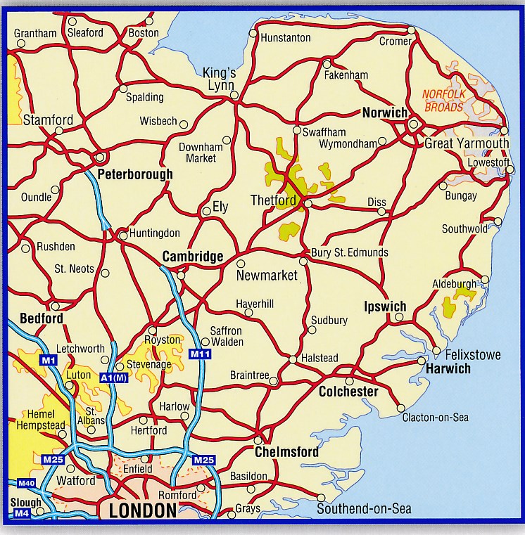
Wegenkaart - landkaart Road Map East Anglia | A-Z Map Company (9781782570257)
- ISBN / CODE: 9781782570257
- Editie: meest recente editie
- Schaal: 1:200000
- Uitgever: A-Z Map Company
- Soort: Wegenkaart
- Serie: Road Map
- Taal: Engels
- Schrijf als eerste een review
-
€ 9,95
Uitverkocht, nooit meer leverbaar Uitverkocht, nooit meer leverbaar
- Afbeeldingen
- Inkijkexemplaar
Beschrijving
Goed leesbare wegenkaart van een deel van Engeland. Met o.a. benzinestations, ferry's, information centres, afstanden op de kaart.
Reviews
Geen reviews gevonden voor dit product.
Schrijf een review
Graag horen wij wat u van dit artikel vindt. Vindt u het goed, leuk, mooi, slecht, lelijk, onbruikbaar of erg handig: schrijf gerust alles op! Het is niet alleen leuk om te doen maar u informeert andere klanten er ook nog mee!