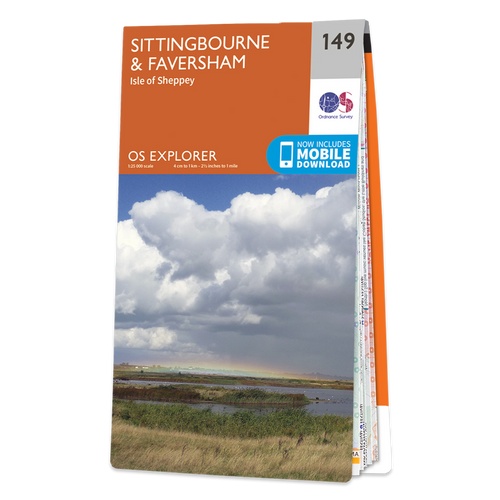
Wandelkaart - Topografische kaart 149 OS Explorer Map Sittingbourne, Faversham | Ordnance Survey (9780319243428)
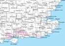
Isle of Sheppey
- ISBN / CODE: 9780319243428
- Editie: 2015
- Schaal: 1:25000
- Uitgever: Ordnance Survey
- Soort: Topografische kaart, Wandelkaart
- Serie: OS Explorer Map
- Taal: Engels
- Hoogte: 23.0 cm
- Breedte: 13.0 cm
- Dikte: 1.0 cm
- Gewicht: 150.0 g
- Bindwijze: -
- Uitvoering: Papier
- Schrijf als eerste een review
-
€ 19,50
Dit artikel is (tijdelijk) niet leverbaar
-
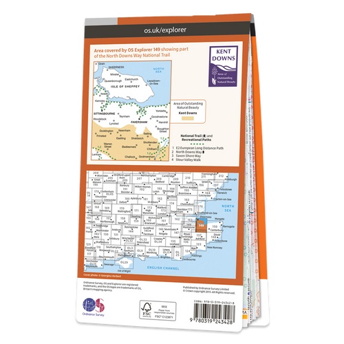
Overzichtskaart Explorer 25.000 topografische kaarten zuidoost Engeland - Kent - Londen


Producten op deze overzichtskaart:
Klik op een product om naar de pagina van dat product te gaan.
- Wandelkaart - Topografische kaart 124 OS Explorer Map Hastings & Bexhill | Ordnance Survey
- Wandelkaart - Topografische kaart 125 OS Explorer Map Romney Marsh & Rye & Winchelsea | Ordnance Survey
- Wandelkaart - Topografische kaart 131 OS Explorer Map Romsey, Andover & Test Valley | Ordnance Survey
- Wandelkaart - Topografische kaart 135 OS Explorer Map Ashdown Forest (greenw) | Ordnance Survey
- Wandelkaart - Topografische kaart 136 OS Explorer Map High Weald | Ordnance Survey
- Wandelkaart - Topografische kaart 137 OS Explorer Map Ashford | Ordnance Survey
- Wandelkaart - Topografische kaart 138 OS Explorer Map Dover, Folkstone, Hythe | Ordnance Survey
- Wandelkaart - Topografische kaart 144 OS Explorer Map Basingstoke, Alto, Whitchurch | Ordnance Survey
- Wandelkaart - Topografische kaart 145 OS Explorer Map Guildford, Farnham | Ordnance Survey
- Wandelkaart - Topografische kaart 146 OS Explorer Map Dorking, Box Hill, Reigate | Ordnance Survey
- Wandelkaart - Topografische kaart 147 OS Explorer Map Sevenoaks and Tonbridge | Ordnance Survey
- Wandelkaart - Topografische kaart 148 OS Explorer Map Maidstone, Medway Towns | Ordnance Survey
- Wandelkaart - Topografische kaart 149 OS Explorer Map Sittingbourne, Faversham | Ordnance Survey
- Wandelkaart - Topografische kaart 150 OS Explorer Map Canterbury, Isle of Thanet | Ordnance Survey
- Wandelkaart - Topografische kaart 158 OS Explorer Map Newbury, Hungerford | Ordnance Survey
- Wandelkaart - Topografische kaart 159 OS Explorer Map Reading, Wokingham & Pangbourne Map | Thames Path | Ordnance Survey
- Wandelkaart - Topografische kaart 160 OS Explorer Map Windsor, Weybridge, Bracknell | Thames Path | Ordnance Survey
- Wandelkaart - Topografische kaart 161 OS Explorer Map London South (greenw.m) | Ordnance Survey
- Wandelkaart - Topografische kaart 162 OS Explorer Map Greenwich, Gravesend | Ordnance Survey
- Wandelkaart - Topografische kaart 163 OS Explorer Map Gravesend, Rochester | Ordnance Survey
- Wandelkaart - Topografische kaart 170 OS Explorer Map Abingdon, Wantage & Vale of White Horse | Ordnance Survey
- Wandelkaart - Topografische kaart 171 OS Explorer Map Chiltern Hills West | Ordnance Survey
- Wandelkaart - Topografische kaart 172 OS Explorer Map Chiltern Hills East | Ordnance Survey
- Wandelkaart - Topografische kaart 173 OS Explorer Map London North | Ordnance Survey
- Wandelkaart - Topografische kaart 174 OS Explorer Map Epping Forest, Lee Valley | Ordnance Survey
- Wandelkaart - Topografische kaart 175 OS Explorer Map Southend-on-Sea, Basildon | Ordnance Survey
- Wandelkaart - Topografische kaart 176 OS Explorer Map Blackwater Estuary | Ordnance Survey
- Wandelkaart - Topografische kaart 180 OS Explorer Map Oxford | Ordnance Survey
- Wandelkaart - Topografische kaart 181 OS Explorer Map Chiltern Hills North | Ordnance Survey
- Wandelkaart - Topografische kaart 182 OS Explorer Map St-Albans, Hatfield | Ordnance Survey
- Wandelkaart - Topografische kaart 183 OS Explorer Map Chelmsford, the Rodings | Ordnance Survey
- Wandelkaart - Topografische kaart 184 OS Explorer Map Colchester, Harwich, Clacton-on-Sea | Ordnance Survey
- Wandelkaart - Topografische kaart 191 OS Explorer Map Banbury, Bicester, Chipping Norton | Ordnance Survey
- Wandelkaart - Topografische kaart 192 OS Explorer Map Buckingham, Milton Keynes | Ordnance Survey
- Wandelkaart - Topografische kaart 193 OS Explorer Map Luton, Stevenage | Ordnance Survey
- Wandelkaart - Topografische kaart 194 OS Explorer Map Hertford, Bishop's Stortford | Ordnance Survey
- Wandelkaart - Topografische kaart 195 OS Explorer Map Braintree, Saffron, Walden | Ordnance Survey
- Wandelkaart - Topografische kaart 196 OS Explorer Map Sudbury, Hadleigh, Dedham Vale | Ordnance Survey
- Wandelkaart - Topografische kaart 197 OS Explorer Map Ipswich, Felixstowe, Harwich | Ordnance Survey
- Wandelkaart - Topografische kaart OL03 OS Explorer Map Meon Valley - Portsmouth, Gosport & Fareham | Ordnance Survey
- Wandelkaart - Topografische kaart OL08 OS Explorer Map Chichester, South Harting & Selsey | Ordnance Survey
- Wandelkaart - Topografische kaart OL10 OS Explorer Map Arundel - Pulborough - Worthing | Ordnance Survey
- Wandelkaart - Topografische kaart OL11 OS Explorer Map Brighton & Hove, Lewes & Burgess Hill | Ordnance Survey
- Wandelkaart - Topografische kaart OL22 OS Explorer Map New Forest | Ordnance Survey
- Wandelkaart - Topografische kaart OL25 OS Explorer Map Eastbourne & Beachy Head | Ordnance Survey
- Wandelkaart - Topografische kaart OL29 OS Explorer Map Isle of Wight | Ordnance Survey
- Wandelkaart - Topografische kaart OL32 OS Explorer Map Winchester - New Alresford - East Meon | Ordnance Survey
- Wandelkaart - Topografische kaart OL33 OS Explorer Map Haslemere - Petersfield - Midhurst - Selborne | Ordnance Survey
- Wandelkaart - Topografische kaart OL34 OS Explorer Map Crawley - Horsham - Cranleigh - Billinghurst | Ordnance Survey
-
Overzichtskaart Explorer 25.000 wandelkaarten zuidoost Engeland - Kent - Londen
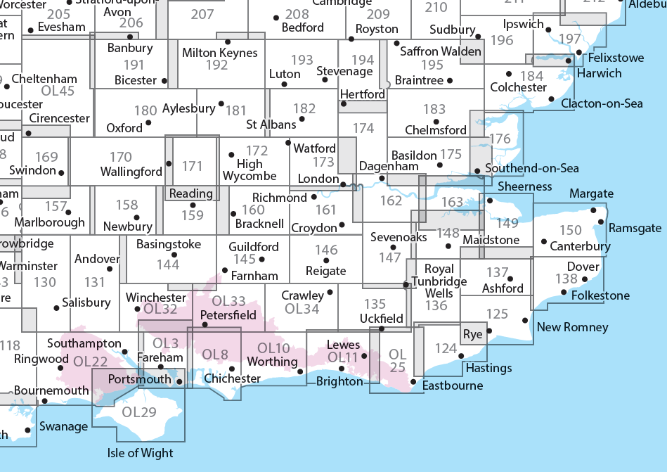
Producten op deze overzichtskaart:
Klik op een product om naar de pagina van dat product te gaan.
- Wandelkaart - Topografische kaart 124 OS Explorer Map Hastings & Bexhill | Ordnance Survey
- Wandelkaart - Topografische kaart 125 OS Explorer Map Romney Marsh & Rye & Winchelsea | Ordnance Survey
- Wandelkaart - Topografische kaart 131 OS Explorer Map Romsey, Andover & Test Valley | Ordnance Survey
- Wandelkaart - Topografische kaart 135 OS Explorer Map Ashdown Forest (greenw) | Ordnance Survey
- Wandelkaart - Topografische kaart 136 OS Explorer Map High Weald | Ordnance Survey
- Wandelkaart - Topografische kaart 137 OS Explorer Map Ashford | Ordnance Survey
- Wandelkaart - Topografische kaart 138 OS Explorer Map Dover, Folkstone, Hythe | Ordnance Survey
- Wandelkaart - Topografische kaart 144 OS Explorer Map Basingstoke, Alto, Whitchurch | Ordnance Survey
- Wandelkaart - Topografische kaart 145 OS Explorer Map Guildford, Farnham | Ordnance Survey
- Wandelkaart - Topografische kaart 146 OS Explorer Map Dorking, Box Hill, Reigate | Ordnance Survey
- Wandelkaart - Topografische kaart 147 OS Explorer Map Sevenoaks and Tonbridge | Ordnance Survey
- Wandelkaart - Topografische kaart 148 OS Explorer Map Maidstone, Medway Towns | Ordnance Survey
- Wandelkaart - Topografische kaart 149 OS Explorer Map Sittingbourne, Faversham | Ordnance Survey
- Wandelkaart - Topografische kaart 150 OS Explorer Map Canterbury, Isle of Thanet | Ordnance Survey
- Wandelkaart - Topografische kaart 158 OS Explorer Map Newbury, Hungerford | Ordnance Survey
- Wandelkaart - Topografische kaart 159 OS Explorer Map Reading, Wokingham & Pangbourne Map | Thames Path | Ordnance Survey
- Wandelkaart - Topografische kaart 160 OS Explorer Map Windsor, Weybridge, Bracknell | Thames Path | Ordnance Survey
- Wandelkaart - Topografische kaart 161 OS Explorer Map London South (greenw.m) | Ordnance Survey
- Wandelkaart - Topografische kaart 162 OS Explorer Map Greenwich, Gravesend | Ordnance Survey
- Wandelkaart - Topografische kaart 163 OS Explorer Map Gravesend, Rochester | Ordnance Survey
- Wandelkaart - Topografische kaart 170 OS Explorer Map Abingdon, Wantage & Vale of White Horse | Ordnance Survey
- Wandelkaart - Topografische kaart 171 OS Explorer Map Chiltern Hills West | Ordnance Survey
- Wandelkaart - Topografische kaart 172 OS Explorer Map Chiltern Hills East | Ordnance Survey
- Wandelkaart - Topografische kaart 173 OS Explorer Map London North | Ordnance Survey
- Wandelkaart - Topografische kaart 174 OS Explorer Map Epping Forest, Lee Valley | Ordnance Survey
- Wandelkaart - Topografische kaart 175 OS Explorer Map Southend-on-Sea, Basildon | Ordnance Survey
- Wandelkaart - Topografische kaart 176 OS Explorer Map Blackwater Estuary | Ordnance Survey
- Wandelkaart - Topografische kaart 180 OS Explorer Map Oxford | Ordnance Survey
- Wandelkaart - Topografische kaart 181 OS Explorer Map Chiltern Hills North | Ordnance Survey
- Wandelkaart - Topografische kaart 182 OS Explorer Map St-Albans, Hatfield | Ordnance Survey
- Wandelkaart - Topografische kaart 183 OS Explorer Map Chelmsford, the Rodings | Ordnance Survey
- Wandelkaart - Topografische kaart 184 OS Explorer Map Colchester, Harwich, Clacton-on-Sea | Ordnance Survey
- Wandelkaart - Topografische kaart 191 OS Explorer Map Banbury, Bicester, Chipping Norton | Ordnance Survey
- Wandelkaart - Topografische kaart 192 OS Explorer Map Buckingham, Milton Keynes | Ordnance Survey
- Wandelkaart - Topografische kaart 193 OS Explorer Map Luton, Stevenage | Ordnance Survey
- Wandelkaart - Topografische kaart 194 OS Explorer Map Hertford, Bishop's Stortford | Ordnance Survey
- Wandelkaart - Topografische kaart 195 OS Explorer Map Braintree, Saffron, Walden | Ordnance Survey
- Wandelkaart - Topografische kaart 196 OS Explorer Map Sudbury, Hadleigh, Dedham Vale | Ordnance Survey
- Wandelkaart - Topografische kaart 197 OS Explorer Map Ipswich, Felixstowe, Harwich | Ordnance Survey
- Wandelkaart - Topografische kaart OL03 OS Explorer Map Meon Valley - Portsmouth, Gosport & Fareham | Ordnance Survey
- Wandelkaart - Topografische kaart OL08 OS Explorer Map Chichester, South Harting & Selsey | Ordnance Survey
- Wandelkaart - Topografische kaart OL10 OS Explorer Map Arundel - Pulborough - Worthing | Ordnance Survey
- Wandelkaart - Topografische kaart OL11 OS Explorer Map Brighton & Hove, Lewes & Burgess Hill | Ordnance Survey
- Wandelkaart - Topografische kaart OL22 OS Explorer Map New Forest | Ordnance Survey
- Wandelkaart - Topografische kaart OL25 OS Explorer Map Eastbourne & Beachy Head | Ordnance Survey
- Wandelkaart - Topografische kaart OL29 OS Explorer Map Isle of Wight | Ordnance Survey
- Wandelkaart - Topografische kaart OL32 OS Explorer Map Winchester - New Alresford - East Meon | Ordnance Survey
- Wandelkaart - Topografische kaart OL33 OS Explorer Map Haslemere - Petersfield - Midhurst - Selborne | Ordnance Survey
- Wandelkaart - Topografische kaart OL34 OS Explorer Map Crawley - Horsham - Cranleigh - Billinghurst | Ordnance Survey
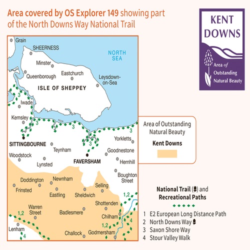
Overzichtskaarten
Beschrijving
Explore the serene Isle of Sheppey and follow the Saxon Shore Way to discover the towns of Sittingbourne and Faversham. Further inland, the Kent Downs – an Area of Outstanding Natural Beauty – are beckoning.
- Sail, kayak, fly kites or just relax on the sandy and pebbled beaches of Sheppey, or go birdwatching at the Swale National Nature Reserve
- Discover Faversham, home of Britain’s oldest brewer and nearby Oare Gunpowder Works Country Park, where gunpowder was manufactured for the battles of Trafalgar and Waterloo
- Walk, ramble or cycle along the Saxon Shore Way through Faversham and Sittingbourne, or head inland to the North Downs Way, a National Trail
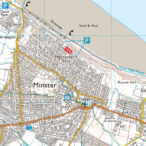
Met zijn 4cm voor 1 km (2 ½ cm voor 1 mijl) schaal, is de OS Explorer kaartenserie de ideale en meest gedetailleerde kaartenreeks voor mensen die graag outdoor-activiteiten zoals fietsen, wandelen, paardrijden, klimmen en watersporten.
Reviews
Geen reviews gevonden voor dit product.
Schrijf een review
Graag horen wij wat u van dit artikel vindt. Vindt u het goed, leuk, mooi, slecht, lelijk, onbruikbaar of erg handig: schrijf gerust alles op! Het is niet alleen leuk om te doen maar u informeert andere klanten er ook nog mee!
Ook interessant voor europa/engeland/kent
-

Fietskaart 05 Cycle Maps UK Kent, Th
€ 12,95Fietskaarten South East England -

Wandelkaart - Topografische kaart 17
€ 19,50Topografische kaarten South East England -

Fietsgids Traffic-Free Cycle Trails
€ 27,95Fietsgidsen East of England - East Anglia -

Wandelgids Wild Swimming Walks near
€ 22,50Wandelgidsen South West England -

Reisgids Wild Guide Southern and Eas
€ 24,50Reisgidsen East of England - East Anglia