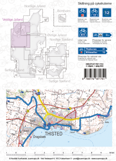
Fietskaart 6 Vestlige Jylland - West Jutland (Denemarken) | Scanmaps (9788779671751)

- ISBN / CODE: 9788779671751
- Editie: 2022
- Schaal: 1:100000
- Uitgever: Scanmaps
- Soort: Fietskaart
- Taal: Engels, Duits
- Uitvoering: Scheur- en watervast
- Bindwijze: -
- Druk: 2
- Beoordeling: 4,0 ★★★★★ (2 reviews) Schrijf een review
-
€ 18,95
Op voorraad. Voor 17.00 uur op werkdagen besteld, morgen in huis in Nederland Levertijd Belgie
Gratis verzending in Nederland vanaf €35,-
-
Overzicht Fietskaarten Denemarken
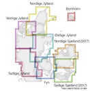
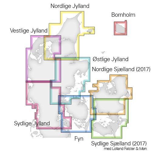
Producten op deze overzichtskaart:
Klik op een product om naar de pagina van dat product te gaan.
- Fietskaart 1 Nordlige Sjaelland - Noord Zeeland (Denemarken) | Scanmaps
- Fietskaart - Fietsgids 2 Sydlige Sjaelland - Zuid Zeeland (set) | Scanmaps
- Fietskaart 2 Sydlige Sjælland, Møn, Lolland og Falster Cykelkort | Scanmaps
- Fietskaart 3 Fyn - Funen (Denemarken) | Scanmaps
- Fietskaart 4 Østlige Jylland - Oostelijk Jutland (Denemarken) | Scanmaps
- Fietskaart 5 Nordlige Jylland - Noordelijk Jutland | Scanmaps
- Fietskaart 6 Vestlige Jylland - West Jutland (Denemarken) | Scanmaps
- Fietskaart 7 Sydlige Jylland - Zuid Jutland (Denemarken) | Scanmaps
- Fietskaart 8 Bornholm (Denemarken) | Scanmaps
Overzichtskaarten
Beschrijving
Reviews
Bijna compleet. Wel watervast, heel veel informatie en overzichtelijk. Helaas geen 'wild'-kampeerplekken weergegeven. Heb ook de kaarten van noord- en zuid-Jutland besteld. Omdat die ook uit 2016 zijn staan de 'wild'-kampeerplekken daar ook niet op. Voor ons erg onhandig. Oost-Jutland uit 2019 geeft die plekken dan weer wel weer. Lijkt er op dat 2016 in dat opzicht verouderd is.
★★★★★ door Kees Meijer 23 augustus 2021Vond u dit een nuttige review? (login om te beoordelen)
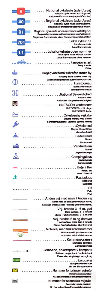
De schaal is goed voor fietsen en zoeken van alternatieven. Ook goed dat de kaart watervast is. Min punten zijn het ontbreken van de legenda van de topografische onderlegger en dat de fietsroutes dik over de onderlegger getekend zijn zodat je nu net van de fiets routes niet weet op wat voor wegen ze lopen(autoweg, gravel, pad of landweg)
★★★★★ door e k 5 augustus 2017Vond u dit een nuttige review? (login om te beoordelen)
Schrijf een review
Graag horen wij wat u van dit artikel vindt. Vindt u het goed, leuk, mooi, slecht, lelijk, onbruikbaar of erg handig: schrijf gerust alles op! Het is niet alleen leuk om te doen maar u informeert andere klanten er ook nog mee!
Ook interessant voor europa/denemarken/jutland
-
 | Scanmaps")
Fietskaart 4 Østlige Jylland - Ooste
€ 18,95Fietskaarten Jutland -

Wandelatlas - Fietsatlas DK Outdoora
€ 39,95Fietsatlassen Denemarken -

Wegenkaart - landkaart Denemarken zu
€ 13,50Wegenkaarten Denemarken -

Reisgids Wat & Hoe Stad & Streek Den
€ 10,49Reisgidsen Denemarken -

Wandelkaart Terrängkartor DK Nationa
€ 22,50Wandelkaarten Jutland