Wegenkaart - landkaart Mozambique and Malawi | Tracks4Africa (9780992182977)
- ISBN / CODE: 9780992182977
- Editie: 15-08-2017
- Druk: 2
- Schaal: 1:1000000
- Uitgever: Tracks4Africa
- Soort: Wegenkaart
- Taal: Engels
- Hoogte: 29.0 cm
- Breedte: 14.0 cm
- Gewicht: 144.0 g
- Uitvoering: Scheur- en watervast
- Bindwijze: -
- Beoordeling: 4,0 ★★★★★ (1 review) Schrijf een review
-
€ 27,50
Op voorraad. Voor 17.00 uur op werkdagen besteld, morgen in huis in Nederland Levertijd Belgie
Gratis verzending in Nederland vanaf €35,-
Beschrijving
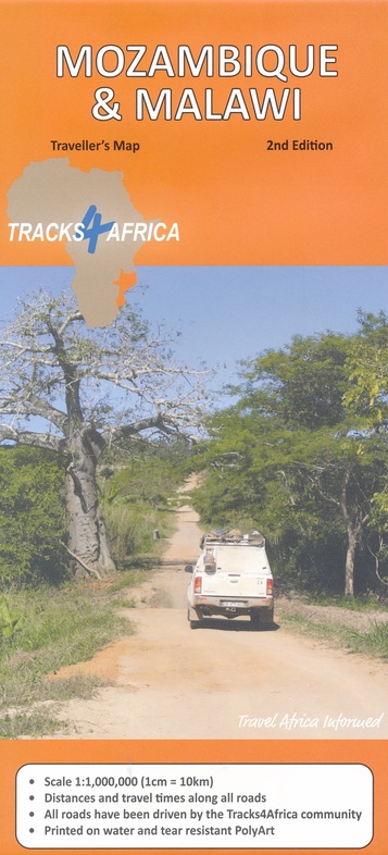
Uitstekende wegenkaart van Mozambique en Malawi, gemaakt door gerenommeerde kaartenmaker Tracks4Africa in Afrika. Met afstanden en reistijden tussen steden en op alle wegen vermeld. GPS via hun website te downloaden.
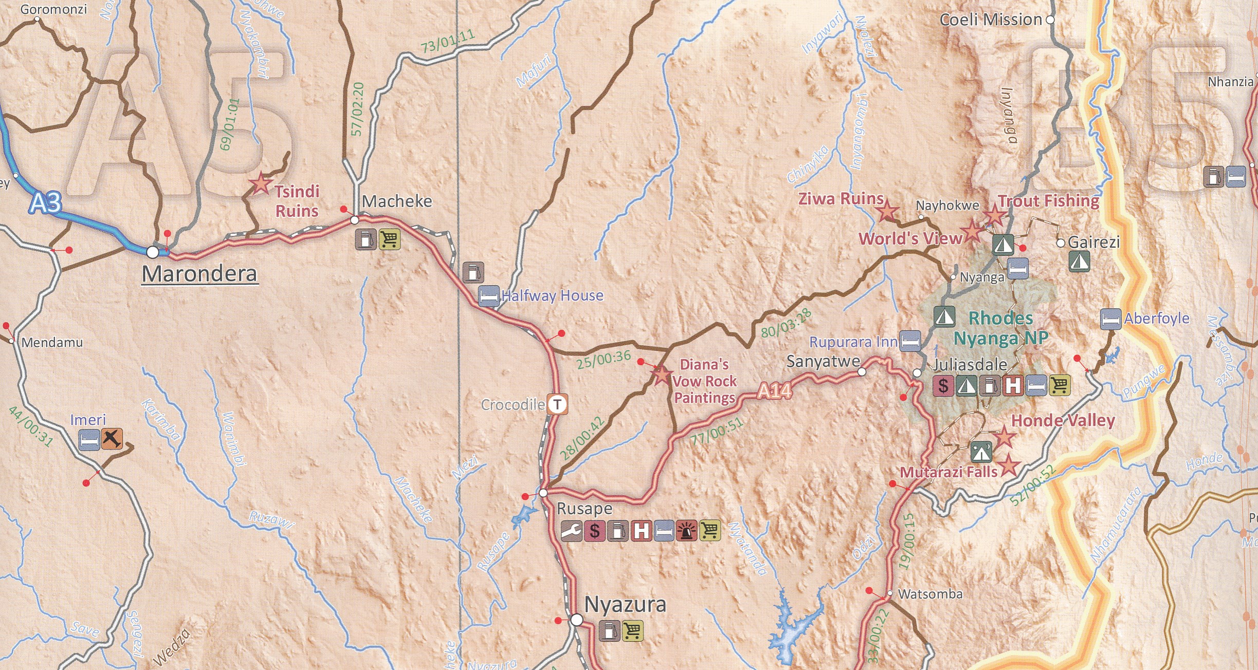
The integrated Tracks4Africa Mozambique and Malawi map is designed to be used in conjunction with the T4A GPS Map of Mozambique and Malawi. It is the largest available map at 1:1,000,000 scale, offering you the perfect trip planning tool for your next trip through Mozambique and Malawi.
This T4A paper map series are probably the first comprehensive country maps in the world, offering travel time information for the entire road network, be it on tar, gravel or sand!
The roads, tracks, places of interest as well as the distance data and travel time estimates on the map reflect the collective travel experience of the Tracks4Africa community of travellers over the past 10 years, with every single road being GPS recorded and verified by this community.
No need to transfer GPS coordinates from the map to your GPS as everything you see on the map is contained in our T4A GPS Maps. Our maps offer the most comprehensive coverage of tourist destinations in Mozambique and Malawi. Use T4A GPS Maps to navigate you to all the destinations you see on this country map.
Key features:
- Large 1:1,000,000 scale
- Travel times and distances included on the map
- What you see on the paper map is exactly what you get on T4A GPS Maps
- Comprehensive set of roads and tracks in nature reserves
- Detailed information on camp sites and attractions
- Border crossings indicated with opening and closing times
- Visit www.tracks4africa.co.za for detail on places of interest
- Complete Lake Malawi is covered
- Overlanding routes between Mozambique and Tanzania indicated with new Unity Bridge crossing
- Each town is shown with up to date tourist services information
- Printed on tear and water resistant PolyArt paper suitable for outdoor use
- Shaded relief background to accentuate mountains and other topographical detail
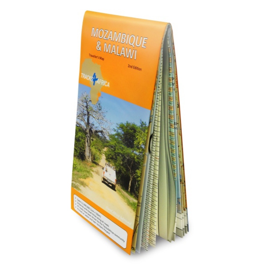
Open gevouwen: 1000 x1380 mm.
Reviews
goed gedetailleerde kaart en vooral de afstanden in tijd zijn geweldig, jammer dat de inset map van het zuiden precies op het gedeelte van de kaart staat waar veel reizigers vandaan komen: nl. Zuid-Afrika.
★★★★★ door evelien sjoukes 27 januari 2014Vond u dit een nuttige review? (login om te beoordelen)
Schrijf een review
Graag horen wij wat u van dit artikel vindt. Vindt u het goed, leuk, mooi, slecht, lelijk, onbruikbaar of erg handig: schrijf gerust alles op! Het is niet alleen leuk om te doen maar u informeert andere klanten er ook nog mee!
Ook interessant voor afrika/malawi
-

Natuurgids Southern African Wildlife
€ 27,95Natuurgidsen Botswana -

Vogelgids SASOL Birds of Southern Af
€ 34,95Vogelgidsen Botswana -

Woordenboek Wat & Hoe taalgids Engel
€ 9,99Woordenboeken & Taalgidsen Botswana -

Wegenkaart - landkaart Mosambik - Ma
€ 15,95Wegenkaarten Malawi -

Reisverhaal Stoere Trut | Sacha Mole
€ 24,95Reisverhalen Mozambique