Wandelkaart - Topografische kaart John Muir Trail | Tom Harrison Maps (9781877689345)
- ISBN / CODE: 9781877689345
- Aantal blz.: 14
- Schaal: 1:630360
- Uitgever: Tom Harrison Maps
- Soort: Topografische kaart, Wandelkaart
- Taal: Engels
- Uitvoering: -
- Bindwijze: -
- Schrijf als eerste een review
-
€ 26,95
Uitverkocht, nooit meer leverbaar
Beschrijving
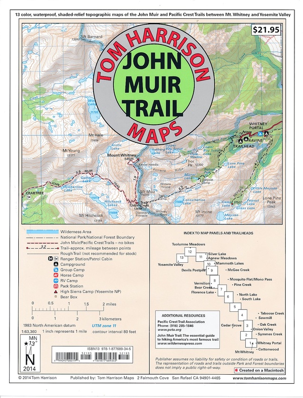
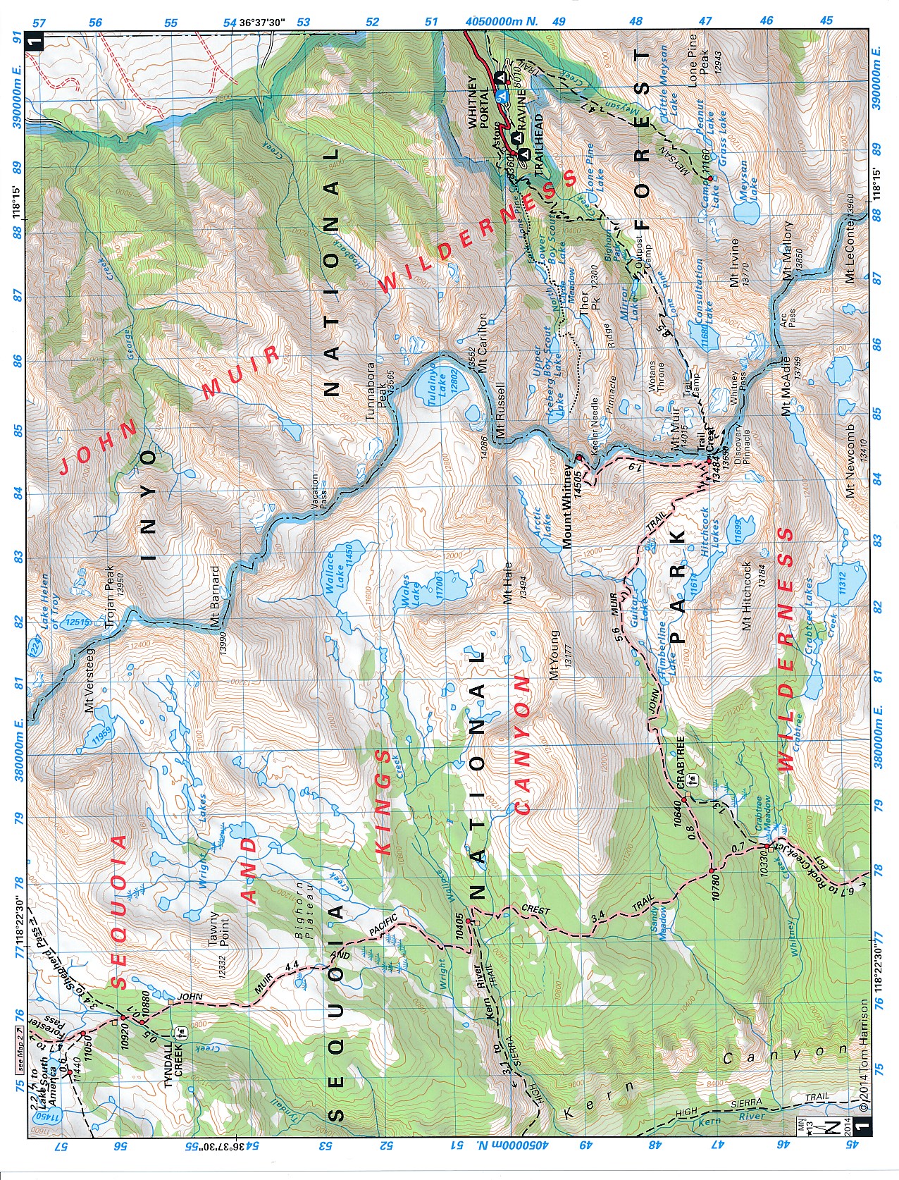
Shaded Relief Topo Maps packet of the famous Sierra High Route that will take hikers from Mount Whitney to Yosemite, CA. Well marked trails over USGS topo maps that were beautifully enhanced with shaded relief to better distinguish details.
Scale 1:630360. 1 inch on map equals 1 mile.
Whitney Portal, Symmes Creek, Onion Valley, Oak Creek, Taboose Creek, North and South Lakes, Vermilion, Bear Creek, Florence Lake, Pine Creek, Mono Pass, McGee Creek, Devils Postpile, Mammoth Lakes, Agnew Meadows, Silver Lake, Tuolomne Meadows, and finally the Yosemite Valley. GPS Compatible! - Complete UTM Grid.
Reviews
Geen reviews gevonden voor dit product.
Schrijf een review
Graag horen wij wat u van dit artikel vindt. Vindt u het goed, leuk, mooi, slecht, lelijk, onbruikbaar of erg handig: schrijf gerust alles op! Het is niet alleen leuk om te doen maar u informeert andere klanten er ook nog mee!
Ook interessant voor noord-amerika/verenigde-staten-van-amerika/californie
-

Wegenkaart - landkaart 05 Californië
€ 14,50Wegenkaarten Californië -

Campinggids - Campergids Northern Ca
€ 22,50Campergidsen Californië -

Reisgids Coastal California | Moon T
€ 22,50Reisgidsen Californië -

Wandelkaart - Topografische kaart 25
€ 16,95Topografische kaarten Zuidwest USA -

Wandelgids Best Day Walks California
€ 22,50Wandelgidsen Californië