Wandkaarten - Noord-Amerika
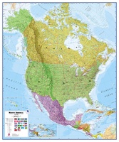 Wandkaart Noord Amerika, politiek, 100 x 120 cm | Maps International
Fraaie politieke kaart van het continent, waarbij vooral de politieke aspecten heel duidelijk te lezen zijn. Alle landen hebben verschillende kleuren, steden en belangrijke verbindingen zijn goed te vinden. Dit …
★★★★★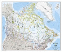 Wandkaart Canada, 97 x 82 cm | National Geographic
Decoratieve wandkaart van Canada. Naast de mooie kleuren staan er bijzonder veel plaatsen op vermeld. This beautiful wall-map from National Geographic depicts Canada and the areas surrounding the Great Lakes …
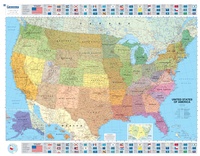
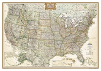 Wandkaart USA - Verenigde Staten politiek, antiek, 108 x 75 cm | National Geographic
Wandkaart van de USA waarbij de kleuren in 'antieke' look zijn weergegeven, de staatgrenzen zeer duidelijk zijn en er veel plaatsen op staan. This Antique-style USA Wall Map by National …
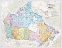
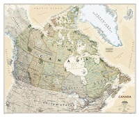
★★★★★★★★★★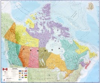 Wandkaart Canada, 120 x 100 cm | Maps International
Mooi, heldere wandkaart van Canada. This Canada wall map clearly depicts all the cities, major roads and also shows all the Provinces and Territory boundaries. All major cities and …
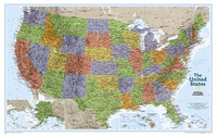
★★★★★★★★★★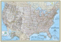 Wandkaart USA - Verenigde Staten Political, 178 x 124 cm | National Geographic
Het klassieke kaartbeeld van National Geographic, de grenzen van de staten van Amerika zijn apart gekleurd. De wandkaart is heel gedetailleerd met veel plaatsen, wegen, rivieren en nationale parken, het …
★★★★★ Wandkaart Classic Canada | 60 x 42 cm | Maps International
Ontdek de uitgestrekte wildernis en bruisende steden van Canada met onze indrukwekkende wandkaart, vormgegeven in een verfijnde klassieke stijl. Deze gedetailleerde kaart toont niet alleen de diverse provincies en territoria …
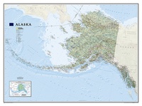 Wandkaart Alaska, 103 x 78 cm | National Geographic
Deze wandkaart van National Geographic is zeer gedetailleerd en bevat alle belangrijke plaatsen. Daarnaast is er ruimte voor de landschappelijke details zoals hoogtelijnen, rivieren, belangrijke wegen en andere items zoals …
★★★★★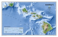 Wandkaart Hawaii, 88 x 58 cm | National Geographic
One of our most visually stunning maps, the Hawaii Physical Map shows all eight of the major islands and includes an inset of the entire chain of reefs stretching nearly …
 Wandkaart USA Politiek | Michelin
An annually updated political map of the USA. Beautifully coloured and laminated, with statistical information including population, surface area, state capital. Highlights the flags of each state. This laminated map, …
 Wandkaart USA Explorer, 81 x 51 cm | National Geographic
This colorful USA political map clearly shows state boundaries, capitals, major highways, rivers, lakes, and many major cities. Insets show detail of Alaska and Hawaii. The United States Explorer map …
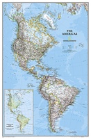 Wandkaart The Americas - Noord & Zuid Amerika, politiek, 60 x 94 cm | National Geographic
National Geographic's Classic style political wall map of The Americas features a bright color palette with blue oceans and the continents' terrain detailed in stunning shaded relief that has been …
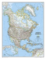
 Wandkaart Noord Amerika, politiek, 60 x 77 cm | National Geographic
The political map of North America features trademark National Geographic detail and accuracy. The map shows country boundaries, place names, major highways and roads, bodies of water, and more. An …
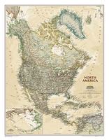
 Wandkaart Noord Amerika, politiek, 91 x 118 cm | National Geographic
The political map of North America features trademark National Geographic detail and accuracy. The map shows country boundaries, place names, major highways and roads, bodies of water, and more. An …
 Wandkaart Noord Amerika, politiek & antiek, 60 x 78 cm | National Geographic
This richly colored map of North America - featuring country boundaries, place names, major highways and roads, and bodies of water - is excellent for reference in your home or …
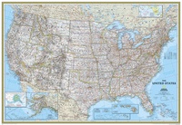 Wandkaart USA - Verenigde Staten Political, 110 x 77 cm | National Geographic
Het klassieke kaartbeeld van National Geographic, de grenzen van de staten van Amerika zijn apart gekleurd. De wandkaart is heel gedetailleerd met veel plaatsen, wegen, rivieren en nationale parken, het …
★★★★★ Wandkaart Canada, antiek, 97 x 82 cm | National Geographic
Our most detailed wall map of Canada, features the classic National Geographic reference styling. Features thousands of place names, accurate political boundaries, national parks, archeological sites, and major infrastructure networks …
 Stadskaart New York City Skyline, 84 x 59 cm | Maps International
Een schitterende en kleurrijke aquarel van de skyline van New York. Een aanwinst voor elke muur. A bright and colourful watercolour skyline of the city of New York. With …
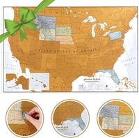 Scratch Map USA - Verenigde Staten Travel Edition 43.2 x 27,9 cm | Maps International
Deze scratch map is een travel edition, wat betekent dat het een kleine versie is met formaat 42 x 30 cm. De kaart zit verpakt in een mooie koker. …
Laatste reviews

Een makkelijk en bruikbaar boek om planten op naam te kunnen brengen middels heldere sleutels. Het boek wordt beschouwd als een boek om altijd bij …
★★★★★ door Peter Teune 19 april 2024 | Heeft dit artikel gekocht
Mooie duidelijke gids, hopelijk ook makkelijk in gebruik. Nog niet gebruikt maar het is een duidelijke gids die ook in de voorbereidingen goed van pas …
★★★★★ door Jo 19 april 2024 | Heeft dit artikel gekocht
Het boekje geeft veel (achtergrond)informatie over de route zelf en over de plaatsen waar je langs komt. Daarnaast is de route bewegwijzerd en dat is …
★★★★★ door Irma 18 april 2024 | Heeft dit artikel gekocht
Boekje was niet meer voorradig, door de inzet van een medewerker toch nog via via een boekje kunnen krijgen. Ik vind dit een hele bijzondere …
★★★★★ door Thea de Weerd 17 april 2024 | Heeft dit artikel gekocht