Winkelwagen
Geen items in winkelwagen
Ga naar winkelwagen
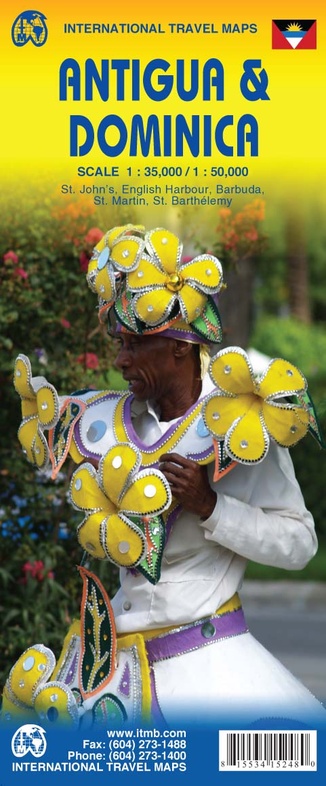
Wegenkaart - landkaart Antigua & Dominica | ITMB (9781553415244)
- ISBN / CODE: 9781553415244
- Schaal: 1:35000
- Uitgever: ITMB
- Soort: Wegenkaart
- Taal: Engels
- Bindwijze: -
- Uitvoering: -
- Schrijf als eerste een review
-
€ 13,95
Uitverkocht, nooit meer leverbaar

Beschrijving
Een degelijke kaart met aanduidingen van o.a. nationale parken, vliegveld, benzinepomp, dirt-roads. Als overzichtskaart goed te gebruiken.
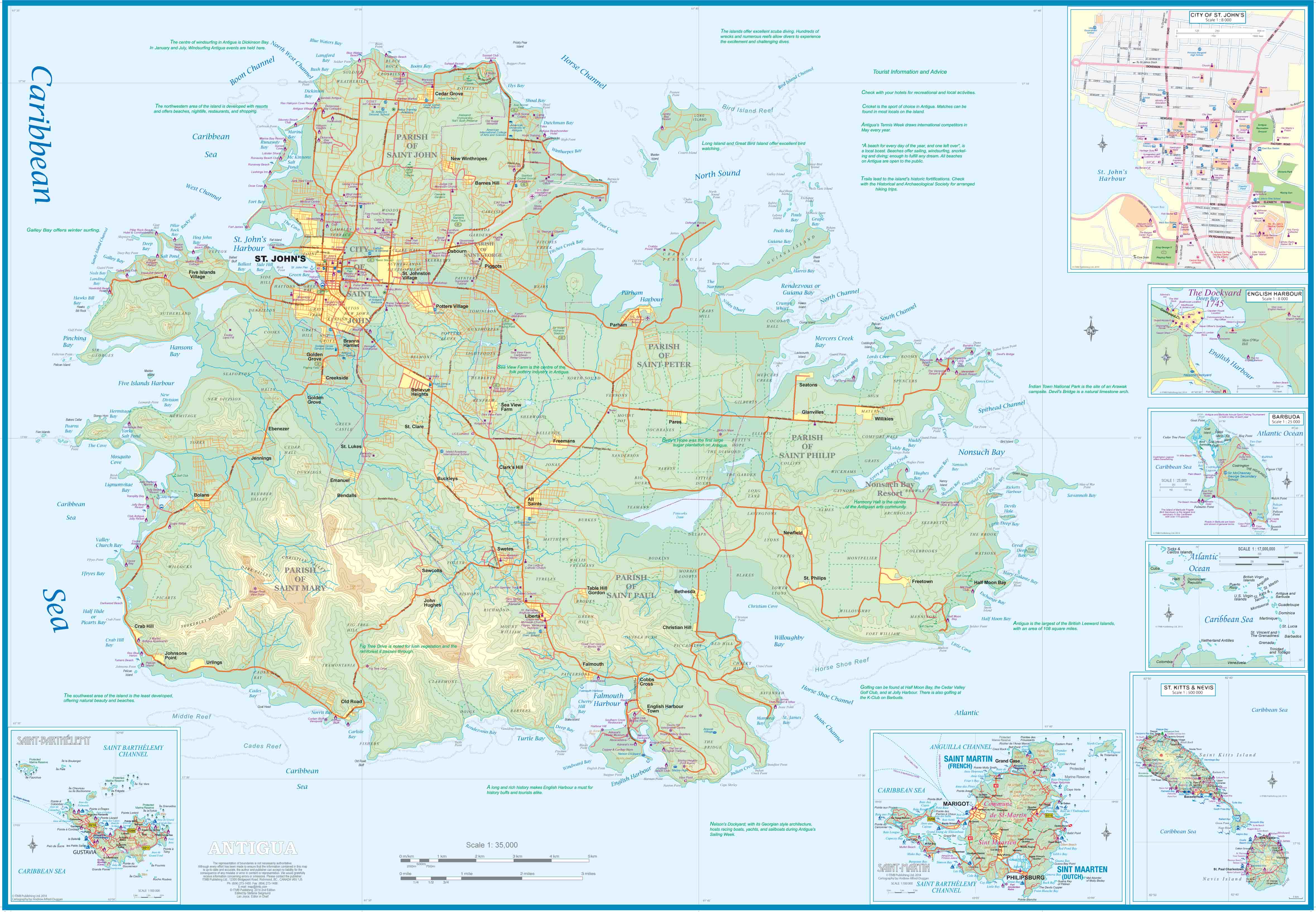
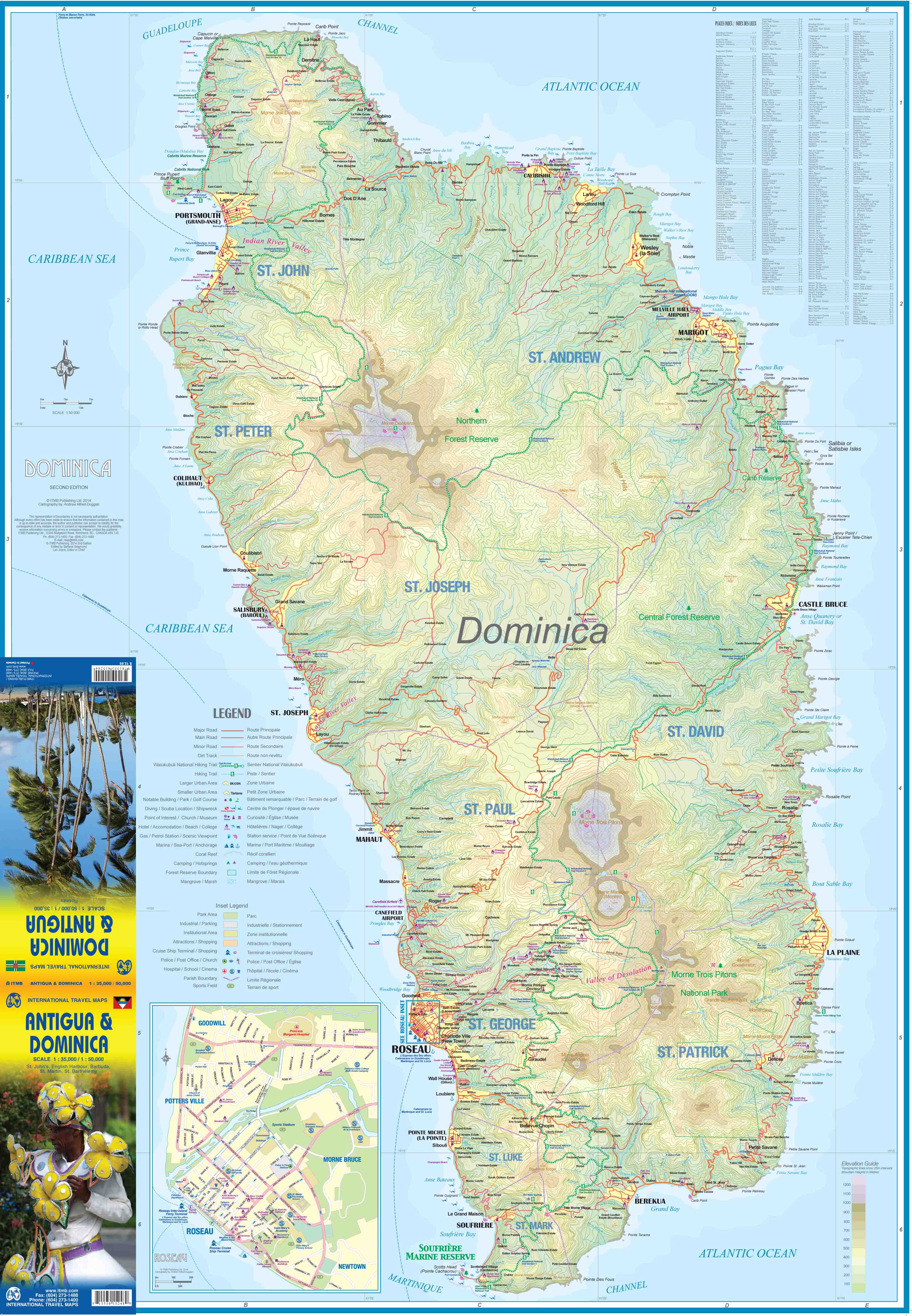
This is a vastly improved map of Antigua. When we first published this title, the digital data was state-of-the-art. Fortunately, advances in digital data base activity can now provide dramatically better mapping information, strengthening this title. The map also includes insets of St. John's (the capital) and of the famous Nelson's Dockyard at English Harbour. Inset maps of St. Barthelemy Island and Sint Maarten (Dutch)/Saint-Martin (French) and of tiny Barbuda are included. Side 2 reproduces our map of Dominica. This is the same map published as Dominica/St. Lucia and is provided here simply to improve marketing. The Caribbean islands are steadily improving ferry connections between the islands, so we are increasingly showing more than one island entity on each published map (this one shows five different island countries). The map also has two covers, so can be marketed either Antigua side outwards or Dominica side outwards
Legend Includes:
Road by classification, Motorways, Main Roads, Rail Ways, Parks, Border, Lakes, Hotels, Motels, Viewpoints, Point of Interests and much more...
Reviews
Geen reviews gevonden voor dit product.
Schrijf een review
Graag horen wij wat u van dit artikel vindt. Vindt u het goed, leuk, mooi, slecht, lelijk, onbruikbaar of erg handig: schrijf gerust alles op! Het is niet alleen leuk om te doen maar u informeert andere klanten er ook nog mee!
Alle gerelateerde rubrieken >
Ook interessant voor midden-amerika/antigua
-

Wegenkaart - landkaart Dominica - Sa
€ 13,95Wegenkaarten Dominica -

Waterkaart Fish Card Caribbean Sea D
€ 7,50Waterkaarten Aruba -

Wegenatlas Travel Atlas Caribbean Is
€ 16,50Wegenatlassen Aruba -

Reisgids Caribbean – the lesser Anti
€ 24,95Reisgidsen Aruba -

Vogelgids Birds of the Lesser Antill
€ 24,95Vogelgidsen Antigua