Wegenatlassen - Schotland
 Wegenatlas Big Road Atlas Britain and Northern Ireland 2025 | A3 | Ringband | Collins
Grote wegenatlas, a3-formaat in ringband. The ultimate 3.2 miles to 1 inch scale large-format, spiral-bound road atlas of Britain, featuring Collins’ popular and well established road mapping, and designed for …
 Wegenatlas Navigator Scotland | A4-Formaat | Ringand | Philip's Maps
Duidelijke en gedetailleerde atlas van Schotland met enkele stadsplattegronden en register. Zuid Schotland is van schaal 1:100.000 en het noorden met schaal 1:200.000 Philip's Navigator Scotland is part of …
★★★★★ Wegenatlas Navigator Camping and Caravanning – Atlas of Britain | Philip's Maps
THE MUST-HAVE ATLAS OF BRITAIN FOR CAMPING, CARAVANNING AND MOTORHOMES'A map that beats all others' - The Daily Telegraph'Scale, accuracy and clarity are without parallel' - Driving Magazine'No. 1 in …
★★★★★★★★★★ Wegenatlas Scotland - Schotland | A-Z Map Company
Handzame gedetailleerde wegenatlas van Schotland. This A-Z map of Scotland is a full colour regional road atlas featuring 92 pages of road mapping covering the whole of the country. …
★★★★★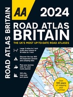 Wegenatlas Road Atlas Britain 2024 - A4 | AA Publishing
Wegenatlas, met spiraal, van Groot-Brittannie, Engeland, Wales en Schotland, met toeristische informatie This top-selling road atlas showcases Britain’s clearest mapping from the experts from the AA. Each page has been …
★★★★★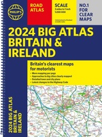 Wegenatlas Big Atlas Britain & Ireland 2023 A3-Formaat | Philip's Maps
Goede gedetailleerde wegenatlas van Groot-Brittannië, schaal 1:200.000 met een overzichtskaart van Ierland, schaal 1:1.000.000. Groot formaat, A3, en in ringband. Philip's is No. 1 in the UK for clear maps …
★★★★★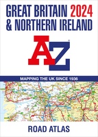 Wegenatlas Great Britain and Northern Ireland Road Atlas 2024 | A-Z Map Company
A full-colour, paperback road atlas of Great Britain, now fully revised and updated. Clear detailed road mapping at a scale of 3.5 miles to 1 inch. Presented in a large, …
 Wegenatlas Philip's Easy to Read Road Atlas of Britain 2025 | A3-Formaat | Paperback | Philip's Maps
With the detail you need at a size you can read, the latest edition of 2025 Philip's Big Easy to Read Road Atlas of Britain is super-clear, super-sized and bang …
 Wegenatlas Glovebox Atlas Scotland - Schotland | AA Publishing
This handy road atlas fits the glovebox of your car, perfect for quick referencing on the move. Including information on route planning, car ferry routes and operators, restricted motorway junctions, …
 Wegenatlas Handy Road Atlas Scotland - Schotland | Collins
Handzame A% wegenatlas van Schotland met register en stadsplattegronden. Discover new places with handy road atlases from Collins. Your ideal companion for navigating around Scotland. It has extremely clear, route …
 Wegenatlas Navigator Britain - Engeland en Schotland 1:100.000 | Philip's Maps
Bijzonder gedetaileerde wegenatlas van Engeland en Schotland op schaal 1:100.000 (met het noorden van Schotland 1:200.000). Alle wegen, bezienswaardigheden, National Trails, campings ... noem maar op en je vindt het …
★★★★★ Wegenatlas Britain for Bikers | Voor Motoren | A-Z Map Company
Discover the best biking routes around Great Britain and Northern Ireland. Your essential rideout roadbook covering the best biking routes around Great Britain and Northern Ireland, including short trips and …
 Wegenatlas Big Road Atlas Britain 2024 - A3 | Ringband | AA Publishing
This best-selling A3 format atlas is available two binding styles; softback and spiral bound. Each page has been titled with its geographical location so you can turn to the page …
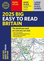
★★★★★ Wegenatlas Easy to Read Road Atlas Britain 2025 | Philip's Maps
"The detail you need at a size you can read". The latest 2025 Philip's Easy to Read Road Atlas of Britain from the best-selling Road Atlas range has over 350 …
★★★★★ Wegenatlas 2025 Collins Handy Road Atlas Britain and Ireland | Collins
Handzame A5 wegenatlas van Engeland, Wales, Schotland en Ierland met register en stadsplattegronden This easy-to-use, handy A5 sized road atlas with popular lie-flat spiral binding features extremely clear route planning …
★★★★★ Wegenatlas Essential Road Atlas Britain 2025 | A4 | Ringband | Collins
This A4 road atlas with lie-flat spiral binding provides clear and detailed road mapping for England, Wales and Southern Scotland at a scale of 3.2 miles to 1 inch (1:200,000). …
 Wegenatlas Philip's Easy to Read Road Atlas of Britain 2025 | A4-Formaat | Ringband | Philip's Maps
"The detail you need at a size you can read". The latest 2025 Philip's Easy to Read Road Atlas of Britain from the best-selling Road Atlas range has over 350 …
Laatste reviews

Een makkelijk en bruikbaar boek om planten op naam te kunnen brengen middels heldere sleutels. Het boek wordt beschouwd als een boek om altijd bij …
★★★★★ door Peter Teune 19 april 2024 | Heeft dit artikel gekocht
Mooie duidelijke gids, hopelijk ook makkelijk in gebruik. Nog niet gebruikt maar het is een duidelijke gids die ook in de voorbereidingen goed van pas …
★★★★★ door Jo 19 april 2024 | Heeft dit artikel gekocht
Het boekje geeft veel (achtergrond)informatie over de route zelf en over de plaatsen waar je langs komt. Daarnaast is de route bewegwijzerd en dat is …
★★★★★ door Irma 18 april 2024 | Heeft dit artikel gekocht
Boekje was niet meer voorradig, door de inzet van een medewerker toch nog via via een boekje kunnen krijgen. Ik vind dit een hele bijzondere …
★★★★★ door Thea de Weerd 17 april 2024 | Heeft dit artikel gekocht