Winkelwagen
Geen items in winkelwagen
Ga naar winkelwagen
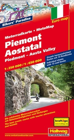
Wegenkaart - landkaart Motomap Motorkaart Piemont - Aosta - Piemonte | Hallwag (9783828307513)
1:250 000 en 1:650 000
- ISBN / CODE: 9783828307513
- Schaal: 1:250000
- Uitgever: Hallwag
- Soort: Wegenkaart
- Serie: Motomap
- Taal: Engels, Duits
- Bindwijze: -
- Uitvoering: -
- Schrijf als eerste een review
-
€ 19,50
Uitverkocht, nooit meer leverbaar
Beschrijving
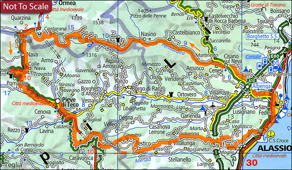
Die schönsten Strecken mit Sehenswürdigkeiten und Herbergen. GPS-Daten: Gratis Download der Motorradtouren. Einzeln herausnehmbare Karten mit 16 Roadbooks
Piemonte - Aosta Valley Motorbike Map Set from Hallwag with individual waterproof and tear-resistant maps for 13 day tours spread over a much wider area than suggested by the map title, including some of the most spectacular Alpine routes. The selected tours are from 145 km to 457 km long, and each is prominently highlighted on a separate handy size, 24.5 x 23 cm map extract printed on waterproof and tear-resistant synthetic paper.
Among the tours presented in this title are:
- a Tour of Mont Blanc from Courmayeaur crossing over to France through the Mont Blanc tunnel and returning via Col du Petit San Bernard
- a circuit from Aosta to Martigny through the Grand St Bernard Pass and back via Chamonix and the tunnel
- a route from Menton to the Mercantour NP and the adjoining part of the Italian Alps returning through the Tende Pass
- a French Riviera circuit with Nice and Monte Carlo
- a one or two day tour, over 450km long, from Domodossola across the Simplon Pass to Brig, along the Swiss section of the Rhone, north around the Urner Alps and returning to Italy via Disentis, Bellinzona and Locarno; with alternatives via the Furka Pass and the St. Gotthard Pass
- a route along the coast of the Italian Riviera with San Remo and the Ligurian Alps
Accompanying information on each map extract indicates the degree of difficulty, distance and approximate timing, etc, and recommended accommodation. All the text is in German only.
All the selected tour are presented together on the accompanying overview road map covering a much wider area of eastern France, all of Switzerland, southern Germany and north-western Italy (west to Marseille and Dijon; north to Metz and beyond Stuttgart; east to Parma and Pisa). Road network is clearly presented with distances on many local roads, gradients, seasonal closures, etc. Topography is shown by relief shading with plenty of spot heights and names of peaks, mountain ranges, valley and other geographical features. Map legend includes English.
Reviews
Geen reviews gevonden voor dit product.
Schrijf een review
Graag horen wij wat u van dit artikel vindt. Vindt u het goed, leuk, mooi, slecht, lelijk, onbruikbaar of erg handig: schrijf gerust alles op! Het is niet alleen leuk om te doen maar u informeert andere klanten er ook nog mee!
Alle gerelateerde rubrieken >
Ook interessant voor europa/italie/val-daosta
-

Wandelatlas 1 Grande traversata dell
€ 18,95Wandelatlassen Val d'Aosta -

Wandelgids 77 Piemonte Piemont - Nor
€ 17,50Wandelgidsen Val d'Aosta -

Reisgids PassePartout Valle d'Aosta
€ 24,50Reisgidsen Val d'Aosta -

Wandelkaart 37 Valle di Champorcher
€ 15,90Wandelkaarten Val d'Aosta -
 | Kümmerly & Frey")
Wegenkaart - landkaart 01 Aostadal -
€ 13,50Wegenkaarten Val d'Aosta