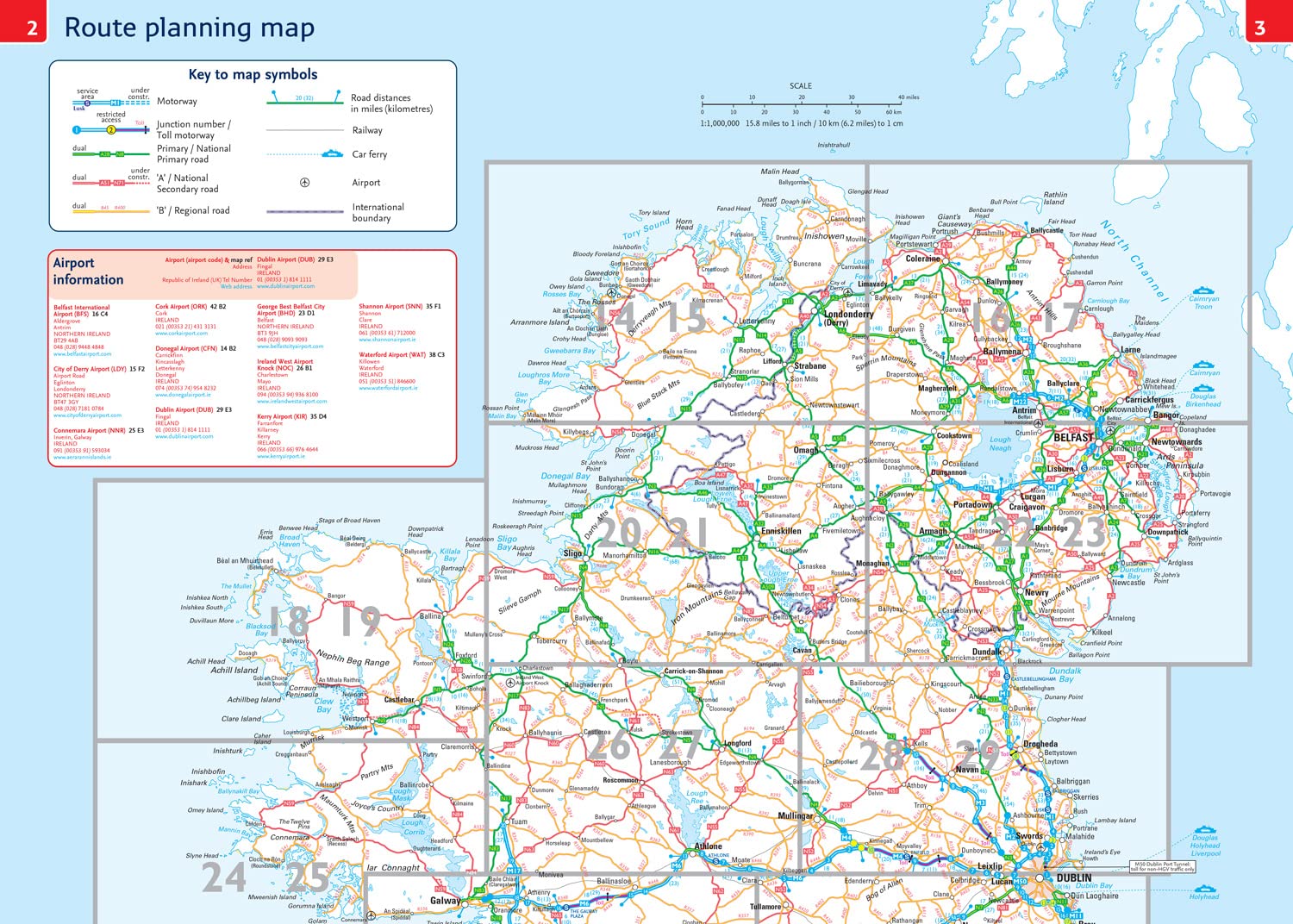
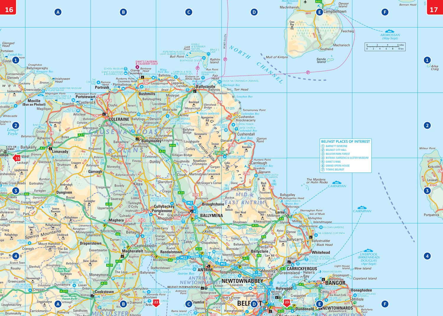
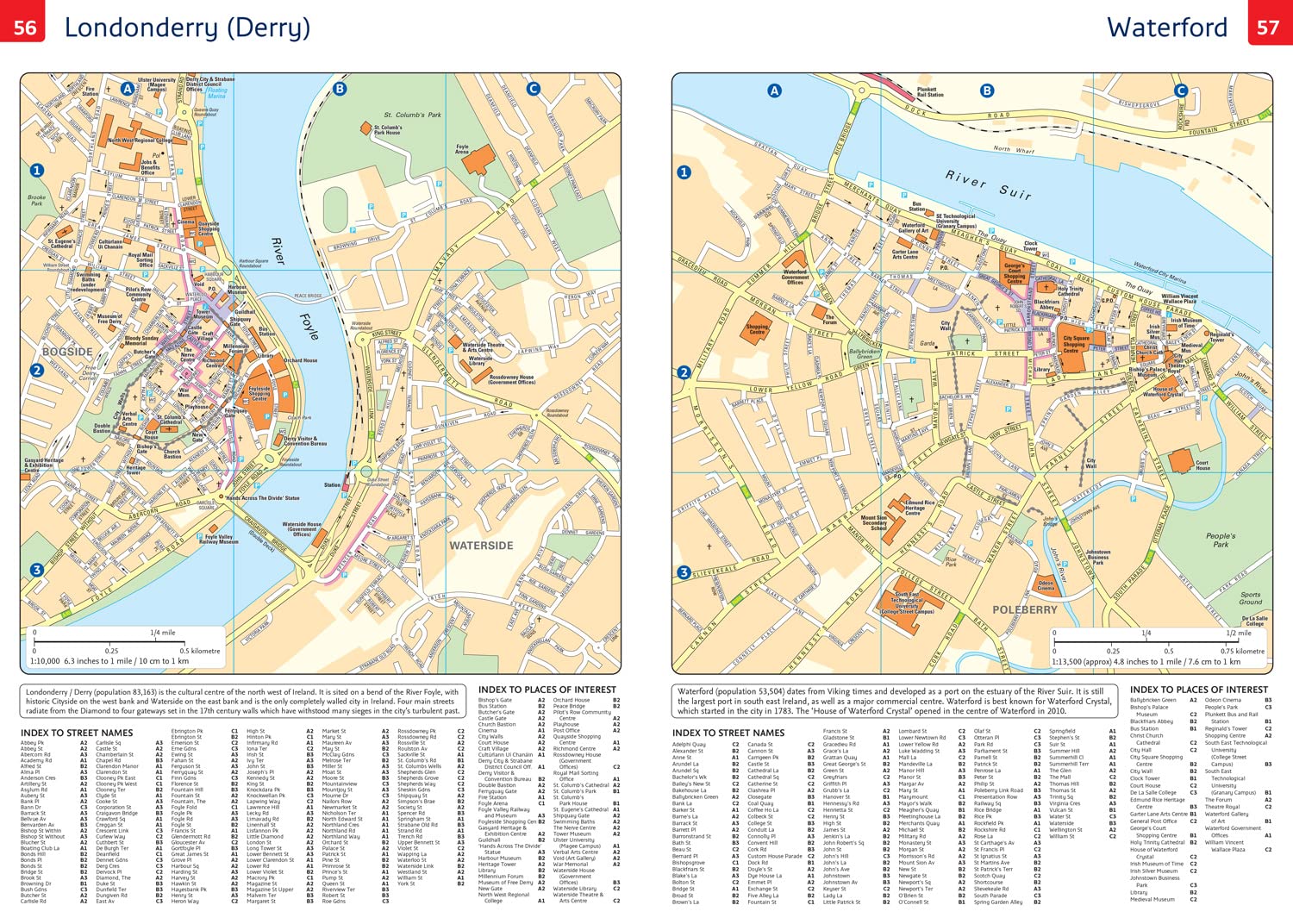
Wegenatlas Road Atlas Ireland | A4-Formaat | Paperback | Collins (9780008787462)
Touring Edition A4 Paperback

- ISBN / CODE: 9780008787462
- Editie: 12-02-2026
- Aantal blz.: 64
- Schaal: 1:330000
- Uitgever: Collins
- Soort: Wegenatlas
- Taal: Engels
- Hoogte: 29.8 cm
- Breedte: 20.8 cm
- Dikte: 0.6 cm
- Bindwijze: Paperback
- Uitvoering: -
- Schrijf als eerste een review
-
€ 9,95
Op voorraad. Voor 17.00 uur op werkdagen besteld, morgen in huis in Nederland Levertijd Belgie
Gratis verzending in Nederland vanaf €50,-
Beschrijving
Reviews
Geen reviews gevonden voor dit product.
Schrijf een review
Graag horen wij wat u van dit artikel vindt. Vindt u het goed, leuk, mooi, slecht, lelijk, onbruikbaar of erg handig: schrijf gerust alles op! Het is niet alleen leuk om te doen maar u informeert andere klanten er ook nog mee!
Ook interessant voor europa/ierland
-

Wandelkaart 27 Discoverer Upper Loug
€ 19,50Wandelkaarten Ierland -

Campergids Mit dem Wohnmobil Irland
€ 22,50Campergidsen Ierland -

Wandelgids 5988 Kompass Wanderführer
€ 19,95Wandelgidsen Noord Ierland -

Wegenkaart - landkaart 3303 Adventur
€ 18,50Wegenkaarten Ierland -

Wandkaart 20427 Ireland – Ierland, 7
€ 25,95Wandkaarten van landen Ierland