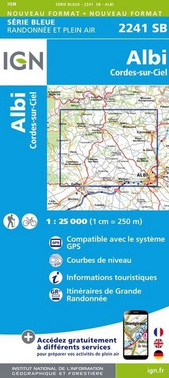
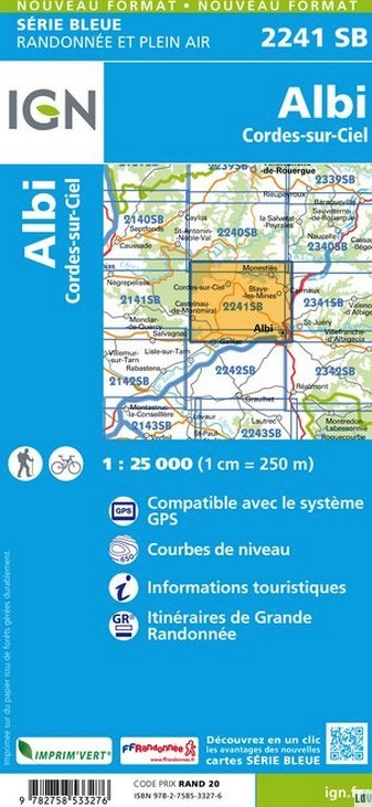
Wandelkaart - Topografische kaart 2241SB Albi, Cordes-sur-Ciel | IGN - Institut Géographique National (9782758552659)
- ISBN / CODE: 9782758552659
- Editie: meest recente editie
- Schaal: 1:25000
- Uitgever: IGN - Institut Géographique National
- Soort: Topografische kaart, Wandelkaart
- Serie: Serie bleue
- Taal: Engels, Frans
- Uitvoering: -
- Bindwijze: -
- Beoordeling: 5,0 ★★★★★ (1 review) Schrijf een review
-
€ 16,95
Leverbaar in 3 - 5 werkdagen in huis in Nederland Levertijd Belgie
Gratis verzending in Nederland vanaf €35,-

-
Topografische kaarten IGN 25.000 Cevennen
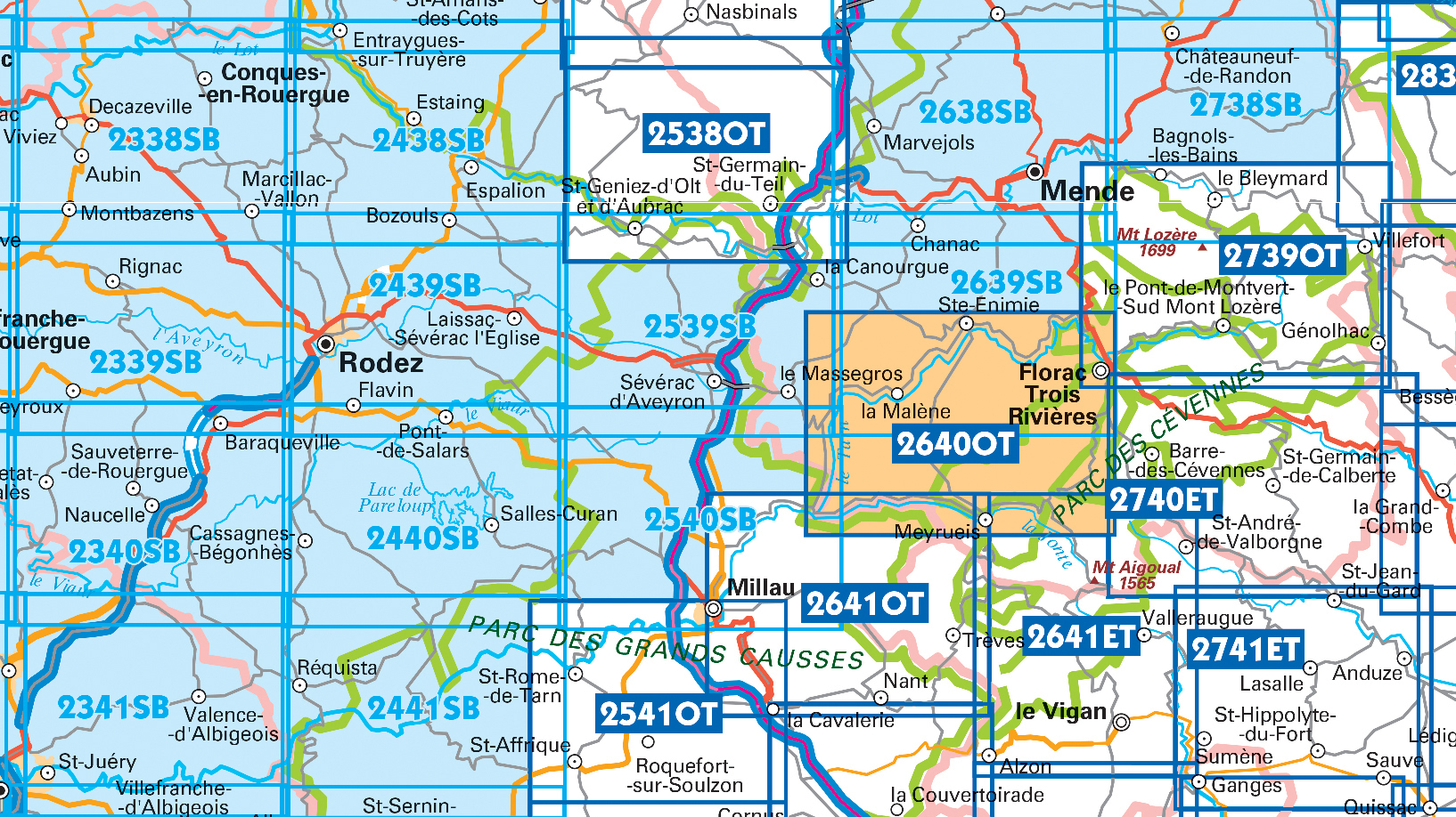
Producten op deze overzichtskaart:
Klik op een product om naar de pagina van dat product te gaan.
- Wandelkaart - Topografische kaart 2241SB Albi, Cordes-sur-Ciel | IGN - Institut Géographique National
- Wandelkaart - Topografische kaart 2338SB Decazeville | IGN - Institut Géographique National
- Wandelkaart - Topografische kaart 2339SB Rieupeyroux - Moyrazes | IGN - Institut Géographique National
- Wandelkaart - Topografische kaart 2340SB Naucelle, La Salvetat, Peyrales | IGN - Institut Géographique National
- Wandelkaart - Topografische kaart 2341SB Carmaux, Valence-d'Albigeoi | IGN - Institut Géographique National
- Wandelkaart - Topografische kaart 2438SB Espalion - Estaing | IGN - Institut Géographique National
- Wandelkaart - Topografische kaart 2439SB Rodez - Laissac | IGN - Institut Géographique National
- Wandelkaart - Topografische kaart 2440SB Salles-Curan, Lac de Pareloup, Cassagnes, Begonhes | IGN - Institut Géographique National
- Wandelkaart - Topografische kaart 2441SB Réquista, Villefranche-de-Panat | IGN - Institut Géographique National
- Wandelkaart - Topografische kaart 2538OT Ste-Eulalie-d'Olt - Hte Vallée du Lot - Mt d'Aubrac | IGN - Institut Géographique National
- Wandelkaart - Topografische kaart 2539SB Sévérac-le-Château, Lapanouse | IGN - Institut Géographique National
- Wandelkaart - Topografische kaart 2540SB St-Beauzély, Aguessac, Gorges-du-Tarn | IGN - Institut Géographique National
- Wandelkaart - Topografische kaart 2541OT Millau, St-Affrique - PNR Grands Causses | IGN - Institut Géographique National
- Wandelkaart - Topografische kaart 2638SB Mende | IGN - Institut Géographique National
- Wandelkaart - Topografische kaart 2639SB Florac | IGN - Institut Géographique National
- Wandelkaart - Topografische kaart 2640OT Gorges du Tarn et de la Jonte | IGN - Institut Géographique National
- Wandelkaart - Topografische kaart 2641ET Mont Aigoual | IGN - Institut Géographique National
- Wandelkaart - Topografische kaart 2641OT Millau | IGN - Institut Géographique National
- Wandelkaart - Topografische kaart 2738SB Le Bleymard | IGN - Institut Géographique National
- Wandelkaart - Topografische kaart 2739OT Mont Lozère - Florac | IGN - Institut Géographique National
- Wandelkaart - Topografische kaart 2740ET Corniche des Cevennes | IGN - Institut Géographique National
- Wandelkaart - Topografische kaart 2741ET Saint-Hippolyte-du-Fort | IGN - Institut Géographique National
-
Topografische kaarten IGN 25.000 Midi - Pyreneeën : Oost

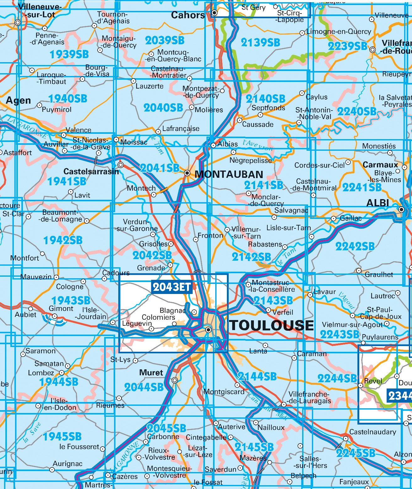
Producten op deze overzichtskaart:
Klik op een product om naar de pagina van dat product te gaan.
- Wandelkaart - Topografische kaart 1940SB Valence | IGN - Institut Géographique National
- Wandelkaart - Topografische kaart 1942SB Beaumont-de-Lomagne | IGN - Institut Géographique National
- Wandelkaart - Topografische kaart 1943SB L'Isle-Jourdain | IGN - Institut Géographique National
- Wandelkaart - Topografische kaart 1944SB Samatan | IGN - Institut Géographique National
- Wandelkaart - Topografische kaart 1945SB Le Fousseret - Aurignac | IGN - Institut Géographique National
- Wandelkaart - Topografische kaart 2039SB Montcuq-en-Quercy-Blanc, Labastide-Marnhac | IGN - Institut Géographique National
- Wandelkaart - Topografische kaart 2040SB Moissac | IGN - Institut Géographique National
- Wandelkaart - Topografische kaart 2041SB Montauban (Tarn-et-Garonne) - Castelsarrasin | IGN - Institut Géographique National
- Wandelkaart - Topografische kaart 2042SB Grenade | IGN - Institut Géographique National
- Wandelkaart - Topografische kaart 2043ET Toulouse | IGN - Institut Géographique National
- Wandelkaart - Topografische kaart 2044SB Muret, Saint Lys | IGN - Institut Géographique National
- Wandelkaart - Topografische kaart 2045SB Lézat-sur-Lèze, Cazeres | IGN - Institut Géographique National
- Wandelkaart - Topografische kaart 2139SB Cahors | IGN - Institut Géographique National
- Wandelkaart - Topografische kaart 2140SB Caussade | IGN - Institut Géographique National
- Wandelkaart - Topografische kaart 2141SB Nègrepelisse | IGN - Institut Géographique National
- Wandelkaart - Topografische kaart 2142SB Villemur-sur-Tarn | IGN - Institut Géographique National
- Wandelkaart - Topografische kaart 2143SB Montastruc-la-Conseillère, Lavaur | IGN - Institut Géographique National
- Wandelkaart - Topografische kaart 2144SB Ramonville-Saint-Agne | IGN - Institut Géographique National
- Wandelkaart - Topografische kaart 2145SB Auterive - Mazères - Saverdun | IGN - Institut Géographique National
- Wandelkaart - Topografische kaart 2239SB Villefranche-de-Rouergue, Martiel | IGN - Institut Géographique National
- Wandelkaart - Topografische kaart 2240SB Varen, Laguépie, Najac | IGN - Institut Géographique National
- Wandelkaart - Topografische kaart 2241SB Albi, Cordes-sur-Ciel | IGN - Institut Géographique National
- Wandelkaart - Topografische kaart 2242SB Gaillac, Graulhet | IGN - Institut Géographique National
- Wandelkaart - Topografische kaart 2244SB Revel, St-Félix-Lauragais, Sorèze | IGN - Institut Géographique National
- Wandelkaart - Topografische kaart 2245SB Bram - Castelnaudary | IGN - Institut Géographique National
- Wandelkaart - Topografische kaart 2340SB Naucelle, La Salvetat, Peyrales | IGN - Institut Géographique National
- Wandelkaart - Topografische kaart 2341SB Carmaux, Valence-d'Albigeoi | IGN - Institut Géographique National
-
Wandelkaarten IGN 25.000 Cevennen


Producten op deze overzichtskaart:
Klik op een product om naar de pagina van dat product te gaan.
- Wandelkaart - Topografische kaart 2241SB Albi, Cordes-sur-Ciel | IGN - Institut Géographique National
- Wandelkaart - Topografische kaart 2338SB Decazeville | IGN - Institut Géographique National
- Wandelkaart - Topografische kaart 2339SB Rieupeyroux - Moyrazes | IGN - Institut Géographique National
- Wandelkaart - Topografische kaart 2340SB Naucelle, La Salvetat, Peyrales | IGN - Institut Géographique National
- Wandelkaart - Topografische kaart 2341SB Carmaux, Valence-d'Albigeoi | IGN - Institut Géographique National
- Wandelkaart - Topografische kaart 2438SB Espalion - Estaing | IGN - Institut Géographique National
- Wandelkaart - Topografische kaart 2439SB Rodez - Laissac | IGN - Institut Géographique National
- Wandelkaart - Topografische kaart 2440SB Salles-Curan, Lac de Pareloup, Cassagnes, Begonhes | IGN - Institut Géographique National
- Wandelkaart - Topografische kaart 2441SB Réquista, Villefranche-de-Panat | IGN - Institut Géographique National
- Wandelkaart - Topografische kaart 2538OT Ste-Eulalie-d'Olt - Hte Vallée du Lot - Mt d'Aubrac | IGN - Institut Géographique National
- Wandelkaart - Topografische kaart 2539SB Sévérac-le-Château, Lapanouse | IGN - Institut Géographique National
- Wandelkaart - Topografische kaart 2540SB St-Beauzély, Aguessac, Gorges-du-Tarn | IGN - Institut Géographique National
- Wandelkaart - Topografische kaart 2541OT Millau, St-Affrique - PNR Grands Causses | IGN - Institut Géographique National
- Wandelkaart - Topografische kaart 2638SB Mende | IGN - Institut Géographique National
- Wandelkaart - Topografische kaart 2639SB Florac | IGN - Institut Géographique National
- Wandelkaart - Topografische kaart 2640OT Gorges du Tarn et de la Jonte | IGN - Institut Géographique National
- Wandelkaart - Topografische kaart 2641ET Mont Aigoual | IGN - Institut Géographique National
- Wandelkaart - Topografische kaart 2641OT Millau | IGN - Institut Géographique National
- Wandelkaart - Topografische kaart 2738SB Le Bleymard | IGN - Institut Géographique National
- Wandelkaart - Topografische kaart 2739OT Mont Lozère - Florac | IGN - Institut Géographique National
- Wandelkaart - Topografische kaart 2740ET Corniche des Cevennes | IGN - Institut Géographique National
- Wandelkaart - Topografische kaart 2741ET Saint-Hippolyte-du-Fort | IGN - Institut Géographique National
-
Wandelkaarten IGN 25.000 Midi - Pyreneeën : Oost

Producten op deze overzichtskaart:
Klik op een product om naar de pagina van dat product te gaan.
- Wandelkaart - Topografische kaart 1940SB Valence | IGN - Institut Géographique National
- Wandelkaart - Topografische kaart 1942SB Beaumont-de-Lomagne | IGN - Institut Géographique National
- Wandelkaart - Topografische kaart 1943SB L'Isle-Jourdain | IGN - Institut Géographique National
- Wandelkaart - Topografische kaart 1944SB Samatan | IGN - Institut Géographique National
- Wandelkaart - Topografische kaart 1945SB Le Fousseret - Aurignac | IGN - Institut Géographique National
- Wandelkaart - Topografische kaart 2039SB Montcuq-en-Quercy-Blanc, Labastide-Marnhac | IGN - Institut Géographique National
- Wandelkaart - Topografische kaart 2040SB Moissac | IGN - Institut Géographique National
- Wandelkaart - Topografische kaart 2041SB Montauban (Tarn-et-Garonne) - Castelsarrasin | IGN - Institut Géographique National
- Wandelkaart - Topografische kaart 2042SB Grenade | IGN - Institut Géographique National
- Wandelkaart - Topografische kaart 2043ET Toulouse | IGN - Institut Géographique National
- Wandelkaart - Topografische kaart 2044SB Muret, Saint Lys | IGN - Institut Géographique National
- Wandelkaart - Topografische kaart 2045SB Lézat-sur-Lèze, Cazeres | IGN - Institut Géographique National
- Wandelkaart - Topografische kaart 2139SB Cahors | IGN - Institut Géographique National
- Wandelkaart - Topografische kaart 2140SB Caussade | IGN - Institut Géographique National
- Wandelkaart - Topografische kaart 2141SB Nègrepelisse | IGN - Institut Géographique National
- Wandelkaart - Topografische kaart 2142SB Villemur-sur-Tarn | IGN - Institut Géographique National
- Wandelkaart - Topografische kaart 2143SB Montastruc-la-Conseillère, Lavaur | IGN - Institut Géographique National
- Wandelkaart - Topografische kaart 2144SB Ramonville-Saint-Agne | IGN - Institut Géographique National
- Wandelkaart - Topografische kaart 2145SB Auterive - Mazères - Saverdun | IGN - Institut Géographique National
- Wandelkaart - Topografische kaart 2239SB Villefranche-de-Rouergue, Martiel | IGN - Institut Géographique National
- Wandelkaart - Topografische kaart 2240SB Varen, Laguépie, Najac | IGN - Institut Géographique National
- Wandelkaart - Topografische kaart 2241SB Albi, Cordes-sur-Ciel | IGN - Institut Géographique National
- Wandelkaart - Topografische kaart 2242SB Gaillac, Graulhet | IGN - Institut Géographique National
- Wandelkaart - Topografische kaart 2244SB Revel, St-Félix-Lauragais, Sorèze | IGN - Institut Géographique National
- Wandelkaart - Topografische kaart 2245SB Bram - Castelnaudary | IGN - Institut Géographique National
- Wandelkaart - Topografische kaart 2340SB Naucelle, La Salvetat, Peyrales | IGN - Institut Géographique National
- Wandelkaart - Topografische kaart 2341SB Carmaux, Valence-d'Albigeoi | IGN - Institut Géographique National
Overzichtskaarten
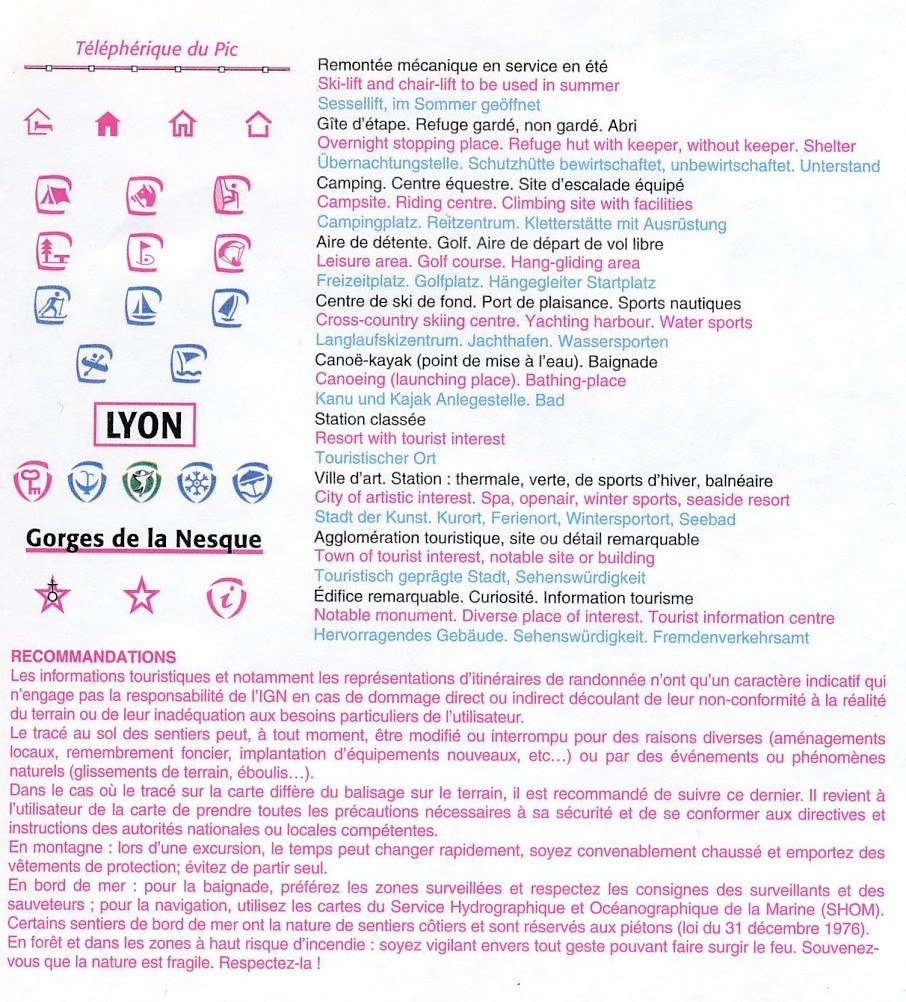
Beschrijving
Reviews
Prima topo serie. Kaart uitsnede en nummering is wel verandert dus even goed kijken op de overzichtskaart.
★★★★★ door willem pijpers 14 november 2019Vond u dit een nuttige review? (login om te beoordelen)
Schrijf een review
Graag horen wij wat u van dit artikel vindt. Vindt u het goed, leuk, mooi, slecht, lelijk, onbruikbaar of erg handig: schrijf gerust alles op! Het is niet alleen leuk om te doen maar u informeert andere klanten er ook nog mee!
Ook interessant voor europa/frankrijk/pyreneeen
-

Natuurgids - Reisgids Crossbill Guid
€ 28,95Natuurgidsen Cevennen -

Wegenkaart - landkaart 526 Languedoc
€ 11,95Wegenkaarten Pyreneeën -

Wandelgids 1086 Traversée des Pyréné
€ 19,95Wandelgidsen Pyreneeën -

Reisverhaal Travels with a Donkey in
€ 9,95Reisverhalen Cevennen -

Wandelkaart - Fietskaart Parc Nation
€ 11,50Fietskaarten Cevennen