Wandelkaart - Topografische kaart 2403SB Steenvoorde - Bailleul | IGN - Institut Géographique National (9782758549338)
- ISBN / CODE: 9782758549338
- Editie: meest recente editie
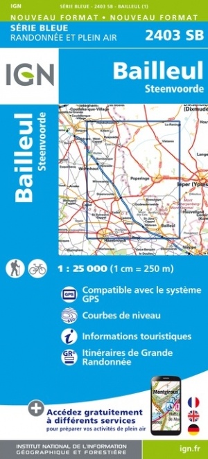
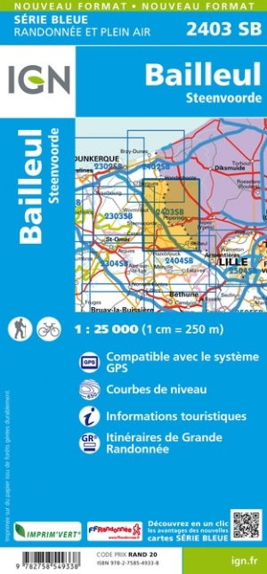
- Schaal: 1:25000
- Uitgever: IGN - Institut Géographique National
- Soort: Topografische kaart, Wandelkaart
- Serie: Serie bleue
- Taal: Engels, Frans
- Bindwijze: -
- Uitvoering: Papier
- Schrijf als eerste een review
-
€ 16,95
Leverbaar in 3 - 5 werkdagen in huis in Nederland Levertijd Belgie
Gratis verzending in Nederland vanaf €35,-
-
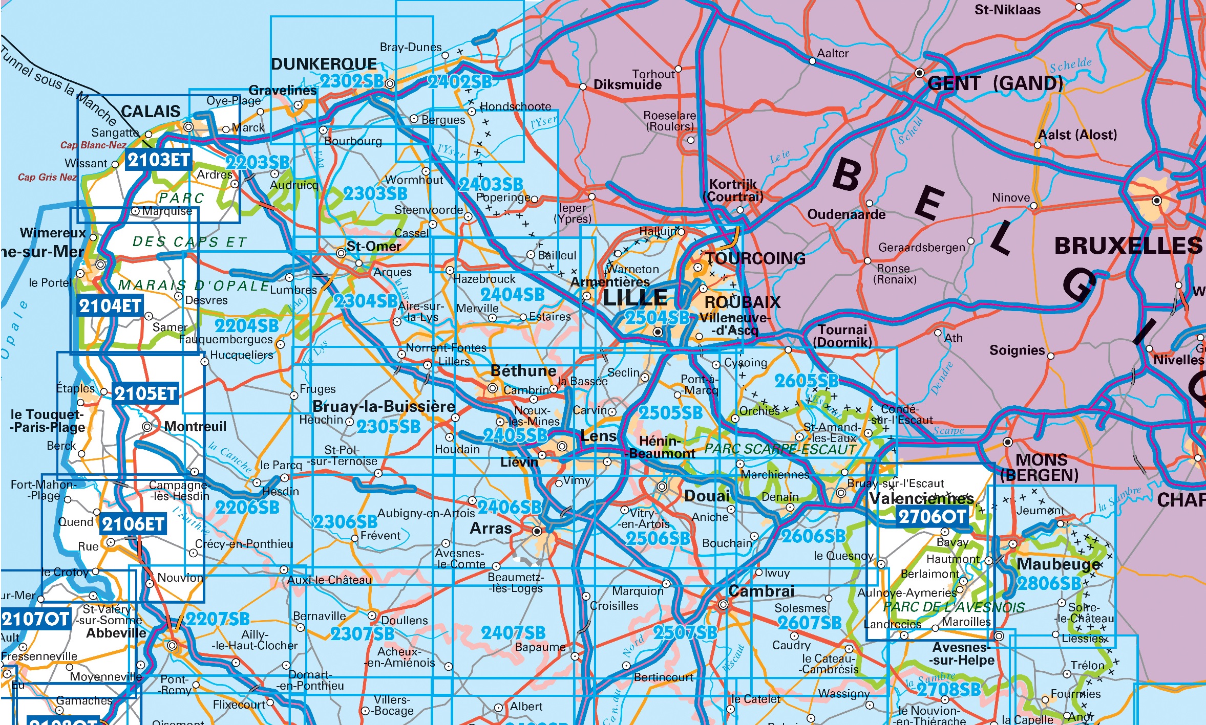
Overzicht IGN 25.000 Pays de Calais - Picardië: Noord


Producten op deze overzichtskaart:
Klik op een product om naar de pagina van dat product te gaan.
- Wandelkaart - Topografische kaart 2103ET Calais | IGN - Institut Géographique National
- Wandelkaart - Topografische kaart 2104ET Boulogne-Sur-Mer | IGN - Institut Géographique National
- Wandelkaart - Topografische kaart 2105ET Le Touquet-Paris-Plage, Berck, Étaples, Vallée de la Canche | IGN - Institut Géographique National
- Wandelkaart - Topografische kaart 2106ET Baie de Somme, Le Crotoy, Fort-Mahon-Plage | IGN - Institut Géographique National
- Wandelkaart - Topografische kaart 2107OT Le Tréport | IGN - Institut Géographique National
- Wandelkaart - Topografische kaart 2203SB Gravelines - Andruicq | IGN - Institut Géographique National
- Wandelkaart - Topografische kaart 2204SB Lumbres - Fruges | IGN - Institut Géographique National
- Wandelkaart - Topografische kaart 2206SB Hesdin, Auxi-le-Château | IGN - Institut Géographique National
- Wandelkaart - Topografische kaart 2207SB Abbeville, Domart-en-Ponthieu | IGN - Institut Géographique National
- Topografische kaart - Wandelkaart 2302SB Dunkerque - Gravelines | IGN - Institut Géographique National
- Wandelkaart - Topografische kaart 2303SB Wormhout - Cassel - Watten | IGN - Institut Géographique National
- Wandelkaart - Topografische kaart 2304SB Aire-Sur-La-Lys, St-Omer | IGN - Institut Géographique National
- Wandelkaart - Topografische kaart 2305SB Lillers - Heuchin | IGN - Institut Géographique National
- Wandelkaart - Topografische kaart 2306SB Saint-Michel-Sur-Ternoise, Frévent | IGN - Institut Géographique National
- Wandelkaart - Topografische kaart 2307SB Doullens - Beauval | IGN - Institut Géographique National
- Wandelkaart - Topografische kaart 2402SB Hondschoote - Bergues | IGN - Institut Géographique National
- Wandelkaart - Topografische kaart 2403SB Steenvoorde - Bailleul | IGN - Institut Géographique National
- Wandelkaart - Topografische kaart 2404SB Armentieres - Hazebrouck | IGN - Institut Géographique National
- Wandelkaart - Topografische kaart 2405SB Lens - Béthune | IGN - Institut Géographique National
- Wandelkaart - Topografische kaart 2406SB Arras, Avesnes-le-Comte | IGN - Institut Géographique National
- Wandelkaart - Topografische kaart 2407SB Bapaume, Acheux-en-Amiénois | IGN - Institut Géographique National
- Wandelkaart - Topografische kaart 2504SB Lille - Roubaix - Tourcoing | IGN - Institut Géographique National
- Wandelkaart - Topografische kaart 2505SB Leforest - Cysoing - Hénin-Beaumont - Carvin | IGN - Institut Géographique National
- Wandelkaart - Topografische kaart 2506SB Douai - Rouvroy - Vitry-en-Artois | IGN - Institut Géographique National
- Wandelkaart - Topografische kaart 2507SB Cambrai - Bertincourt | IGN - Institut Géographique National
- Wandelkaart - Topografische kaart 2606SB Valenciennes - Denain | IGN - Institut Géographique National
- Wandelkaart - Topografische kaart 2607SB Le Cateau-Cambrésis, Caudry | IGN - Institut Géographique National
- Wandelkaart - Topografische kaart 2706OT Foret De Mormal | IGN - Institut Géographique National
- Wandelkaart - Topografische kaart 2806SB Jeumont - Maubeuge | IGN - Institut Géographique National
-
Overzicht IGN 25.000 Pays de Calais - Picardië: Noord
Producten op deze overzichtskaart:
Klik op een product om naar de pagina van dat product te gaan.
- Wandelkaart - Topografische kaart 2103ET Calais | IGN - Institut Géographique National
- Wandelkaart - Topografische kaart 2104ET Boulogne-Sur-Mer | IGN - Institut Géographique National
- Wandelkaart - Topografische kaart 2105ET Le Touquet-Paris-Plage, Berck, Étaples, Vallée de la Canche | IGN - Institut Géographique National
- Wandelkaart - Topografische kaart 2106ET Baie de Somme, Le Crotoy, Fort-Mahon-Plage | IGN - Institut Géographique National
- Wandelkaart - Topografische kaart 2107OT Le Tréport | IGN - Institut Géographique National
- Wandelkaart - Topografische kaart 2203SB Gravelines - Andruicq | IGN - Institut Géographique National
- Wandelkaart - Topografische kaart 2204SB Lumbres - Fruges | IGN - Institut Géographique National
- Wandelkaart - Topografische kaart 2206SB Hesdin, Auxi-le-Château | IGN - Institut Géographique National
- Wandelkaart - Topografische kaart 2207SB Abbeville, Domart-en-Ponthieu | IGN - Institut Géographique National
- Topografische kaart - Wandelkaart 2302SB Dunkerque - Gravelines | IGN - Institut Géographique National
- Wandelkaart - Topografische kaart 2303SB Wormhout - Cassel - Watten | IGN - Institut Géographique National
- Wandelkaart - Topografische kaart 2304SB Aire-Sur-La-Lys, St-Omer | IGN - Institut Géographique National
- Wandelkaart - Topografische kaart 2305SB Lillers - Heuchin | IGN - Institut Géographique National
- Wandelkaart - Topografische kaart 2306SB Saint-Michel-Sur-Ternoise, Frévent | IGN - Institut Géographique National
- Wandelkaart - Topografische kaart 2307SB Doullens - Beauval | IGN - Institut Géographique National
- Wandelkaart - Topografische kaart 2402SB Hondschoote - Bergues | IGN - Institut Géographique National
- Wandelkaart - Topografische kaart 2403SB Steenvoorde - Bailleul | IGN - Institut Géographique National
- Wandelkaart - Topografische kaart 2404SB Armentieres - Hazebrouck | IGN - Institut Géographique National
- Wandelkaart - Topografische kaart 2405SB Lens - Béthune | IGN - Institut Géographique National
- Wandelkaart - Topografische kaart 2406SB Arras, Avesnes-le-Comte | IGN - Institut Géographique National
- Wandelkaart - Topografische kaart 2407SB Bapaume, Acheux-en-Amiénois | IGN - Institut Géographique National
- Wandelkaart - Topografische kaart 2504SB Lille - Roubaix - Tourcoing | IGN - Institut Géographique National
- Wandelkaart - Topografische kaart 2505SB Leforest - Cysoing - Hénin-Beaumont - Carvin | IGN - Institut Géographique National
- Wandelkaart - Topografische kaart 2506SB Douai - Rouvroy - Vitry-en-Artois | IGN - Institut Géographique National
- Wandelkaart - Topografische kaart 2507SB Cambrai - Bertincourt | IGN - Institut Géographique National
- Wandelkaart - Topografische kaart 2606SB Valenciennes - Denain | IGN - Institut Géographique National
- Wandelkaart - Topografische kaart 2607SB Le Cateau-Cambrésis, Caudry | IGN - Institut Géographique National
- Wandelkaart - Topografische kaart 2706OT Foret De Mormal | IGN - Institut Géographique National
- Wandelkaart - Topografische kaart 2806SB Jeumont - Maubeuge | IGN - Institut Géographique National
Overzichtskaarten
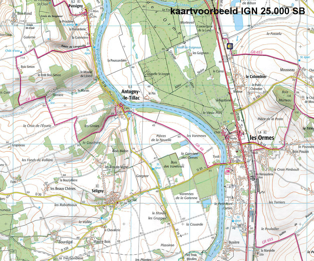
Beschrijving
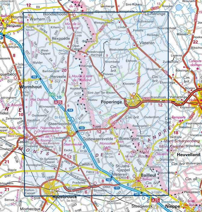
Communes couvertes : Bailleul, Herzeele, Wormhout, Hondschoote, Godewaersvelde, Houtkerque, Boeschepe, Saint-Sylvestre-Cappel, Saint-Jans-Cappel, Sainte-Marie-Cappel, Bambecque, Méteren, Rexpoëde, Pradelles, Hardifort, Hazebrouck, Terdeghem, Strazeele, Eecke, Caëstre, West-Cappel
Lieux à découvrir : Mont Scherpenberg, Mont Rouge, Mont des Recollets, Mont Noir, Mont Cassel, Monts de Flandre, Cimetières britaniques, Drievenmeulen, Moulin à vent de l'Hofland, Moulin de la Roome, Moulin de la Victoire, la Briarde, Moulin Deshod, Steenmeulen, Noordmeulen
Dimensions : 132 cm x 96 cm
Reviews
Geen reviews gevonden voor dit product.
Schrijf een review
Graag horen wij wat u van dit artikel vindt. Vindt u het goed, leuk, mooi, slecht, lelijk, onbruikbaar of erg handig: schrijf gerust alles op! Het is niet alleen leuk om te doen maar u informeert andere klanten er ook nog mee!
Ook interessant voor europa/frankrijk/picardie-nw-frankrijk
-

Reisgids Michelin groene gids Picard
€ 22,99Reisgidsen Picardie - Noordwest Frankrijk -

Wandelkaart - Topografische kaart 25
€ 16,95Topografische kaarten Picardie - Noordwest Frankrijk -

Fietskaart 3 Calais | Alta Via
€ 13,95Fietskaarten Picardie - Noordwest Frankrijk -

Fietsgids Véloguide Paris - Roubaix
€ 15,50Fietsgidsen Picardie - Noordwest Frankrijk -

Wandelgids Picardië | Uitgeverij Elm
€ 18,99Wandelgidsen Picardie - Noordwest Frankrijk