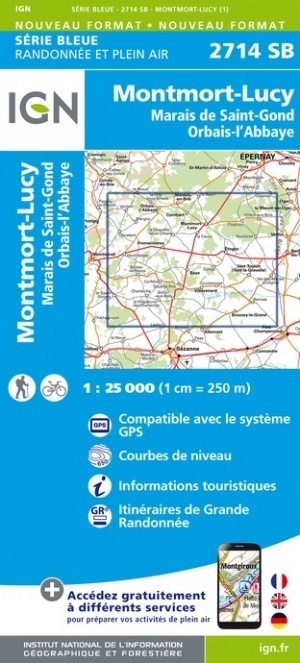
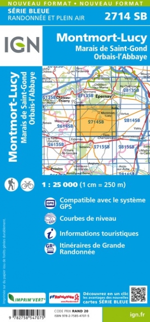
Wandelkaart - Topografische kaart 2714SB Montmort-Lucy | IGN - Institut Géographique National (9782758547075)
Marais de St-Gond, Orbais-l'Abbaye
- ISBN / CODE: 9782758547075
- Editie: meest recente versie
- Schaal: 1:25000
- Uitgever: IGN - Institut Géographique National
- Soort: Topografische kaart, Wandelkaart
- Serie: Serie bleue
- Taal: Engels, Frans
- Schrijf als eerste een review
-
€ 16,95
Leverbaar in 3 - 5 werkdagen in huis in Nederland Levertijd Belgie
Gratis verzending in Nederland vanaf €35,-

-
Topografische kaarten IGN 25.000 Champagne - Ardennen: Zuid
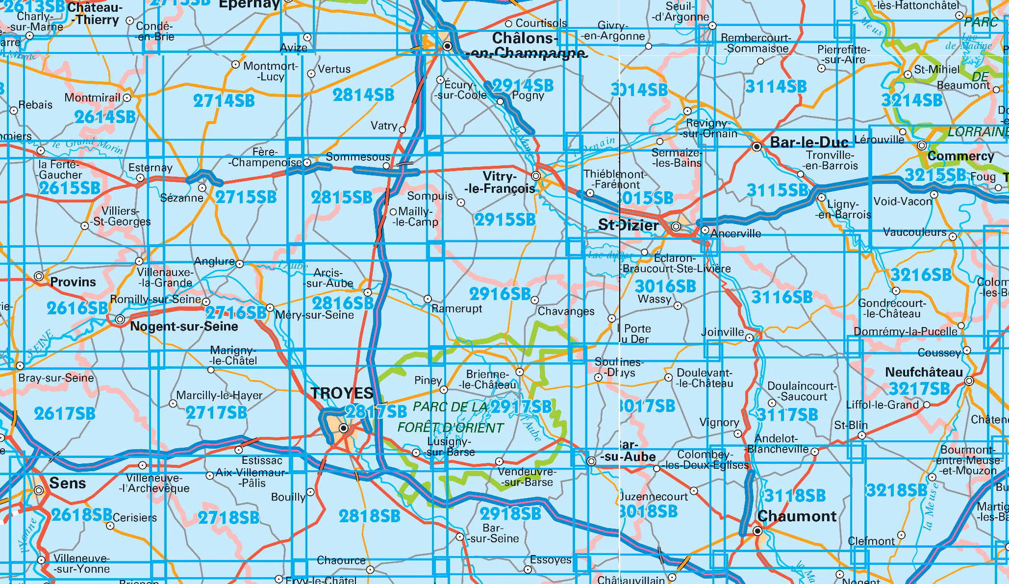
Producten op deze overzichtskaart:
Klik op een product om naar de pagina van dat product te gaan.
- Wandelkaart - Topografische kaart 2615SB Esternay, Villiers-St-Georges | IGN - Institut Géographique National
- Wandelkaart - Topografische kaart 2616SB Provins | IGN - Institut Géographique National
- Wandelkaart - Topografische kaart 2714SB Montmort-Lucy | IGN - Institut Géographique National
- Wandelkaart - Topografische kaart 2715SB Connantre - Sézanne | IGN - Institut Géographique National
- Wandelkaart - Topografische kaart 2716SB Romilly-sur-Seine | IGN - Institut Géographique National
- Wandelkaart - Topografische kaart 2717SB Estissac | IGN - Institut Géographique National
- Wandelkaart - Topografische kaart 2718SB Auxon | IGN - Institut Géographique National
- Wandelkaart - Topografische kaart 2814SB Thibie - Vertus | IGN - Institut Géographique National
- Wandelkaart - Topografische kaart 2815SB Mailly-le-Camp, Fère-Champenoise | IGN - Institut Géographique National
- Wandelkaart - Topografische kaart 2816SB Arcis-sur-Aube, Plancy-l'Abbaye | IGN - Institut Géographique National
- Wandelkaart - Topografische kaart 2817SB Troyes, Lusigny-sur-Barse | IGN - Institut Géographique National
- Topografische kaart - Wandelkaart 2818SB Bouilly | IGN - Institut Géographique National
- Wandelkaart - Topografische kaart 2914SB Marson, Châlons-en-Champagne | IGN - Institut Géographique National
- Wandelkaart - Topografische kaart 2915SB Vitry-le-François, Sompuis | IGN - Institut Géographique National
- Wandelkaart - Topografische kaart 2916SB Chavanges, Dampierre | IGN - Institut Géographique National
- Wandelkaart - Topografische kaart 2917SB Brienne-le-Chateau, Piney, Lacs de la Foret d'Orient | IGN - Institut Géographique National
- Topografische kaart - Wandelkaart 2918SB Bar-sur-Seine | IGN - Institut Géographique National
- Wandelkaart - Topografische kaart 3014SB Revigny-sur-Ornain | IGN - Institut Géographique National
- Wandelkaart - Topografische kaart 3015SB Saint-Dizier, Pargny-sur-Saulx | IGN - Institut Géographique National
- Wandelkaart - Topografische kaart 3016SB Wassy, Montier-en-Der, Lac du Der-Chantecoq | IGN - Institut Géographique National
- Wandelkaart - Topografische kaart 3017SB Doulevant-le-Chateau, Soulaines, Dhuys | IGN - Institut Géographique National
- Topografische kaart - Wandelkaart 3018SB Bar-sur-Aube | IGN - Institut Géographique National
- Wandelkaart - Topografische kaart 3114SB Pierrefitte-sur-Aire | IGN - Institut Géographique National
- Wandelkaart - Topografische kaart 3115SB Bar-le-Duc | IGN - Institut Géographique National
- Wandelkaart - Topografische kaart 3116SB Joinville | IGN - Institut Géographique National
- Wandelkaart - Topografische kaart 3117SB Doulaincourt, Saucourt, Andelot-Blancheville | IGN - Institut Géographique National
- Wandelkaart - Topografische kaart 3118SB Chaumont, Biesles | IGN - Institut Géographique National
- Topografische kaart - Wandelkaart 3119SB Nogent | IGN - Institut Géographique National
- Topografische kaart - Wandelkaart 3120SB Langres - Auberive | IGN - Institut Géographique National
- Wandelkaart - Topografische kaart 3215SB Commercy | IGN - Institut Géographique National
- Wandelkaart - Topografische kaart 3216SB Gondrecourt-le-Château | IGN - Institut Géographique National
- Wandelkaart - Topografische kaart 3217SB Neufchateau, St-Blin | IGN - Institut Géographique National
- Wandelkaart - Topografische kaart 3218SB Bourmont - Clefmont | IGN - Institut Géographique National
- Wandelkaart - Topografische kaart 3219SB Bourbonne-les-Bains - Val-de-Meuse (Montigny-le-Roi) | IGN - Institut Géographique National
-
Wandelkaarten IGN 25.000 Champagne - Ardennen: Zuid


Producten op deze overzichtskaart:
Klik op een product om naar de pagina van dat product te gaan.
- Wandelkaart - Topografische kaart 2615SB Esternay, Villiers-St-Georges | IGN - Institut Géographique National
- Wandelkaart - Topografische kaart 2616SB Provins | IGN - Institut Géographique National
- Wandelkaart - Topografische kaart 2714SB Montmort-Lucy | IGN - Institut Géographique National
- Wandelkaart - Topografische kaart 2715SB Connantre - Sézanne | IGN - Institut Géographique National
- Wandelkaart - Topografische kaart 2716SB Romilly-sur-Seine | IGN - Institut Géographique National
- Wandelkaart - Topografische kaart 2717SB Estissac | IGN - Institut Géographique National
- Wandelkaart - Topografische kaart 2718SB Auxon | IGN - Institut Géographique National
- Wandelkaart - Topografische kaart 2814SB Thibie - Vertus | IGN - Institut Géographique National
- Wandelkaart - Topografische kaart 2815SB Mailly-le-Camp, Fère-Champenoise | IGN - Institut Géographique National
- Wandelkaart - Topografische kaart 2816SB Arcis-sur-Aube, Plancy-l'Abbaye | IGN - Institut Géographique National
- Wandelkaart - Topografische kaart 2817SB Troyes, Lusigny-sur-Barse | IGN - Institut Géographique National
- Topografische kaart - Wandelkaart 2818SB Bouilly | IGN - Institut Géographique National
- Wandelkaart - Topografische kaart 2914SB Marson, Châlons-en-Champagne | IGN - Institut Géographique National
- Wandelkaart - Topografische kaart 2915SB Vitry-le-François, Sompuis | IGN - Institut Géographique National
- Wandelkaart - Topografische kaart 2916SB Chavanges, Dampierre | IGN - Institut Géographique National
- Wandelkaart - Topografische kaart 2917SB Brienne-le-Chateau, Piney, Lacs de la Foret d'Orient | IGN - Institut Géographique National
- Topografische kaart - Wandelkaart 2918SB Bar-sur-Seine | IGN - Institut Géographique National
- Wandelkaart - Topografische kaart 3014SB Revigny-sur-Ornain | IGN - Institut Géographique National
- Wandelkaart - Topografische kaart 3015SB Saint-Dizier, Pargny-sur-Saulx | IGN - Institut Géographique National
- Wandelkaart - Topografische kaart 3016SB Wassy, Montier-en-Der, Lac du Der-Chantecoq | IGN - Institut Géographique National
- Wandelkaart - Topografische kaart 3017SB Doulevant-le-Chateau, Soulaines, Dhuys | IGN - Institut Géographique National
- Topografische kaart - Wandelkaart 3018SB Bar-sur-Aube | IGN - Institut Géographique National
- Wandelkaart - Topografische kaart 3114SB Pierrefitte-sur-Aire | IGN - Institut Géographique National
- Wandelkaart - Topografische kaart 3115SB Bar-le-Duc | IGN - Institut Géographique National
- Wandelkaart - Topografische kaart 3116SB Joinville | IGN - Institut Géographique National
- Wandelkaart - Topografische kaart 3117SB Doulaincourt, Saucourt, Andelot-Blancheville | IGN - Institut Géographique National
- Wandelkaart - Topografische kaart 3118SB Chaumont, Biesles | IGN - Institut Géographique National
- Topografische kaart - Wandelkaart 3119SB Nogent | IGN - Institut Géographique National
- Topografische kaart - Wandelkaart 3120SB Langres - Auberive | IGN - Institut Géographique National
- Wandelkaart - Topografische kaart 3215SB Commercy | IGN - Institut Géographique National
- Wandelkaart - Topografische kaart 3216SB Gondrecourt-le-Château | IGN - Institut Géographique National
- Wandelkaart - Topografische kaart 3217SB Neufchateau, St-Blin | IGN - Institut Géographique National
- Wandelkaart - Topografische kaart 3218SB Bourmont - Clefmont | IGN - Institut Géographique National
- Wandelkaart - Topografische kaart 3219SB Bourbonne-les-Bains - Val-de-Meuse (Montigny-le-Roi) | IGN - Institut Géographique National
Overzichtskaarten
Beschrijving
Reviews
Geen reviews gevonden voor dit product.
Schrijf een review
Graag horen wij wat u van dit artikel vindt. Vindt u het goed, leuk, mooi, slecht, lelijk, onbruikbaar of erg handig: schrijf gerust alles op! Het is niet alleen leuk om te doen maar u informeert andere klanten er ook nog mee!
Ook interessant voor europa/frankrijk/champagne-ardennen
-

Reisgids Gids voor de Slagvelden 191
€ 9,95Reisgidsen Champagne - Ardennen -

Fietskaart 26 Fietsroute-Netwerk Ve
€ 9,95Fietskaarten Champagne - Ardennen -

Wandelgids Champagne-Ardennen | Roth
€ 17,50Wandelgidsen Champagne - Ardennen -

Historische Kaart Grande Guerre - Ch
€ 9,95Historische Kaarten Champagne - Ardennen -

Wandelkaart - Topografische kaart 28
€ 16,95Topografische kaarten Champagne - Ardennen