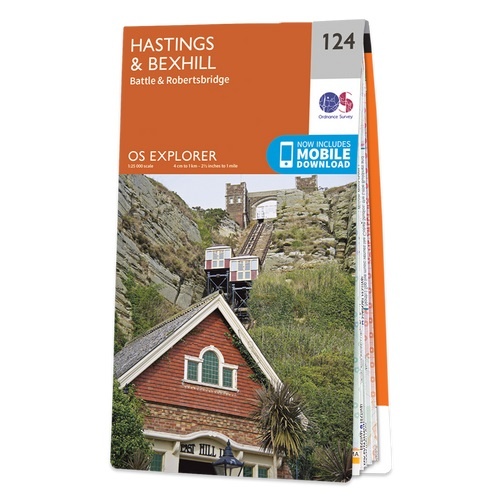
Wandelkaart - Topografische kaart 124 OS Explorer Map Hastings & Bexhill | Ordnance Survey (9780319243206)
Battle & Robertsbridge
- ISBN / CODE: 9780319243206
- Editie: 2015
- Schaal: 1:25000
- Uitgever: Ordnance Survey
- Soort: Topografische kaart, Wandelkaart
- Serie: OS Explorer Map
- Taal: Engels
- Hoogte: 23.0 cm
- Breedte: 13.0 cm
- Dikte: 1.0 cm
- Gewicht: 150.0 g
- Bindwijze: -
- Uitvoering: Papier
- Beoordeling: 5,0 ★★★★★ (3 reviews) Schrijf een review
-
€ 19,50
Leverbaar in 3 - 5 werkdagen in huis in Nederland Levertijd Belgie
Gratis verzending in Nederland vanaf €35,-
-
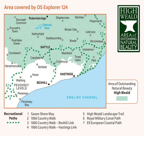
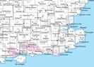
Overzichtskaart Explorer 25.000 topografische kaarten zuidoost Engeland - Kent - Londen


Producten op deze overzichtskaart:
Klik op een product om naar de pagina van dat product te gaan.
- Wandelkaart - Topografische kaart 124 OS Explorer Map Hastings & Bexhill | Ordnance Survey
- Wandelkaart - Topografische kaart 125 OS Explorer Map Romney Marsh & Rye & Winchelsea | Ordnance Survey
- Wandelkaart - Topografische kaart 131 OS Explorer Map Romsey, Andover & Test Valley | Ordnance Survey
- Wandelkaart - Topografische kaart 135 OS Explorer Map Ashdown Forest (greenw) | Ordnance Survey
- Wandelkaart - Topografische kaart 136 OS Explorer Map High Weald | Ordnance Survey
- Wandelkaart - Topografische kaart 137 OS Explorer Map Ashford | Ordnance Survey
- Wandelkaart - Topografische kaart 138 OS Explorer Map Dover, Folkstone, Hythe | Ordnance Survey
- Wandelkaart - Topografische kaart 144 OS Explorer Map Basingstoke, Alto, Whitchurch | Ordnance Survey
- Wandelkaart - Topografische kaart 145 OS Explorer Map Guildford, Farnham | Ordnance Survey
- Wandelkaart - Topografische kaart 146 OS Explorer Map Dorking, Box Hill, Reigate | Ordnance Survey
- Wandelkaart - Topografische kaart 147 OS Explorer Map Sevenoaks and Tonbridge | Ordnance Survey
- Wandelkaart - Topografische kaart 148 OS Explorer Map Maidstone, Medway Towns | Ordnance Survey
- Wandelkaart - Topografische kaart 149 OS Explorer Map Sittingbourne, Faversham | Ordnance Survey
- Wandelkaart - Topografische kaart 150 OS Explorer Map Canterbury, Isle of Thanet | Ordnance Survey
- Wandelkaart - Topografische kaart 158 OS Explorer Map Newbury, Hungerford | Ordnance Survey
- Wandelkaart - Topografische kaart 159 OS Explorer Map Reading, Wokingham & Pangbourne Map | Thames Path | Ordnance Survey
- Wandelkaart - Topografische kaart 160 OS Explorer Map Windsor, Weybridge, Bracknell | Thames Path | Ordnance Survey
- Wandelkaart - Topografische kaart 161 OS Explorer Map London South (greenw.m) | Ordnance Survey
- Wandelkaart - Topografische kaart 162 OS Explorer Map Greenwich, Gravesend | Ordnance Survey
- Wandelkaart - Topografische kaart 163 OS Explorer Map Gravesend, Rochester | Ordnance Survey
- Wandelkaart - Topografische kaart 170 OS Explorer Map Abingdon, Wantage & Vale of White Horse | Ordnance Survey
- Wandelkaart - Topografische kaart 171 OS Explorer Map Chiltern Hills West | Ordnance Survey
- Wandelkaart - Topografische kaart 172 OS Explorer Map Chiltern Hills East | Ordnance Survey
- Wandelkaart - Topografische kaart 173 OS Explorer Map London North | Ordnance Survey
- Wandelkaart - Topografische kaart 174 OS Explorer Map Epping Forest, Lee Valley | Ordnance Survey
- Wandelkaart - Topografische kaart 175 OS Explorer Map Southend-on-Sea, Basildon | Ordnance Survey
- Wandelkaart - Topografische kaart 176 OS Explorer Map Blackwater Estuary | Ordnance Survey
- Wandelkaart - Topografische kaart 180 OS Explorer Map Oxford | Ordnance Survey
- Wandelkaart - Topografische kaart 181 OS Explorer Map Chiltern Hills North | Ordnance Survey
- Wandelkaart - Topografische kaart 182 OS Explorer Map St-Albans, Hatfield | Ordnance Survey
- Wandelkaart - Topografische kaart 183 OS Explorer Map Chelmsford, the Rodings | Ordnance Survey
- Wandelkaart - Topografische kaart 184 OS Explorer Map Colchester, Harwich, Clacton-on-Sea | Ordnance Survey
- Wandelkaart - Topografische kaart 191 OS Explorer Map Banbury, Bicester, Chipping Norton | Ordnance Survey
- Wandelkaart - Topografische kaart 192 OS Explorer Map Buckingham, Milton Keynes | Ordnance Survey
- Wandelkaart - Topografische kaart 193 OS Explorer Map Luton, Stevenage | Ordnance Survey
- Wandelkaart - Topografische kaart 194 OS Explorer Map Hertford, Bishop's Stortford | Ordnance Survey
- Wandelkaart - Topografische kaart 195 OS Explorer Map Braintree, Saffron, Walden | Ordnance Survey
- Wandelkaart - Topografische kaart 196 OS Explorer Map Sudbury, Hadleigh, Dedham Vale | Ordnance Survey
- Wandelkaart - Topografische kaart 197 OS Explorer Map Ipswich, Felixstowe, Harwich | Ordnance Survey
- Wandelkaart - Topografische kaart OL03 OS Explorer Map Meon Valley - Portsmouth, Gosport & Fareham | Ordnance Survey
- Wandelkaart - Topografische kaart OL08 OS Explorer Map Chichester, South Harting & Selsey | Ordnance Survey
- Wandelkaart - Topografische kaart OL10 OS Explorer Map Arundel - Pulborough - Worthing | Ordnance Survey
- Wandelkaart - Topografische kaart OL11 OS Explorer Map Brighton & Hove, Lewes & Burgess Hill | Ordnance Survey
- Wandelkaart - Topografische kaart OL22 OS Explorer Map New Forest | Ordnance Survey
- Wandelkaart - Topografische kaart OL25 OS Explorer Map Eastbourne & Beachy Head | Ordnance Survey
- Wandelkaart - Topografische kaart OL29 OS Explorer Map Isle of Wight | Ordnance Survey
- Wandelkaart - Topografische kaart OL32 OS Explorer Map Winchester - New Alresford - East Meon | Ordnance Survey
- Wandelkaart - Topografische kaart OL33 OS Explorer Map Haslemere - Petersfield - Midhurst - Selborne | Ordnance Survey
- Wandelkaart - Topografische kaart OL34 OS Explorer Map Crawley - Horsham - Cranleigh - Billinghurst | Ordnance Survey
-
Overzichtskaart Explorer 25.000 wandelkaarten zuidoost Engeland - Kent - Londen
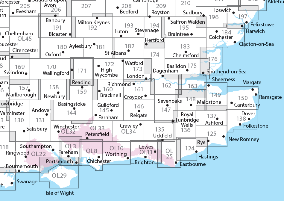
Producten op deze overzichtskaart:
Klik op een product om naar de pagina van dat product te gaan.
- Wandelkaart - Topografische kaart 124 OS Explorer Map Hastings & Bexhill | Ordnance Survey
- Wandelkaart - Topografische kaart 125 OS Explorer Map Romney Marsh & Rye & Winchelsea | Ordnance Survey
- Wandelkaart - Topografische kaart 131 OS Explorer Map Romsey, Andover & Test Valley | Ordnance Survey
- Wandelkaart - Topografische kaart 135 OS Explorer Map Ashdown Forest (greenw) | Ordnance Survey
- Wandelkaart - Topografische kaart 136 OS Explorer Map High Weald | Ordnance Survey
- Wandelkaart - Topografische kaart 137 OS Explorer Map Ashford | Ordnance Survey
- Wandelkaart - Topografische kaart 138 OS Explorer Map Dover, Folkstone, Hythe | Ordnance Survey
- Wandelkaart - Topografische kaart 144 OS Explorer Map Basingstoke, Alto, Whitchurch | Ordnance Survey
- Wandelkaart - Topografische kaart 145 OS Explorer Map Guildford, Farnham | Ordnance Survey
- Wandelkaart - Topografische kaart 146 OS Explorer Map Dorking, Box Hill, Reigate | Ordnance Survey
- Wandelkaart - Topografische kaart 147 OS Explorer Map Sevenoaks and Tonbridge | Ordnance Survey
- Wandelkaart - Topografische kaart 148 OS Explorer Map Maidstone, Medway Towns | Ordnance Survey
- Wandelkaart - Topografische kaart 149 OS Explorer Map Sittingbourne, Faversham | Ordnance Survey
- Wandelkaart - Topografische kaart 150 OS Explorer Map Canterbury, Isle of Thanet | Ordnance Survey
- Wandelkaart - Topografische kaart 158 OS Explorer Map Newbury, Hungerford | Ordnance Survey
- Wandelkaart - Topografische kaart 159 OS Explorer Map Reading, Wokingham & Pangbourne Map | Thames Path | Ordnance Survey
- Wandelkaart - Topografische kaart 160 OS Explorer Map Windsor, Weybridge, Bracknell | Thames Path | Ordnance Survey
- Wandelkaart - Topografische kaart 161 OS Explorer Map London South (greenw.m) | Ordnance Survey
- Wandelkaart - Topografische kaart 162 OS Explorer Map Greenwich, Gravesend | Ordnance Survey
- Wandelkaart - Topografische kaart 163 OS Explorer Map Gravesend, Rochester | Ordnance Survey
- Wandelkaart - Topografische kaart 170 OS Explorer Map Abingdon, Wantage & Vale of White Horse | Ordnance Survey
- Wandelkaart - Topografische kaart 171 OS Explorer Map Chiltern Hills West | Ordnance Survey
- Wandelkaart - Topografische kaart 172 OS Explorer Map Chiltern Hills East | Ordnance Survey
- Wandelkaart - Topografische kaart 173 OS Explorer Map London North | Ordnance Survey
- Wandelkaart - Topografische kaart 174 OS Explorer Map Epping Forest, Lee Valley | Ordnance Survey
- Wandelkaart - Topografische kaart 175 OS Explorer Map Southend-on-Sea, Basildon | Ordnance Survey
- Wandelkaart - Topografische kaart 176 OS Explorer Map Blackwater Estuary | Ordnance Survey
- Wandelkaart - Topografische kaart 180 OS Explorer Map Oxford | Ordnance Survey
- Wandelkaart - Topografische kaart 181 OS Explorer Map Chiltern Hills North | Ordnance Survey
- Wandelkaart - Topografische kaart 182 OS Explorer Map St-Albans, Hatfield | Ordnance Survey
- Wandelkaart - Topografische kaart 183 OS Explorer Map Chelmsford, the Rodings | Ordnance Survey
- Wandelkaart - Topografische kaart 184 OS Explorer Map Colchester, Harwich, Clacton-on-Sea | Ordnance Survey
- Wandelkaart - Topografische kaart 191 OS Explorer Map Banbury, Bicester, Chipping Norton | Ordnance Survey
- Wandelkaart - Topografische kaart 192 OS Explorer Map Buckingham, Milton Keynes | Ordnance Survey
- Wandelkaart - Topografische kaart 193 OS Explorer Map Luton, Stevenage | Ordnance Survey
- Wandelkaart - Topografische kaart 194 OS Explorer Map Hertford, Bishop's Stortford | Ordnance Survey
- Wandelkaart - Topografische kaart 195 OS Explorer Map Braintree, Saffron, Walden | Ordnance Survey
- Wandelkaart - Topografische kaart 196 OS Explorer Map Sudbury, Hadleigh, Dedham Vale | Ordnance Survey
- Wandelkaart - Topografische kaart 197 OS Explorer Map Ipswich, Felixstowe, Harwich | Ordnance Survey
- Wandelkaart - Topografische kaart OL03 OS Explorer Map Meon Valley - Portsmouth, Gosport & Fareham | Ordnance Survey
- Wandelkaart - Topografische kaart OL08 OS Explorer Map Chichester, South Harting & Selsey | Ordnance Survey
- Wandelkaart - Topografische kaart OL10 OS Explorer Map Arundel - Pulborough - Worthing | Ordnance Survey
- Wandelkaart - Topografische kaart OL11 OS Explorer Map Brighton & Hove, Lewes & Burgess Hill | Ordnance Survey
- Wandelkaart - Topografische kaart OL22 OS Explorer Map New Forest | Ordnance Survey
- Wandelkaart - Topografische kaart OL25 OS Explorer Map Eastbourne & Beachy Head | Ordnance Survey
- Wandelkaart - Topografische kaart OL29 OS Explorer Map Isle of Wight | Ordnance Survey
- Wandelkaart - Topografische kaart OL32 OS Explorer Map Winchester - New Alresford - East Meon | Ordnance Survey
- Wandelkaart - Topografische kaart OL33 OS Explorer Map Haslemere - Petersfield - Midhurst - Selborne | Ordnance Survey
- Wandelkaart - Topografische kaart OL34 OS Explorer Map Crawley - Horsham - Cranleigh - Billinghurst | Ordnance Survey
Overzichtskaarten
Beschrijving
- Visit the seaside towns of Hastings and Bexhill with their medieval Old Towns, Victorian and Edwardian seafronts and pavilions
- Glimpse wild deer and boar roaming in the forests near Robertsbridge and Dartwell Reservoir in the High Weald
- Walk or cycle in the footsteps of William the Conqueror on the 1066 Path, or start the Saxon Shore Way from Hastings to head north to Winchelsea
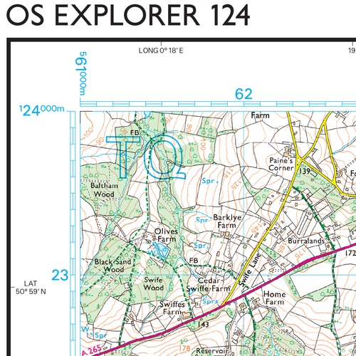
Met zijn 4cm voor 1 km (2 ½ cm voor 1 mijl) schaal, is de OS Explorer kaartenserie de ideale en meest gedetailleerde kaartenreeks voor mensen die graag outdoor-activiteiten zoals fietsen, wandelen, paardrijden, klimmen en watersporten.
Deze kaart is nog gedetailleerder dan de 'gewone' Landranger maps. Voor- en achterzijde bedrukt! Zeker op de moors en andere natuurgebieden van onschatbare waarden met echt alle aspecten van het landschap op de kaart ingetekend. Zeer goede detailkaart met topografische ondergrond. Hierop zijn toeristische symbolen van bezienswaardigheden ingetekend, daarnaast staan bijvoorbeeld campings en jeugdherbergen vermeld en - voor wandelaars het belangrijkst - alle right of way paden en Lange afstands Wandelpaden zijn er op te vinden. De ideale kaart voor het wandelen in Engeland, Wales of Schotland.
These highly detailed maps show all the administrative boundaries, settlements as small as isolated farms, the road network down to unfenced roads and country tracks, and field boundaries (hedges and drystone walls) which make navigation across the countryside much easier. Steep gradients on roads are indicated. Various landmarks, e.g. powerlines, archaeological sites, windmills, churches and lighthouses are shown and additional graphics indicate natural terrain features such as cliffs, scree, mud and vegetation variations. The contour interval is 5 metres in the lower parts of the country and 10 metres in the uplands, and spot heights are marked. Each map covers an area of 30 x 20km (i.e. approx. 19 x 12 miles), with some double-sided maps covering more, as indicated in the individual descriptions. The maps are fully GPS compatible, with the National Grid shown at 1km intervals and latitude and longitude indicated by margin ticks at 1'.
The Explorer series has replaced the earlier, green-cover Pathfinder maps. The Explorer series is now complete and covers all of England, Wales & Scotland. Some sheets for popular areas like the National Parks are still branded as Outdoor Leisure (OL) maps, but are now included in this series as the cartography is the same as that in the Explorer Maps. The Explorer maps offer a substantial improvement on the Pathfinder series, with greater use of colour, larger area per map, and stronger emphasis on information for ramblers and tourists.
This series is ideal for walking and other outdoor pursuits and each map shows a large amount of information for ramblers and tourists. Public rights of way are shown (except in Scotland), together with other routes with public access: National Trails and Recreational Paths, permitted paths and bridleways, and selected cycle routes. Open access land created under the Countryside and Rights of Way Act 2000 is marked. Tourist information includes caravan and camp sites, Park & Ride locations, recreation/leisure/sport centres, museums, historic buildings, English Heritage and National Trust sites, rural pubs, etc. The map legend is in English only, except for the tourist information content which is also in French and German
Reviews
Deze kaart besteld voor onze vakantie. Ik was bekend met dit merk, maar bestelde ze altijd in Engeland. Dit jaar dus in Nederland en dat is erg goed bevallen. Nette website met goede betalingsmogelijkheden. De dag van verzending een mail gekregen en de volgende dag lag de kaart in de brievenbus.
★★★★★ door Emma 3 juni 2015Vond u dit een nuttige review? (login om te beoordelen)
Ik ben zeer tevreden over de service van de medewerkers van De Zwerver. De persoon die ik aan de telefoon kreeg, hoopte oprecht met mij dat de gewenste wandelkaart van Zuid Oost Engeland op voorraad was. Dat was zo. Vervolgens lag de kaart op de afgesproken dag in de brievenbus. En na bestudering bleek de kaart precies aan onze verwachtingen te voldoen: helder en gedetailleerd! Reden voor ons om vaker bij de Zwerver te bestellen! Vriendelijke groet, Ineke Blankespoor
★★★★★ door Ineke Blankespoor 2 oktober 2012Vond u dit een nuttige review? (login om te beoordelen)
Toen ik belde om te vragen of de door mij gewenste kaart op voorraad was, kreeg ik een zeer vriendelijke medewerker aan de telefoon. De kaart kon per direkt geleverd worden. Dat maakte mij erg blij en dat beinvloedt natuurlijk deze peiling. Maar ook de afhandeling (betaling en levering) was zeer goed geregeld. Ik heb dus alleen maar positieve herinneringen aan mijn contact met "de Zwerver" Vriendelijke groet, Ineke Blankespoor
★★★★★ door Ineke Blankespoor 1 oktober 2012Vond u dit een nuttige review? (login om te beoordelen)
Schrijf een review
Graag horen wij wat u van dit artikel vindt. Vindt u het goed, leuk, mooi, slecht, lelijk, onbruikbaar of erg handig: schrijf gerust alles op! Het is niet alleen leuk om te doen maar u informeert andere klanten er ook nog mee!
Ook interessant voor europa/engeland/south-east-england
-

Wandelkaart - Topografische kaart 17
€ 19,50Topografische kaarten South West England -

Fietsgids 20 Classic Sportives - Sou
€ 19,95Fietsgidsen South East England -

Wandelgids Weekend Walks The Surrey
€ 9,95Wandelgidsen South East England -

Wegenkaart - landkaart 3 Road Map Br
€ 9,95Wegenkaarten South East England -

Stadsplattegrond Popout Map Brighton
€ 6,95Stadsplattegronden South East England