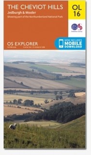
Wandelkaart - Topografische kaart OL16 OS Explorer Map Cheviot Hills | Ordnance Survey (9780319242551)
Northumberland National Park
- ISBN / CODE: 9780319242551
- Editie: meest recente versie
- Schaal: 1:25000
- Uitgever: Ordnance Survey
- Soort: Topografische kaart, Wandelkaart
- Serie: OS Explorer Map
- Taal: Engels
- Uitvoering: Papier
- Bindwijze: -
- Beoordeling: 5,0 ★★★★★ (1 review) Schrijf een review
-
€ 19,50
Op voorraad. Voor 17.00 uur op werkdagen besteld, morgen in huis in Nederland Levertijd Belgie
Gratis verzending in Nederland vanaf €35,-
-
Overzichtskaart Explorer 25.000 topografische kaarten Zuid Schotland - Borders
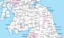

Producten op deze overzichtskaart:
Klik op een product om naar de pagina van dat product te gaan.
- Wandelkaart - Topografische kaart 307 OS Explorer Map Consett, Derwent reservoir | Ordnance Survey
- Wandelkaart - Topografische kaart 308 OS Explorer Map Durham, Sunderland | Ordnance Survey
- Wandelkaart - Topografische kaart 309 OS Explorer Map Stranraer & The Rhins | Ordnance Survey
- Wandelkaart - Topografische kaart 310 OS Explorer Map Glenluce, Kirkcowan | Ordnance Survey
- Wandelkaart - Topografische kaart 311 OS Explorer Map Wigtown, Whithorn, The Machars | Ordnance Survey
- Wandelkaart - Topografische kaart 312 OS Explorer Map Kirkcudbright, Castle Douglas | Ordnance Survey
- Wandelkaart - Topografische kaart 313 OS Explorer Map Dumfries, Dalbeattie | Ordnance Survey
- Wandelkaart - Topografische kaart 314 OS Explorer Map Solway Firth, Wigton, Silloth explorer | Ordnance Survey
- Wandelkaart - Topografische kaart 315 OS Explorer Map Carlisle, Brampton, Longtown, Gretna Green | Ordnance Survey
- Wandelkaart - Topografische kaart 316 OS Explorer Map Newcastle upon Tyne | Ordnance Survey
- Wandelkaart - Topografische kaart 317 OS Explorer Map Ballantrae, Barr & Barrhill | Ordnance Survey
- Wandelkaart - Topografische kaart 318 OS Explorer Map Galloway Forest Park North | Ordnance Survey
- Wandelkaart - Topografische kaart 319 OS Explorer Map Galloway Forest Park South | Ordnance Survey
- Wandelkaart - Topografische kaart 320 OS Explorer Map Castle Douglas, Loch Ken, New Galloway | Ordnance Survey
- Wandelkaart - Topografische kaart 321 OS Explorer Map Nithsdale, Dumfries | Ordnance Survey
- Wandelkaart - Topografische kaart 322 OS Explorer Map Annandale | Ordnance Survey
- Wandelkaart - Topografische kaart 323 OS Explorer Map Eskdale, Castle O'er Forest | Ordnance Survey
- Wandelkaart - Topografische kaart 324 OS Explorer Map Liddesdale, Kershope Forest | Ordnance Survey
- Wandelkaart - Topografische kaart 325 OS Explorer Map Morpeth, Blyth | Ordnance Survey
- Wandelkaart - Topografische kaart 326 OS Explorer Map Ayr, Troon | Ordnance Survey
- Wandelkaart - Topografische kaart 327 OS Explorer Map Cumnock, Dalmellington | Ordnance Survey
- Wandelkaart - Topografische kaart 328 OS Explorer Map Sanquhar, New Cumnock | Ordnance Survey
- Wandelkaart - Topografische kaart 329 OS Explorer Map Lowther Hills, Sanquhar, Leadhills | Ordnance Survey
- Wandelkaart - Topografische kaart 330 OS Explorer Map Moffat, St Mary's Loch | Ordnance Survey
- Wandelkaart - Topografische kaart 331 OS Explorer Map Teviotdale South | Ordnance Survey
- Wandelkaart - Topografische kaart 332 OS Explorer Map Alnwick, Amble | Ordnance Survey
- Wandelkaart - Topografische kaart 333 OS Explorer Map Kilmarnock, Irvine | Ordnance Survey
- Wandelkaart - Topografische kaart 334 OS Explorer Map East Kilbride, Galston, Darvel | Ordnance Survey
- Wandelkaart - Topografische kaart 335 OS Explorer Map Lanark, Tinto Hills | Ordnance Survey
- Wandelkaart - Topografische kaart 336 OS Explorer Map Biggar, Broughton | Ordnance Survey
- Wandelkaart - Topografische kaart 337 OS Explorer Map Peebles, Interleithen | Ordnance Survey
- Wandelkaart - Topografische kaart 338 OS Explorer Map Galashiels, Selkirk, Melrose | Ordnance Survey
- Wandelkaart - Topografische kaart 339 OS Explorer Map Kelso, Coldstream, Lower Tweed Valley | Ordnance Survey
- Wandelkaart - Topografische kaart 340 OS Explorer Map Holy Island, Bamburgh | Ordnance Survey
- Wandelkaart - Topografische kaart 341 OS Explorer Map Greenock, Largs, Millport | Ordnance Survey
- Wandelkaart - Topografische kaart 342 OS Explorer Map Glasgow | Ordnance Survey
- Wandelkaart - Topografische kaart 343 OS Explorer Map Motherwell, Coatbridge | Ordnance Survey
- Wandelkaart - Topografische kaart 344 OS Explorer Map Pentland Hills | Ordnance Survey
- Wandelkaart - Topografische kaart 345 OS Explorer Map Lammermuir Hills | Ordnance Survey
- Wandelkaart - Topografische kaart 346 OS Explorer Map Berwick-upon-Tweed | Ordnance Survey
- Wandelkaart - Topografische kaart 349 OS Explorer Map Falkirk, Cumbernauld, Livingston | Ordnance Survey
- Wandelkaart - Topografische kaart 350 OS Explorer Map Edinburgh | Ordnance Survey
- Wandelkaart - Topografische kaart 351 OS Explorer Map Dunbar, North Berwick | Ordnance Survey
- Wandelkaart - Topografische kaart 361 OS Explorer Map Isle of Arran | Ordnance Survey
- Wandelkaart - Topografische kaart 362 OS Explorer Map Cowal West, Isle of Bute | Ordnance Survey
- Wandelkaart - Topografische kaart OL16 OS Explorer Map Cheviot Hills | Ordnance Survey
- Wandelkaart - Topografische kaart OL42 OS Explorer Map Kielder Water & Forest | Ordnance Survey
- Wandelkaart - Topografische kaart OL43 OS Explorer Map Hadrian's Wall | Ordnance Survey
-
Overzichtskaart Explorer 25.000 wandelkaarten Zuid Schotland - Borders


Producten op deze overzichtskaart:
Klik op een product om naar de pagina van dat product te gaan.
- Wandelkaart - Topografische kaart 307 OS Explorer Map Consett, Derwent reservoir | Ordnance Survey
- Wandelkaart - Topografische kaart 308 OS Explorer Map Durham, Sunderland | Ordnance Survey
- Wandelkaart - Topografische kaart 309 OS Explorer Map Stranraer & The Rhins | Ordnance Survey
- Wandelkaart - Topografische kaart 310 OS Explorer Map Glenluce, Kirkcowan | Ordnance Survey
- Wandelkaart - Topografische kaart 311 OS Explorer Map Wigtown, Whithorn, The Machars | Ordnance Survey
- Wandelkaart - Topografische kaart 312 OS Explorer Map Kirkcudbright, Castle Douglas | Ordnance Survey
- Wandelkaart - Topografische kaart 313 OS Explorer Map Dumfries, Dalbeattie | Ordnance Survey
- Wandelkaart - Topografische kaart 314 OS Explorer Map Solway Firth, Wigton, Silloth explorer | Ordnance Survey
- Wandelkaart - Topografische kaart 315 OS Explorer Map Carlisle, Brampton, Longtown, Gretna Green | Ordnance Survey
- Wandelkaart - Topografische kaart 316 OS Explorer Map Newcastle upon Tyne | Ordnance Survey
- Wandelkaart - Topografische kaart 317 OS Explorer Map Ballantrae, Barr & Barrhill | Ordnance Survey
- Wandelkaart - Topografische kaart 318 OS Explorer Map Galloway Forest Park North | Ordnance Survey
- Wandelkaart - Topografische kaart 319 OS Explorer Map Galloway Forest Park South | Ordnance Survey
- Wandelkaart - Topografische kaart 320 OS Explorer Map Castle Douglas, Loch Ken, New Galloway | Ordnance Survey
- Wandelkaart - Topografische kaart 321 OS Explorer Map Nithsdale, Dumfries | Ordnance Survey
- Wandelkaart - Topografische kaart 322 OS Explorer Map Annandale | Ordnance Survey
- Wandelkaart - Topografische kaart 323 OS Explorer Map Eskdale, Castle O'er Forest | Ordnance Survey
- Wandelkaart - Topografische kaart 324 OS Explorer Map Liddesdale, Kershope Forest | Ordnance Survey
- Wandelkaart - Topografische kaart 325 OS Explorer Map Morpeth, Blyth | Ordnance Survey
- Wandelkaart - Topografische kaart 326 OS Explorer Map Ayr, Troon | Ordnance Survey
- Wandelkaart - Topografische kaart 327 OS Explorer Map Cumnock, Dalmellington | Ordnance Survey
- Wandelkaart - Topografische kaart 328 OS Explorer Map Sanquhar, New Cumnock | Ordnance Survey
- Wandelkaart - Topografische kaart 329 OS Explorer Map Lowther Hills, Sanquhar, Leadhills | Ordnance Survey
- Wandelkaart - Topografische kaart 330 OS Explorer Map Moffat, St Mary's Loch | Ordnance Survey
- Wandelkaart - Topografische kaart 331 OS Explorer Map Teviotdale South | Ordnance Survey
- Wandelkaart - Topografische kaart 332 OS Explorer Map Alnwick, Amble | Ordnance Survey
- Wandelkaart - Topografische kaart 333 OS Explorer Map Kilmarnock, Irvine | Ordnance Survey
- Wandelkaart - Topografische kaart 334 OS Explorer Map East Kilbride, Galston, Darvel | Ordnance Survey
- Wandelkaart - Topografische kaart 335 OS Explorer Map Lanark, Tinto Hills | Ordnance Survey
- Wandelkaart - Topografische kaart 336 OS Explorer Map Biggar, Broughton | Ordnance Survey
- Wandelkaart - Topografische kaart 337 OS Explorer Map Peebles, Interleithen | Ordnance Survey
- Wandelkaart - Topografische kaart 338 OS Explorer Map Galashiels, Selkirk, Melrose | Ordnance Survey
- Wandelkaart - Topografische kaart 339 OS Explorer Map Kelso, Coldstream, Lower Tweed Valley | Ordnance Survey
- Wandelkaart - Topografische kaart 340 OS Explorer Map Holy Island, Bamburgh | Ordnance Survey
- Wandelkaart - Topografische kaart 341 OS Explorer Map Greenock, Largs, Millport | Ordnance Survey
- Wandelkaart - Topografische kaart 342 OS Explorer Map Glasgow | Ordnance Survey
- Wandelkaart - Topografische kaart 343 OS Explorer Map Motherwell, Coatbridge | Ordnance Survey
- Wandelkaart - Topografische kaart 344 OS Explorer Map Pentland Hills | Ordnance Survey
- Wandelkaart - Topografische kaart 345 OS Explorer Map Lammermuir Hills | Ordnance Survey
- Wandelkaart - Topografische kaart 346 OS Explorer Map Berwick-upon-Tweed | Ordnance Survey
- Wandelkaart - Topografische kaart 349 OS Explorer Map Falkirk, Cumbernauld, Livingston | Ordnance Survey
- Wandelkaart - Topografische kaart 350 OS Explorer Map Edinburgh | Ordnance Survey
- Wandelkaart - Topografische kaart 351 OS Explorer Map Dunbar, North Berwick | Ordnance Survey
- Wandelkaart - Topografische kaart 361 OS Explorer Map Isle of Arran | Ordnance Survey
- Wandelkaart - Topografische kaart 362 OS Explorer Map Cowal West, Isle of Bute | Ordnance Survey
- Wandelkaart - Topografische kaart OL16 OS Explorer Map Cheviot Hills | Ordnance Survey
- Wandelkaart - Topografische kaart OL42 OS Explorer Map Kielder Water & Forest | Ordnance Survey
- Wandelkaart - Topografische kaart OL43 OS Explorer Map Hadrian's Wall | Ordnance Survey
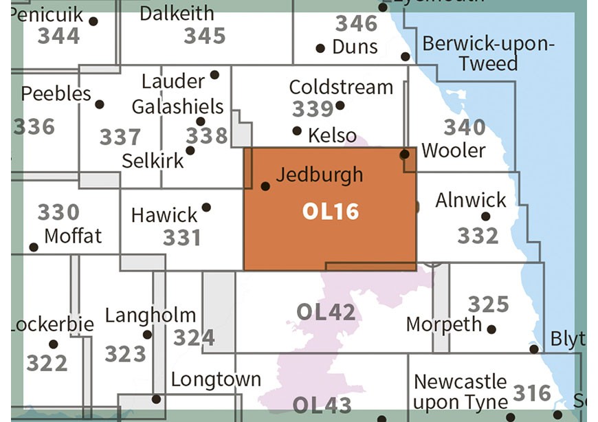
Overzichtskaarten
Beschrijving
Een van de beste detailkaarten die er op de wereld gemaakt worden: zeer gedetailleerd, prachtig helder kleurgebruik, veel topografische aspecten en - zeer belangrijk - allerlei toeristische en recreatieve aspecten zijn ingetekend. De perfecte kaart voor vakantie en vrije tijd: wandelen, fietsen of gewoon de omgeving verkennen. Door de grootte van de kaart, voor- en achterzijde,
bestrijkt het een behoorlijk groot gebied!
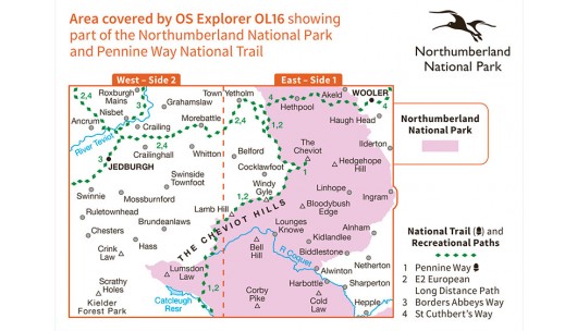
Jedburgh & Wooler. Showing part of the Northumberland National Park and the Pennine Way
These highly detailed maps show all the administrative boundaries, settlements as small as isolated farms, road network down to unfenced roads and country tracks, and field boundaries (hedges and drystone walls) which make navigation across the countryside much easier. Steep gradients on roads are indicated. Various landmarks, eg. powerlines, archaeological sites, windmills, churches and lighthouses are shown, and additional graphics indicate natural terrain features such as cliffs, scree, mud and vegetation variations. Contour interval is 5 metres in the lower parts of the country and 10 metres in the uplands, and spot heights are marked. Each map covers an area of 30 x 20km (i.e. approx. 19 x 12 miles), with some double-sided maps covering more, as indicated in the individual descriptions. The maps are fully GPS compatible, with the National Grid shown at 1km intervals and latitude and longitude indicated by margin ticks at 1'.
Explorer maps show a large amount of information for ramblers and tourists. Public rights of way are shown (except in Scotland), together with other routes with public access: National Trails and Recreational Paths, permitted paths and bridleways, and selected cycle routes. Open access land created under the Countryside and Rights of Way Act 2000 is marked. Tourist information includes caravan and camp sites, Park & Ride locations, recreation/leisure/sport centres, museums, historic buildings, English Heritage and National Trust sites, rural pubs, etc. The map legend is in English only, except for the tourist information content which is also in French and German.
Reviews
De bestelling was prima in orde. Een paar keer heel nuttig toen de routebeschrijving wat te wensen overliet.
★★★★★ door Peter Bemelmans 27 juli 2023 | Heeft dit artikel gekochtVond u dit een nuttige review? (login om te beoordelen)
Schrijf een review
Graag horen wij wat u van dit artikel vindt. Vindt u het goed, leuk, mooi, slecht, lelijk, onbruikbaar of erg handig: schrijf gerust alles op! Het is niet alleen leuk om te doen maar u informeert andere klanten er ook nog mee!
Ook interessant voor europa/engeland/north-east-england
-

Wandelgids Park Rangers Favourite Wa
€ 9,95Wandelgidsen North East England -

Wandelkaart - Topografische kaart OL
€ 19,50Topografische kaarten North East England -

Fietskaart Reivers Cycle Routes | No
€ 16,50Fietskaarten North East England -

Wegenkaart - landkaart National Park
€ 7,95Wegenkaarten ♦ Northumberland National Park -

Reisgids Northumberland | Sacristy P
€ 41,50Reisgidsen North East England