Wegenatlas Traveller's Atlas Southern Africa - Zuidelijk Afrika | A3-Formaat | Ringband | Tracks4Africa (9780994720870)

- ISBN / CODE: 9780994720870
- Editie: 2022
- Druk: 2
- Aantal blz.: 262
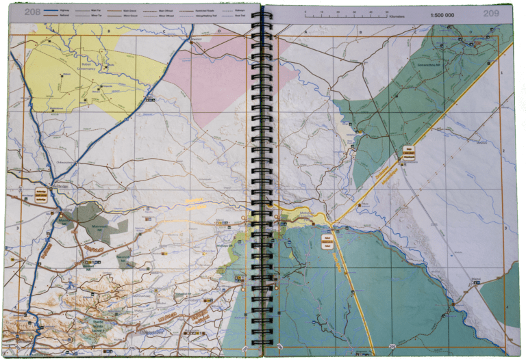
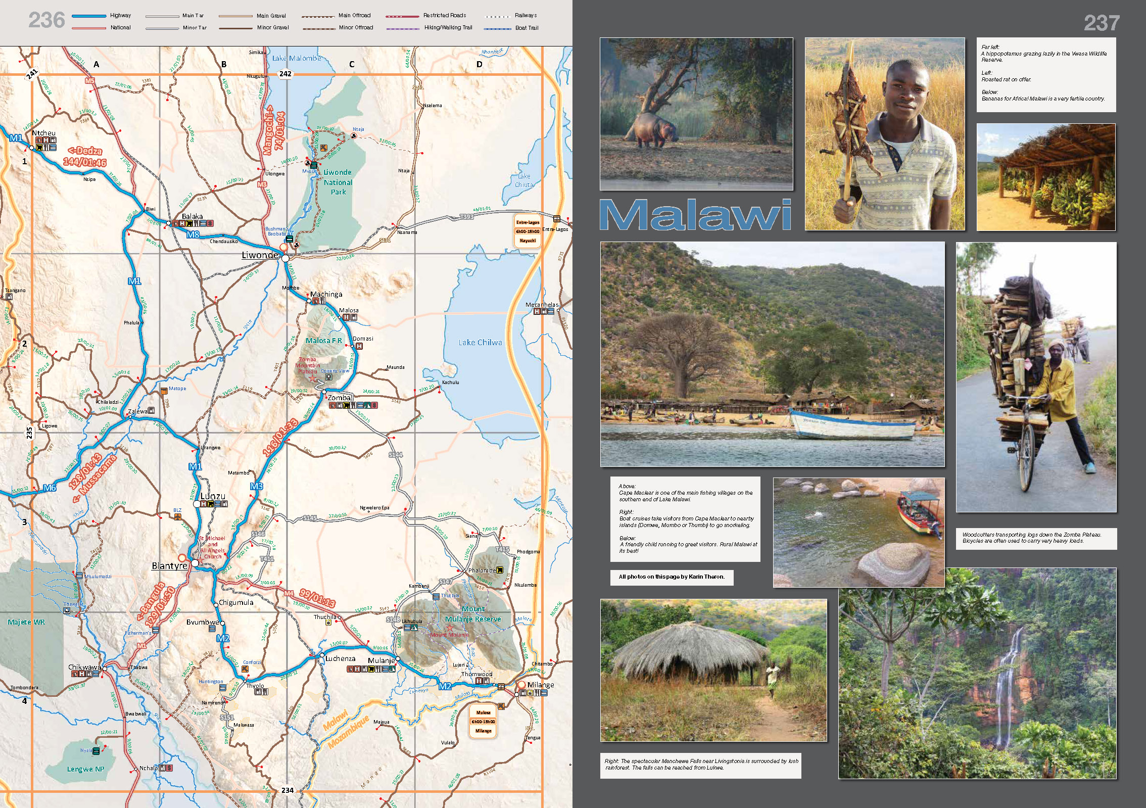
- Schaal: 1:500000
- Uitgever: Tracks4Africa
- Soort: Wegenatlas
- Taal: Engels
- Hoogte: 42.5 cm
- Breedte: 30.0 cm
- Dikte: 3.0 cm
- Gewicht: 2750.0 g
- Bindwijze: RIngband
- Uitvoering: -
- Beoordeling: 4,3 ★★★★★ ★★★★★ (3 reviews) Schrijf een review
-
€ 79,95
Op voorraad. Voor 17.00 uur op werkdagen besteld, morgen in huis in Nederland Levertijd Belgie
Gratis verzending in Nederland vanaf €35,-
Beschrijving
- 1:4m maps for Southern and Eastern Africa – ideal for macro planning.
- 1:1m maps for Southern Africa, covering the following countries: Angola, Botswana, eSwatini, Lesotho, Malawi, Mozambique, Namibia,
- South Africa, Zambia and Zimbabwe.
- 1:500k maps for South Africa, Malawi, most part of Zambia and the area around Moremi/Chobe in Botswana.
- This Atlas is designed for overland travel and compiled from the same data used on our famous GPS maps. Use it for trip planning or on the road as a companion for your GPS navigation system.
- The detailed road network covers 518 350km.
- All major and secondary routes feature distances and travel times (1m and 500k maps only).
- Each country page features a table with the times and distances between major towns.
- Per country information includes legal requirements for your vehicle, road conditions, traffic rules, signals used by locals as well as general tips such as fuel availability.
- Comprehensive information of what you need to transit borders.
- Featuring 127 border posts with opening times.
- Map scales include 1:4000 000, 1:1000 000; 1:500 000
- 518 350km of off-road tracks and major roads.
- Distance and travel time between towns.
- Essential facilities available in towns.
- Camping and lodging.
- Tourist attractions.
- All border crossings, with opening times.
- All international airports, with IATA/ICAO codes.
- Protected areas.
Reviews
Zeer informatief, en kunnen dit goed gebruiken voor onze autoreizen door Afrika. Enige probleem is het gewicht en afmeting van het boek. Die raak je onderweg niet kwijt. We gaan het dit jaar allemaal beleven.
★★★★★ door Jose Aaldering 11 april 2023 | Heeft dit artikel gekochtVond u dit een nuttige review? (login om te beoordelen)
Prima kaart, goed gedetailleerd. Ook goed in gebruik in combinatie met autonavigatie van tracks for africa. Kaart is groot. Ringbandjes vragen Om zorgvuldig gebruik. Maar zeker niet na eenmaal gebruik versleten. We hebben de kaart 5 weken gebruikt. Kan zo weer mee. Aanrader.
★★★★★ door Marleen 23 november 2019Vond u dit een nuttige review? (login om te beoordelen)
Kaartwerk en detail zijn prachtig. De kaart die je moet hebben als je zelf gaat rijden in Zuidelijk Afrika. Nadeel is echter de binding. De ringetjes zijn klein en kwetsbaar, dus na 1 reis is kaart versleten.
★★★★★ door Julien van Oosten 30 juli 2018Vond u dit een nuttige review? (login om te beoordelen)
Schrijf een review
Graag horen wij wat u van dit artikel vindt. Vindt u het goed, leuk, mooi, slecht, lelijk, onbruikbaar of erg handig: schrijf gerust alles op! Het is niet alleen leuk om te doen maar u informeert andere klanten er ook nog mee!
Ook interessant voor afrika/angola
-

Vogelgids SASOL Birds of Southern Af
€ 34,95Vogelgidsen Botswana -

Reisgids The Complete Guide To Afric
€ 29,95Reisgidsen Botswana -

Woordenboek Wat & Hoe taalgids Engel
€ 9,99Woordenboeken & Taalgidsen Botswana -

Wegenkaart - landkaart Kgalagadi - T
€ 17,50Wegenkaarten Botswana -

Natuurgids On Track | Struik Nature
€ 7,50Natuurgidsen Angola