Wegenkaart - landkaart Amboseli National Park | Jacana maps (9781770090682)
- ISBN / CODE: 9781770090682
- Schaal: 1:50000
- Uitgever: Jacana maps
- Soort: Wegenkaart
- Taal: Engels
- Schrijf als eerste een review
-
€ 11,50
Uitverkocht, nooit meer leverbaar
Beschrijving
Amboseli National Park, located in southern Kenya at the foot of Mount Kilimanjaro, is Kenya's most popular national park. The park forms part of the unique Amboseli swamp ecosystem drawing buffalo, elephant, hippo, wildebeest and an abundant bird life on a daily basis. Amboseli's elephants are probably the best known and most studied in the world by Cynthia Moss and her team who are conducting the longest continuous study of elephants ever undertaken.
Amboseli is also home to Kenya's most fiercely traditional tribes, the Maasai. All around the Park you will see village people going about their daily lives, with their cattle moving to and from the swamps for watering. Numerous villages around the Park offer visits to tourists as 'cultural bomas'.
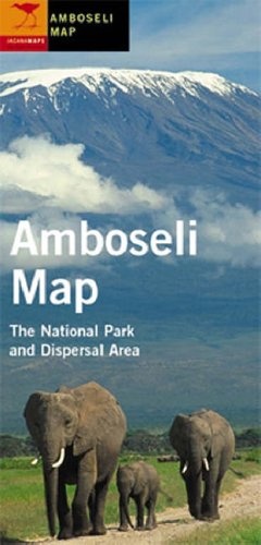
Side one features a map of the National Park, the Amboseli wet season Dispersal Area and the Selenkay Conservation Area Track System.
Side one of this folded map features a map of the National Park, the Amboseli wet season Dispersal Area and the Selenkay Conservation Area Track System. The reverse side provides information on the area's geology, the Amboseli ecosystem, the Maasai and travel.
Reviews
Geen reviews gevonden voor dit product.
Schrijf een review
Graag horen wij wat u van dit artikel vindt. Vindt u het goed, leuk, mooi, slecht, lelijk, onbruikbaar of erg handig: schrijf gerust alles op! Het is niet alleen leuk om te doen maar u informeert andere klanten er ook nog mee!
Ook interessant voor afrika/kenia
-

Wandelkaart Mount Kenya | EWP
€ 16,25Wandelkaarten Kenia -

Natuurgids Africa Wildlife an introd
€ 9,95Natuurgidsen Angola -

Reisgids Kenya - Kenia | Lonely Plan
€ 23,95Reisgidsen Kenia -

Reisverhaal Africa Solo | Mark Beaum
€ 15,50Reisverhalen Botswana -

Wegenkaart - landkaart Kenia | Reise
€ 11,50Wegenkaarten Kenia