Wegenkaart - landkaart Pocket map Western Cape | MapStudio (9781770265271)
- ISBN / CODE: 9781770265271
- Schaal: 1:1300000
- Uitgever: MapStudio
- Soort: Wegenkaart
- Serie: Pocket map
- Taal: Engels
- Schrijf als eerste een review
-
€ 8,95
Uitverkocht, nooit meer leverbaar
Beschrijving
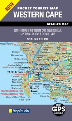
Handige wegenkaart van Zuid Westelijk Zuid Afrika op zakformaat, met plaatsnamenindex, coördinaten, wegnummers, natuurparken en extra informatie.
Convenient pocket size map includes latest updated information including key tourist areas and street plans.
Detailed maps of Table Mountain and the Cape Winelands are included. Additional highlights include a comprehensive index to place names, route numbers, nature reserves and parks and tourist information.
A small, double sided folded paper map, which really is pocketable. The first side displays a road map of the Western Cape Province, at a scale of 1:1 300 000 while the reverse holds a street map of the Table Mountain area, at a scale of 1:35 000, and also a road map of the Winelands region at a scale of 1:170 000. Each of the three maps has its own key, and there is also an adjacent place name index, with co-ordinates, for the main Western Cape map
Reviews
Geen reviews gevonden voor dit product.
Schrijf een review
Graag horen wij wat u van dit artikel vindt. Vindt u het goed, leuk, mooi, slecht, lelijk, onbruikbaar of erg handig: schrijf gerust alles op! Het is niet alleen leuk om te doen maar u informeert andere klanten er ook nog mee!
Ook interessant voor afrika/zuid-afrika
-

Campinggids - Campergids Camp and Ca
€ 32,95Campergidsen Zuid-Afrika -

Stadsplattegrond Pocket map Pretoria
€ 11,50Stadsplattegronden Zuid-Afrika -

Wegenkaart - landkaart Cape Town & G
€ 13,95Wegenkaarten Kaapstad -

Reisgids South Africa | Eyewitness
€ 24,95Reisgidsen Zuid-Afrika -

Reisverhaal Ek sien jou! | Esther Bo
€ 12,50Reisverhalen Zuid-Afrika