Wegenkaart - landkaart 92G Lower Mainland British Columbia - Richmond and New Westminster | ITMB (9781553418276)

- ISBN / CODE: 9781553418276
- Editie: 01-01-2010
- Druk: 1
- Aantal blz.: 1
- Schaal: 1:250000
- Uitgever: ITMB
- Soort: Wegenkaart
- Taal: Engels
- Hoogte: 25.0 cm
- Breedte: 10.0 cm
- Gewicht: 57.0 g
- Uitvoering: Scheur- en watervast
- Bindwijze: -
- Schrijf als eerste een review
-
€ 14,95
Op voorraad. Voor 17.00 uur op werkdagen besteld, morgen in huis in Nederland Levertijd Belgie
Gratis verzending in Nederland vanaf €50,-
Beschrijving
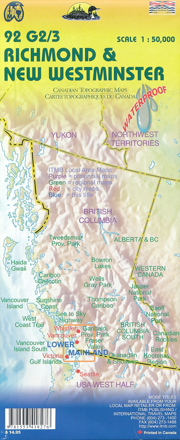
Goede wegenkaart van British Columbia met topografische uitsnede van Richmond en Westminster.
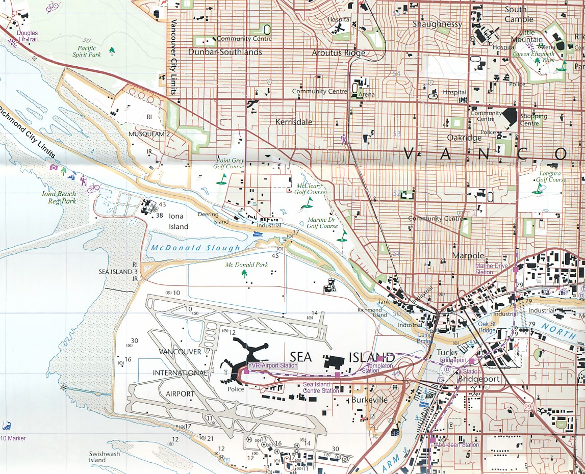
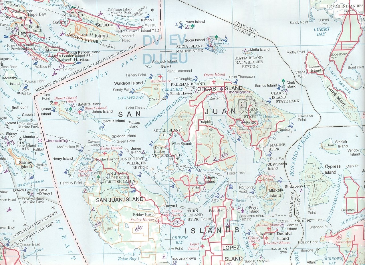
Topographic/Recreation Map 92G&92G2 and G3 - With the 2010 Winter Olympics bearing down on us, this very timely map presents a lovely regional map showing all of the Olympic venues (the Games are being held in Vancouver, Richmond, UBC, Whistler, and the Callaghan Valley – not just in Vancouver). The area of coverage is from Everett (just north of Seattle) in the USA to north of Pemberton, and from Victoria in the west to Chilliwack in the east on the one side, and a detailed 1:50,000 topo map of the Richmond/New Westminster/Surrey/Langley outer urban areas of Metro Vancouver. Both maps are Government of Canada NTS maps, overlaid with touristic and recreational information by ITMB, which holds the copyright on behalf of the Queen (I love being able to say that). The Lower Mainland portion is particularly useful, in that it includes the east coast of Vancouver Island, from Victoria to Nanaimo and west to French River, all of the Gulf Islands (Cdn) and the San Juan Islands (USA), detailed road information for the American portion of the region from just north of Seattle to the border, and, again, very detailed road information on the Canadian side all the way north to Whistler and beyond, including most of the Sunshine Coast, all of Garibaldi and Golden Ears Parks, and, of course, all of the Olympic Games venues. The Richmond to Langley side of the map consists of two 1:50,000 government topographic maps merged together to cover all of 92G2 and 92G3 areas. This won’t mean much to people outside of Canada, but all of Canada is divided into 13,500 topographic mapping areas, of which these are two. These exceptionally detailed survey maps show all roads, major buildings, ferry routes, geographical information, and neighbourhoods from the US border (49th Parallel to about 25th Ave in the City of Vancouver (49degrees/15minutes) and from the ocean to Maple Ridge/Langley. The map has been overlaid with touristic and recreational information, and updated to show recent rapid transit and bridge information. This is an excellent map for anyone coming to Vancouver for the Olympics, but is also a lovely long-term map of one of the most attractive areas of Canada; printed double-sided on durable ITM waterproof paper
Reviews
Geen reviews gevonden voor dit product.
Schrijf een review
Graag horen wij wat u van dit artikel vindt. Vindt u het goed, leuk, mooi, slecht, lelijk, onbruikbaar of erg handig: schrijf gerust alles op! Het is niet alleen leuk om te doen maar u informeert andere klanten er ook nog mee!
Ook interessant voor noord-amerika/canada/british-columbia
-

Vogelgids - Natuurgids British Colum
€ 10,95Natuurgidsen British Columbia -

Reisgids Eyewitness Travel USA- Cana
€ 20,95Reisgidsen British Columbia -

Wegenkaart - landkaart Sunshine Coas
€ 14,95Wegenkaarten British Columbia -

Reisverhaal Een half jaar met drie o
€ 32,95Reisverhalen British Columbia -

Wandelkaart - Topografische kaart 25
€ 17,95Topografische kaarten British Columbia