Winkelwagen
Geen items in winkelwagen
Ga naar winkelwagen
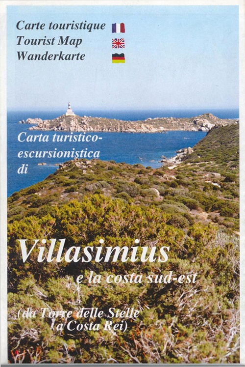
Wandelkaart - Topografische kaart A09 Villasimius | Abies (0422389222758)
e la costa sud-est; da Torre delle Stelle a Costa Rei
- ISBN / CODE: 0422389222758
- Schaal: 1:30000
- Uitgever: Abies
- Soort: Topografische kaart, Wandelkaart
- Taal: Engels
- Schrijf als eerste een review
-
€ 11,25
Uitverkocht, nooit meer leverbaar

Beschrijving
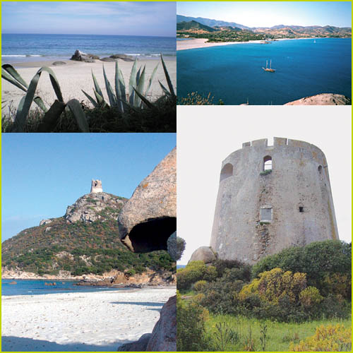
The whole area - which is characterized by an exceptional combination of sea and mountains - is well-known only thanks to its seashore, its white beaches and its little creeks, but also its history, its traditions and above all its nature, are equally remarkable. Especially outside the summer months, it is easy to meet the friendly inhabitants of the place, whose history goes back to the Phoenicians or even before. Pink flamingos can be found in Notteri Pond, strawberry trees (arbutus unedo) can be seen on Mount Minniminni and fragrant wild herbs and large carob trees appear along the country roads…
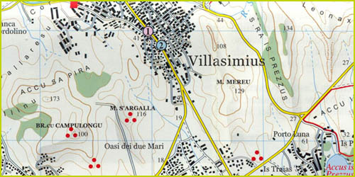
Villasimius - Torre delle Stelle - Costa Rei area at 1:30,000 in a series of contoured maps from Ed. Abies. Overprint highlights campsites, caravan parks, hotels, agriturismo farms, restaurants, shops with local produce, petrol stations, beaches and diving sites, golf courses, horse riding facilities, etc. This title has no UTM grid.
Main series at 1:60,000 (Nos. 1 to 12)
The maps have contours at 100m intervals and colouring for woodlands and maquis shrubland. Local trails are highlighted, with additional overprint for selected hiking, mountain bike and kayaking routes listed on the reverse of the maps with brief notes and grading for the degree of difficulty. All the maps have a UTM grid for GPS users.
Very extensive range of symbols highlight numerous places of interest and tourist facilities, including campsites and caravan parks, beaches, sport and recreational sites, archaeological remains and nuraghi, etc. The maps also indicate places where typical local products can be purchased. On the reverse each title has descriptions of its main places of interest, beaches, etc.
More detailed maps at 1:25,000/1:30,000 (Nos. 3A to 12A)
Contour interval is 25m, plus colouring for vegetation. Local trails are marked but unless indicated in the individual description, special routes are not included. Tourist overprint, as described above, is also less extensive than on the 1:60,000 maps. Most titles have GPS coordinates. On the reverse are extensive notes describing the area.
Map legend and additional text on all the maps includes English
Reviews
Geen reviews gevonden voor dit product.
Schrijf een review
Graag horen wij wat u van dit artikel vindt. Vindt u het goed, leuk, mooi, slecht, lelijk, onbruikbaar of erg handig: schrijf gerust alles op! Het is niet alleen leuk om te doen maar u informeert andere klanten er ook nog mee!
Alle gerelateerde rubrieken >
Ook interessant voor europa/italie/sardinie
-

Reisgids Trotter Sardinie | Lannoo
€ 22,99Reisgidsen Sardinië -

Wegenkaart - landkaart 15 Sardinien
€ 14,95Wegenkaarten Sardinië -

Wandelkaart A03 Loiri - Porto San Pa
€ 12,95Wandelkaarten Sardinië -

Campergids Camper Guide Sardinien -
€ 21,95Campergidsen Sardinië -

Wandelgids 5770 Kompass Wanderführer
€ 19,95Wandelgidsen Sardinië