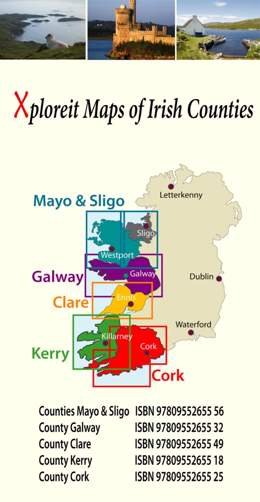
Wegenkaart - landkaart - Fietskaart Galway (Ierland) | Xploreit Maps (9780955265532)

- ISBN / CODE: 9780955265532
- Schaal: 1:100000
- Uitgever: Xploreit Maps
- Soort: Fietskaart, Wegenkaart
- Taal: Engels
- Uitvoering: Scheur- en watervast
- Bindwijze: -
- Beoordeling: 5,0 ★★★★★ (1 review) Schrijf een review
-
€ 23,95
Uitverkocht, nooit meer leverbaar
-
Overzicht Fietskaarten Ierland - xploreit maps 1:100.000


Producten op deze overzichtskaart:
Klik op een product om naar de pagina van dat product te gaan.
Overzichtskaarten
Beschrijving
Mooie geplastificeerde en scheurvaste kaart met index
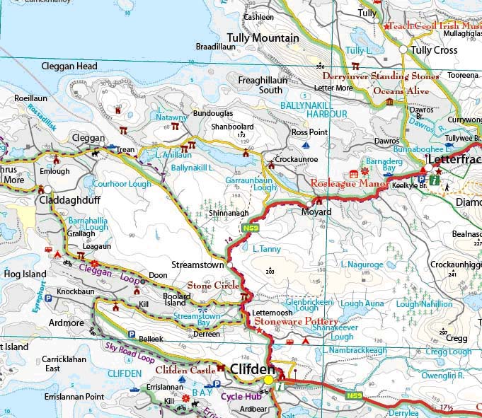
The Xploreit Map of County Galway includes all of County Galway along with parts of counties Clare, Tipperary, Offaly, Roscommon and Mayo. A lace-like Atlantic coastline enclosing shimmering lakes and rusty bogs with the majestic Twelve Bens and Maumturks is shown - and that’s just part of Connemara! Galway has a fascinating countryside containing several scenic routes and walking trails with stunning vistas and dramatic viewpoints. There are numerous castles, towers, medieval churches, historic houses, megalithic tombs and dazzling beaches just waiting to be explored. This map will help you on your way with all the information available at a glance. The scale of the Galway map is 1:100,000.
Walking Routes All the National Waymarked routes and an extensive selection of looped walks in Galway are shown. Some are listed below: The Aran Way The Hymany Way The Western Way The Burren Way The Suck Valley Way (partly shown) New Village Forest Loop Killary Fjord Famine Road Walk Diamond Hill Loop Connemara Ballykine Woods Loop near Cong
Cycling Routes Cycling Loops and trails located near ‘Cycle Hub’ towns such as Clifden and Doolin are shown: The Cleggan Cycle Loop The Roundstone Bog Road Loop The Errislannan Cycle Loop The Sheeffry Cycle Route The Derroura Mountain Bike Trail The Portumna Forest Mountain Bike Trail The Burren Cycleway The Slieve Elva Loop The Dolmen Cycleway The Lough Derg Cycleway (partly shown) Although Galway does not have any signposted long distance cycle routes, all the scenic drives are shown which allows the cyclist to choose from a number of options when planning a suitable route
Reviews
Mooie stevige en vooral ook overzichtelijke kaart. Naast enkele andere kaarten heb ik deze aangeschaft voor een fietstocht langs o.a. de westkust van Ierland (Killarney naar Galway). Staat veel nuttige informatie op voor fietsers (maar ook voor anderen).
★★★★★ door Ed Bos 3 april 2017Vond u dit een nuttige review? (login om te beoordelen)
Schrijf een review
Graag horen wij wat u van dit artikel vindt. Vindt u het goed, leuk, mooi, slecht, lelijk, onbruikbaar of erg handig: schrijf gerust alles op! Het is niet alleen leuk om te doen maar u informeert andere klanten er ook nog mee!
Ook interessant voor europa/ierland/connemara
-
 | Ordnance Survey Ireland")
Wegenkaart - landkaart Ireland West
€ 19,50Wegenkaarten Donegal - Mayo - Noordwest Ierland -

Reisverhaal Connemara, listening to
€ 18,95Reisverhalen Connemara - West Ierland -
, Galway | Ordnance Survey Ireland")
Topografische kaart - Wandelkaart 37
€ 19,50Topografische kaarten Donegal - Mayo - Noordwest Ierland -
 | Conrad Stein Verlag")
Wandelgids Irland (Ierland) | Conrad
€ 15,95Wandelgidsen Connemara - West Ierland -

Reisgids Wild Atlantic Way - Where t
€ 14,95Reisgidsen Cork - Kerry - Dingle - Zuidwest Ierland