Winkelwagen
Geen items in winkelwagen
Ga naar winkelwagen
Kaarten - Dordogne - Limousin
 Wandelkaart - Topografische kaart 1930SB Oradour-sur-Glane | IGN - Institut Géographique National
 Wandelkaart - Topografische kaart 2030SB Ambazac | IGN - Institut Géographique National
 Wandelkaart - Topografische kaart 2130SB St-Sulpice-Laurière, Bourganeuf | IGN - Institut Géographique National
 Wandelkaart - Topografische kaart 1831SB Rochefoucauld - Exideuil | IGN - Institut Géographique National
 Wandelkaart - Topografische kaart 1931SB Rochechouart | IGN - Institut Géographique National
 Wandelkaart - Topografische kaart 2031SB Limoges | IGN - Institut Géographique National
 Wandelkaart - Topografische kaart 2231SB Gentioux-Pigerolles, Royère-de-Vassivière | IGN - Institut Géographique National
 Wandelkaart - Topografische kaart 1832SB Montbron, Piégut-Pluviers | IGN - Institut Géographique National★★★★★
 Wandelkaart - Topografische kaart 1932SB Châlus - St-Mathieu | IGN - Institut Géographique National
 Wandelkaart - Topografische kaart 2032SB Nexon | IGN - Institut Géographique National
 Wandelkaart - Topografische kaart 2132SB Châteauneuf-la-Forêt, Chamberet | IGN - Institut Géographique National
 Wandelkaart - Topografische kaart 2232SB Bugeat - Peyrelevade | IGN - Institut Géographique National
 Wandelkaart - Topografische kaart 1733SB Montmoreau-Saint-Cybard | IGN - Institut Géographique National
 Wandelkaart - Topografische kaart 1833SB Nontron, Brantôme, Mareuil | IGN - Institut Géographique National
 Wandelkaart - Topografische kaart 1933SB Thiviers, St-Pardoux-la-Rivière | IGN - Institut Géographique National
 Wandelkaart - Topografische kaart 2133SB Uzerche, Treignac, Seilhac | IGN - Institut Géographique National
 Wandelkaart - Topografische kaart 2233SB Egletons - Meymac - Corrèze | IGN - Institut Géographique National
 Wandelkaart - Topografische kaart 1834SB Périgueux , Tocane-Saint-Apre | IGN - Institut Géographique National
 Wandelkaart - Topografische kaart 1934SB Excideuil - Périgueux | IGN - Institut Géographique National
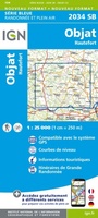 Wandelkaart - Topografische kaart 2034SB Objat - Hautefort | IGN - Institut Géographique National★★★★★
Laatste reviews

Goede kaart op fijne schaal
Ideale schaal waar ook de kleinere wegen duidelijk zijn aangegeven. Beschrijving op website is correct.
★★★★★ door Peter 16 mei 2024 | Heeft dit artikel gekocht
Fijne kaart
Overzichtelijke kaart. Niks op aan te merken.
★★★★★ door Bastiaan de Leeuw 16 mei 2024 | Heeft dit artikel gekocht
Fijne kaart
Fijne overzichtelijke kaart. Niet veel op aan te merken!
★★★★★ door Bastiaan de Leeuw 16 mei 2024 | Heeft dit artikel gekocht
Wat onoverzichtelijke kaart
Voor het wandelen niet heel geschikt. Door het kleurgebruik zit er weinig contrast in en komt het erg donker over. Wat ingewikkeld oriënteren. Maar je …
★★★★★ door Bastiaan de Leeuw 16 mei 2024 | Heeft dit artikel gekocht