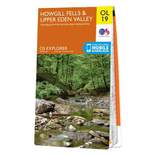
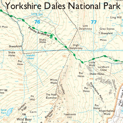
Wandelkaart - Topografische kaart OL19 OS Explorer Map Howgill Fells and Upper Eden Valley | Ordnance Survey (9780319475362)
Yorkshire Dales
- ISBN / CODE: 9780319475362
- Editie: 2016
- Schaal: 1:25000
- Uitgever: Ordnance Survey
- Soort: Topografische kaart, Wandelkaart
- Serie: OS Explorer Map
- Taal: Engels
- Hoogte: 23.0 cm
- Breedte: 13.0 cm
- Dikte: 1.0 cm
- Gewicht: 150.0 g
- Bindwijze: -
- Uitvoering: Papier
- Schrijf als eerste een review
-
€ 28,50
Op voorraad. Voor 17.00 uur op werkdagen besteld, morgen in huis in Nederland Levertijd Belgie
Gratis verzending in Nederland vanaf €35,-
-
Overzichtskaart Explorer 25.000 topografische kaarten Noord Engeland - Lake District

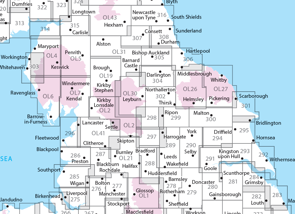
Producten op deze overzichtskaart:
Klik op een product om naar de pagina van dat product te gaan.
- Wandelkaart - Topografische kaart 275 OS Explorer Map Liverpool St Helens, Widnes & Runcorn | Ordnance Survey
- Wandelkaart - Topografische kaart 276 OS Explorer Map Bolton Central, Wigan & Warrington | Ordnance Survey
- Wandelkaart - Topografische kaart 277 OS Explorer Map Manchester & Salford | Ordnance Survey
- Wandelkaart - Topografische kaart 278 OS Explorer Map Sheffield & Barnsley | Ordnance Survey
- Wandelkaart - Topografische kaart 279 OS Explorer Map Doncaster | Ordnance Survey
- Wandelkaart - Topografische kaart 280 OS Explorer Map Isle of Axholme | Ordnance Survey
- Wandelkaart - Topografische kaart 281 OS Explorer Map Ancholme Valley | Ordnance Survey
- Wandelkaart - Topografische kaart 282 OS Explorer Map Lincolnshire Wolds North | Ordnance Survey
- Wandelkaart - Topografische kaart 283 OS Explorer Map Louth, Mablethorpe | Ordnance Survey
- Wandelkaart - Topografische kaart 284 OS Explorer Map Grimsby, Cleethorpes, Immingham | Ordnance Survey
- Wandelkaart - Topografische kaart 285 OS Explorer Map Southport, Chorley | Ordnance Survey
- Wandelkaart - Topografische kaart 286 OS Explorer Map Blackpool, Preston | Ordnance Survey
- Wandelkaart - Topografische kaart 287 OS Explorer Map West Pennine Moors | Ordnance Survey
- Wandelkaart - Topografische kaart 288 OS Explorer Map Bradford, Huddersfield | Ordnance Survey
- Wandelkaart - Topografische kaart 289 OS Explorer Map Leeds | Ordnance Survey
- Wandelkaart - Topografische kaart 290 OS Explorer Map York | Ordnance Survey
- Wandelkaart - Topografische kaart 291 OS Explorer Map Goole, Gilberdyke | Ordnance Survey
- Wandelkaart - Topografische kaart 292 OS Explorer Map Withernsea & Spurn Head | Ordnance Survey
- Wandelkaart - Topografische kaart 293 OS Explorer Map Kingston upon Hull, Beverley | Ordnance Survey
- Wandelkaart - Topografische kaart 294 OS Explorer Map Market Weighton, Yorkshire Wolds Central | Ordnance Survey
- Wandelkaart - Topografische kaart 295 OS Explorer Map Bridlington, Driffield, Hornsea | Ordnance Survey
- Wandelkaart - Topografische kaart 296 OS Explorer Map Lancaster, Morecambe, Fleetwood | Ordnance Survey
- Wandelkaart - Topografische kaart 297 OS Explorer Map Lower Wharfedale & Washburn Valley | Ordnance Survey
- Wandelkaart - Topografische kaart 298 OS Explorer Map Nidderdale | Ordnance Survey
- Wandelkaart - Topografische kaart 299 OS Explorer Map Ripon, Boroughbridge | Ordnance Survey
- Wandelkaart - Topografische kaart 300 OS Explorer Map Howardian Hills, Malton | Ordnance Survey
- Wandelkaart - Topografische kaart 301 OS Explorer Map Scarborough, Bridlington & Flamborough Head | Ordnance Survey
- Wandelkaart - Topografische kaart 302 OS Explorer Map Northallerton, Thirsk | Ordnance Survey
- Wandelkaart - Topografische kaart 303 OS Explorer Map Whitehaven, Workington | Ordnance Survey
- Wandelkaart - Topografische kaart 304 OS Explorer Map Darlington, Richmond | Ordnance Survey
- Wandelkaart - Topografische kaart 305 OS Explorer Map Bishop Auckland | Ordnance Survey
- Wandelkaart - Topografische kaart 306 OS Explorer Map Middlesbrough, Hartlepool | Ordnance Survey
- Wandelkaart - Topografische kaart 307 OS Explorer Map Consett, Derwent reservoir | Ordnance Survey
- Wandelkaart - Topografische kaart 308 OS Explorer Map Durham, Sunderland | Ordnance Survey
- Wandelkaart - Topografische kaart 314 OS Explorer Map Solway Firth, Wigton, Silloth explorer | Ordnance Survey
- Wandelkaart - Topografische kaart 315 OS Explorer Map Carlisle, Brampton, Longtown, Gretna Green | Ordnance Survey
- Wandelkaart - Topografische kaart 316 OS Explorer Map Newcastle upon Tyne | Ordnance Survey
- Wandelkaart - Topografische kaart OL01 OS Explorer Map The Peak District - Dark Peak Area | Ordnance Survey
- Wandelkaart - Topografische kaart OL02 OS Explorer Map Yorkshire Dales - Southern & Western Area | Ordnance Survey
- Wandelkaart - Topografische kaart OL04 OS Explorer Map The English Lakes - North Western area | Ordnance Survey
- Wandelkaart - Topografische kaart OL05 OS Explorer Map The English Lakes - North Eastern area | Ordnance Survey
- Wandelkaart - Topografische kaart OL06 OS Explorer Map English Lakes - South Western area | Ordnance Survey
- Wandelkaart - Topografische kaart OL07 OS Explorer Map English Lakes - South Eastern area | Ordnance Survey
- Wandelkaart - Topografische kaart OL19 OS Explorer Map Howgill Fells and Upper Eden Valley | Ordnance Survey
- Wandelkaart - Topografische kaart OL21 OS Explorer Map South Pennines | Ordnance Survey
- Wandelkaart - Topografische kaart OL26 OS Explorer Map North York Moors - Western area | Ordnance Survey
- Wandelkaart - Topografische kaart OL27 OS Explorer Map North York Moors - Eastern area | Ordnance Survey
- Wandelkaart - Topografische kaart OL30 OS Explorer Map Yorkshire Dales - Northern & Central Area | Ordnance Survey
- Wandelkaart - Topografische kaart OL31 OS Explorer Map North Pennines | Ordnance Survey
- Wandelkaart - Topografische kaart OL41 OS Explorer Map Forest of Bowland - Ribblesdale | Ordnance Survey
- Wandelkaart - Topografische kaart OL43 OS Explorer Map Hadrian's Wall | Ordnance Survey
-
Overzichtskaart Explorer 25.000 wandelkaarten Noord Engeland - Lake District

Producten op deze overzichtskaart:
Klik op een product om naar de pagina van dat product te gaan.
- Wandelkaart - Topografische kaart 275 OS Explorer Map Liverpool St Helens, Widnes & Runcorn | Ordnance Survey
- Wandelkaart - Topografische kaart 276 OS Explorer Map Bolton Central, Wigan & Warrington | Ordnance Survey
- Wandelkaart - Topografische kaart 277 OS Explorer Map Manchester & Salford | Ordnance Survey
- Wandelkaart - Topografische kaart 278 OS Explorer Map Sheffield & Barnsley | Ordnance Survey
- Wandelkaart - Topografische kaart 279 OS Explorer Map Doncaster | Ordnance Survey
- Wandelkaart - Topografische kaart 280 OS Explorer Map Isle of Axholme | Ordnance Survey
- Wandelkaart - Topografische kaart 281 OS Explorer Map Ancholme Valley | Ordnance Survey
- Wandelkaart - Topografische kaart 282 OS Explorer Map Lincolnshire Wolds North | Ordnance Survey
- Wandelkaart - Topografische kaart 283 OS Explorer Map Louth, Mablethorpe | Ordnance Survey
- Wandelkaart - Topografische kaart 284 OS Explorer Map Grimsby, Cleethorpes, Immingham | Ordnance Survey
- Wandelkaart - Topografische kaart 285 OS Explorer Map Southport, Chorley | Ordnance Survey
- Wandelkaart - Topografische kaart 286 OS Explorer Map Blackpool, Preston | Ordnance Survey
- Wandelkaart - Topografische kaart 287 OS Explorer Map West Pennine Moors | Ordnance Survey
- Wandelkaart - Topografische kaart 288 OS Explorer Map Bradford, Huddersfield | Ordnance Survey
- Wandelkaart - Topografische kaart 289 OS Explorer Map Leeds | Ordnance Survey
- Wandelkaart - Topografische kaart 290 OS Explorer Map York | Ordnance Survey
- Wandelkaart - Topografische kaart 291 OS Explorer Map Goole, Gilberdyke | Ordnance Survey
- Wandelkaart - Topografische kaart 292 OS Explorer Map Withernsea & Spurn Head | Ordnance Survey
- Wandelkaart - Topografische kaart 293 OS Explorer Map Kingston upon Hull, Beverley | Ordnance Survey
- Wandelkaart - Topografische kaart 294 OS Explorer Map Market Weighton, Yorkshire Wolds Central | Ordnance Survey
- Wandelkaart - Topografische kaart 295 OS Explorer Map Bridlington, Driffield, Hornsea | Ordnance Survey
- Wandelkaart - Topografische kaart 296 OS Explorer Map Lancaster, Morecambe, Fleetwood | Ordnance Survey
- Wandelkaart - Topografische kaart 297 OS Explorer Map Lower Wharfedale & Washburn Valley | Ordnance Survey
- Wandelkaart - Topografische kaart 298 OS Explorer Map Nidderdale | Ordnance Survey
- Wandelkaart - Topografische kaart 299 OS Explorer Map Ripon, Boroughbridge | Ordnance Survey
- Wandelkaart - Topografische kaart 300 OS Explorer Map Howardian Hills, Malton | Ordnance Survey
- Wandelkaart - Topografische kaart 301 OS Explorer Map Scarborough, Bridlington & Flamborough Head | Ordnance Survey
- Wandelkaart - Topografische kaart 302 OS Explorer Map Northallerton, Thirsk | Ordnance Survey
- Wandelkaart - Topografische kaart 303 OS Explorer Map Whitehaven, Workington | Ordnance Survey
- Wandelkaart - Topografische kaart 304 OS Explorer Map Darlington, Richmond | Ordnance Survey
- Wandelkaart - Topografische kaart 305 OS Explorer Map Bishop Auckland | Ordnance Survey
- Wandelkaart - Topografische kaart 306 OS Explorer Map Middlesbrough, Hartlepool | Ordnance Survey
- Wandelkaart - Topografische kaart 307 OS Explorer Map Consett, Derwent reservoir | Ordnance Survey
- Wandelkaart - Topografische kaart 308 OS Explorer Map Durham, Sunderland | Ordnance Survey
- Wandelkaart - Topografische kaart 314 OS Explorer Map Solway Firth, Wigton, Silloth explorer | Ordnance Survey
- Wandelkaart - Topografische kaart 315 OS Explorer Map Carlisle, Brampton, Longtown, Gretna Green | Ordnance Survey
- Wandelkaart - Topografische kaart 316 OS Explorer Map Newcastle upon Tyne | Ordnance Survey
- Wandelkaart - Topografische kaart OL01 OS Explorer Map The Peak District - Dark Peak Area | Ordnance Survey
- Wandelkaart - Topografische kaart OL02 OS Explorer Map Yorkshire Dales - Southern & Western Area | Ordnance Survey
- Wandelkaart - Topografische kaart OL04 OS Explorer Map The English Lakes - North Western area | Ordnance Survey
- Wandelkaart - Topografische kaart OL05 OS Explorer Map The English Lakes - North Eastern area | Ordnance Survey
- Wandelkaart - Topografische kaart OL06 OS Explorer Map English Lakes - South Western area | Ordnance Survey
- Wandelkaart - Topografische kaart OL07 OS Explorer Map English Lakes - South Eastern area | Ordnance Survey
- Wandelkaart - Topografische kaart OL19 OS Explorer Map Howgill Fells and Upper Eden Valley | Ordnance Survey
- Wandelkaart - Topografische kaart OL21 OS Explorer Map South Pennines | Ordnance Survey
- Wandelkaart - Topografische kaart OL26 OS Explorer Map North York Moors - Western area | Ordnance Survey
- Wandelkaart - Topografische kaart OL27 OS Explorer Map North York Moors - Eastern area | Ordnance Survey
- Wandelkaart - Topografische kaart OL30 OS Explorer Map Yorkshire Dales - Northern & Central Area | Ordnance Survey
- Wandelkaart - Topografische kaart OL31 OS Explorer Map North Pennines | Ordnance Survey
- Wandelkaart - Topografische kaart OL41 OS Explorer Map Forest of Bowland - Ribblesdale | Ordnance Survey
- Wandelkaart - Topografische kaart OL43 OS Explorer Map Hadrian's Wall | Ordnance Survey
Overzichtskaarten
Beschrijving
Een van de beste detailkaarten die er op de wereld gemaakt worden: zeer gedetailleerd, prachtig helder kleurgebruik, veel topografische aspecten en - zeer belangrijk - allerlei toeristische en recreatieve aspecten zijn ingetekend. De perfecte kaart voor vakantie en vrije tijd: wandelen, fietsen of gewoon de omgeving verkennen. Door de grootte van de kaart, voor- en achterzijde,
bestrijkt het een behoorlijk groot gebied!
Reviews
Geen reviews gevonden voor dit product.
Schrijf een review
Graag horen wij wat u van dit artikel vindt. Vindt u het goed, leuk, mooi, slecht, lelijk, onbruikbaar of erg handig: schrijf gerust alles op! Het is niet alleen leuk om te doen maar u informeert andere klanten er ook nog mee!
Ook interessant voor europa/engeland/yorkshire-and-the-humber
-

Wegenkaart - landkaart Visitors map
€ 11,50Wegenkaarten Yorkshire and the Humber -

Reisgids Slow Travel Yorkshire Dales
€ 18,50Reisgidsen Yorkshire and the Humber -

Fietsgids Cycling in the Yorkshire D
€ 20,95Fietsgidsen Yorkshire and the Humber -

Wandelgids Yorkshire Wolds Way | Aur
€ 20,95Wandelgidsen Yorkshire and the Humber -

Wandelkaart - Topografische kaart OL
€ 19,50Topografische kaarten Yorkshire and the Humber