Wales
 Wandelgids Walking the Wales Coast Path | Cicerone
The Wales Coast Path offers an unparalleled opportunity to walk a nation's coastline in its entirety. Stretching 1400km (870 miles) from Chester to Chepstow, including Anglesey, the waymarked trail takes …
 Reisgids Great British Wilderness Weekends - Engeland en Schotland | Bradt Travel Guides
Prachtige reisgids met veel ideeen om er een mooi weekend van te maken! Bed down among some of the most dramatic landscapes in the world and discover your own bolthole …
 Wegenkaart - landkaart Wales & southwest England | ITMB
Een degelijke kaart met aanduidingen van o.a. nationale parken, vliegveld, benzinepompen. Finally, we have been able to create our own map of the lovely country of Wales. I use the …
 Fietskaart Cycle Map Celtic Trail - Lon Geltaidd | Sustrans
Het is niet een heel overzichtelijke kaart, het zijn juist blokken van een deel van de route waarop deze staat ingetekend. Daarin juist wel heel goed met handige stedenkaarten en …
 Wandelgids Pembrokeshire North - Wales | Northern Eye Books
Zeer handzaam boekje van een tiental rondwandelingen, met goede kaarten en beschrijving. Leuke toevoeging op de route of als je alleen maar naar die streek gaat en op zoek bent …
 Wandelgids Scrambles in Snowdonia | Cicerone
This revised edition of Steve Ashton's classic guide presents 80 scrambles in the stunning Snowdonia National Park, offering challenge, adventure and exhilaration, but also breathtaking scenery and an unparalleled opportunity …
 Wandelgids 55 Pathfinder Guides Gower, Swansea and Cardiff | Ordnance Survey
Wandelgids van een deel van Engeland, Schotland of Wales. Deze gids bevat 28 dagwandelingen, variërend van korte tochten tot pittige dagtochten. De bijbehorende kaarten zijn uitstekend: men heeft de topografische …
 Fietsgids Wild Cycling | Little Brown
Compacte gids met 50 fietsroutes in de Britse wildernis. Met aanduiding van de moeilijkheid, hoogteprofielen en beschrijvingen van de fietstochten. Het kaartmateriaal is wel erg beperkt. Here is plenty …
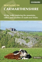 Wandelgids Walking in Carmarthenshire | Cicerone
This guidebook presents 30 contrasting day walks exploring the mountains, valleys and coastline of Carmarthernshire in south-west Wales. Ranging from 2 to 10 miles in length and suitable for walkers …
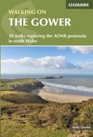 Wandelgids Walking on the Gower | Cicerone
Wandelgids met 30 wandelroutes in het zuiden van Wales This guidebook presents 30 circular day walks across the Gower Area of Outstanding Natural Beauty, taking in the rich variety of …
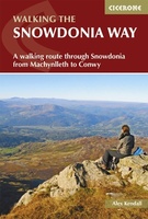 Wandelgids Snowdonia Way | Cicerone
Een beschrijving van de Snowdonia Way, goede beschrijving met gedetailleerd kaartmateriaal..Ook praktische informatie en hoogteprofielen per etappe. This guidebook describes the Snowdonia Way in Wales, a long-distance route through …
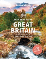 Reisgids Best Road Trips Great Britain - Groot Brittannië | Lonely Planet
Discover the freedom of the open road with Lonely Planet's Great Britain's Best Road Trips. This trusted travel companion features 36 amazing drives, from 3-day escapes to 3-week adventures. Explore …
 Wandelgids Pembrokeshire Coast Path | Trailblazer Guides
Goede wandelgids waarin met veel details alle etappes zijn beschreven. Tevens informatie over overnachtingen en openbaar vervoer. Practical guidebook to walking the Pembrokeshire Coast Path. The walk follows a National …
 Reisgids Experience Great Britain - Groot Brittannië | Lonely Planet
De nieuwste reisgidsen-serie van Lonely Planet: een luxe uitgave met als titel Experience waarin aandacht voor de belangrijkste niet te missen hoogtepunten van het land. Ook hier wordt het kort …
 Wandelkaart National 3 Peaks Challenge Map | Discovery Walking Guides
Goede scheur- en watervaste wandelkaart. National 3 Peaks Challenge Maps. Ben Nevis, Scafell Pike and Snowdon at 20k scale. Waterproof, tearproof and 100% recyclable 820mm by 420mm double sided map …
 Reisgids Wild Ruins B.C.: The Explorer's Guide to Britain’s Ancient Sites | Wild Things Publishing
Discover Britain's extraordinary prehistory in this handbook to its wildest and most beautiful ancient remains. The sequel to the best-selling Wild Ruins, 18,000 copies sold. Wild ruins B.C. reveals the …
★★★★★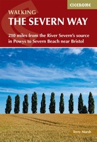 Wandelgids The Severn Way | Cicerone
Uitstekende wandelgids van de Severn Way, waarbij naast alle noodzakelijke informatie ook gebruik gemaakt wordt van de echte topografische kaart. Guidebook to walking the Severn Way, a 210 mile …
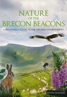 Natuurgids Nature of the Brecon Beacons | Pesda Press
Een gids met de meest voorkomende flora en fauna van de Brecon Beacons. Inclusief beschrijvingen en foto's. For most people wandering through the beautiful landscape of the Brecon Beacons …
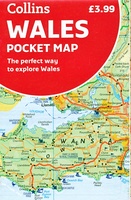 Wegenkaart - landkaart Pocket Map Wales | Collins
Kleine handzame kaart van Wales Handy little full colour map of Wales. Excellent value and very detailed for its size. Key features of this map include: • Clear mapping …
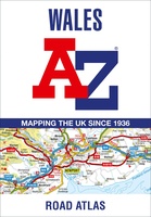 Wegenatlas Wales road atlas | A-Z Map Company
Handige wegenatlas op A5 formaat, makkelijk te gebruiken met grote letters en heel goed leesbaar. De schaal is behoorlijk gedetaileerd en zeker ook voor fietsers goed te gebruiken. Met veel …
Laatste reviews

Zoals altijd een prima gids van Cicerone, in feite onmisbare gids voor hiken in dit gebied. De gids bevat verschillende dagtochten van ± 1 tot …
★★★★★ door Pieter Boddaert 16 mei 2024 | Heeft dit artikel gekocht
Heel blij met de kaart geweest, uiteindelijk wel 5 keer per dag in handen gehad tijdens mijn tocht. Gebruikersvriendelijk en dankzij platsificeering ook uiterst geschickt …
★★★★★ door Jasmin 16 mei 2024 | Heeft dit artikel gekocht
Snelle levering
★★★★★ door Pierre 16 mei 2024 | Heeft dit artikel gekocht
Snelle levering
★★★★★ door Pierre Dilissen 16 mei 2024 | Heeft dit artikel gekocht