Winkelwagen
Geen items in winkelwagen
Ga naar winkelwagen
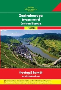
Wegenatlas - Atlas Autoatlas Centraal Europa | Freytag & Berndt (9783707907476)
- ISBN / CODE: 9783707907476
- Editie: 2012
- Schaal: 1:500000
- Uitgever: Freytag & Berndt
- Soort: Atlas, Wegenatlas
- Serie: Autoatlas
- Taal: Engels, Duits
- Beoordeling: 2,0 ★★★★★ (1 review) Schrijf een review
-
€ 23,50
Uitverkocht, nooit meer leverbaar
Beschrijving
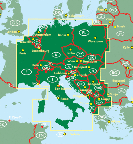
Voor de centraal europese landen Oostenrijk, Zwitserland, Tsjechische Republiek, Duitsland, Oost Frankrijk, Hongarije, Italie, Polen, Slowakije, Slowenie, Kroatie, Bosnie-Herzegovina, Servie, Montenegro, Kosovo, Macedonie, Albanie, Belgie, Nederland, Luxemburg
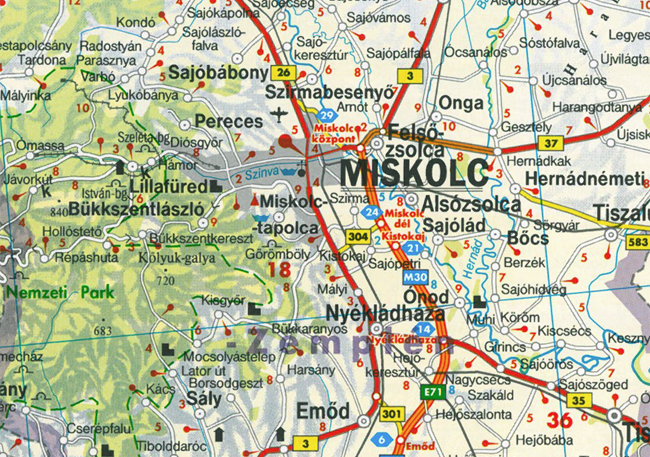
Gedetailleerde - gebonden - wegenatlas met uitgebreide legenda in 10 talen, toeristische informatie, plaatsnamenregister met postcodes.
Met plattegronden van: Amsterdam, Athene, Berlijn, Beograd, Bern, Bratislava, Brussel, Bukarest, Budapest, Chisnau, Dublin, Helsinki, Istanbul, Kopenhagen, Kiev, la Valetta, Lefkosia, Lissabon, London, Ljubliana, Luxemburg, Madrid, Minsk, Monaco, Moskau, Oslo, Parijs, Podgorica, Praag, Reykjavik, Riga, Rome, San Marino, Sarajevo, Skope, Sofia, Stockholm, Tallinn, Tirana, Vilnius, Warschau, Wenen, Zagbreb
This highly detailed atlas covers Germany, Netherlands, Belgium, Luxembourg, Switzerland, Liechtenstein, Austria, Slovenia, Croatia, Bosnia Herzegovina, Montenegro, Hungary, Slovakia, the Czech Republic and Poland, as well as the Russian oblast of Kaliningrad, most of the Italian territory (from Milan to Naples), Southern Denmark, and Eastern France.
The first section of the book covers speed limits, emergency numbers, and general overviews of the road networks in Central Europe.
The rest of the atlas shows the whole region, broken up into the various countries, at 1:500 000. An icon system is used to indicate loads of tourist information, such as:
All road types, railway lines and ferry routes
uresque towns, scenic routes, places of particular interest
que sites, places of worship, monuments and mines
Cabins, golf courses, camp sites, zoos, airports, marinas and other places of leisure
There's also find an extensive index of localities as well as plans for all the major cities in these countries. The legend and all information is in a multitude of languages, including English.
Reviews
Wegenatlas centraal Europa
Valt tegen door het ontbreken van onbedrukte rand waardoor het deels onbruikbaar is
★★★★★ door J van der Lelij 21 juli 2014Vond u dit een nuttige review? (login om te beoordelen)
Schrijf een review
Graag horen wij wat u van dit artikel vindt. Vindt u het goed, leuk, mooi, slecht, lelijk, onbruikbaar of erg handig: schrijf gerust alles op! Het is niet alleen leuk om te doen maar u informeert andere klanten er ook nog mee!
Alle gerelateerde rubrieken >
Ook interessant voor europa
-

Legpuzzel Crazy European Map | Educa
€ 12,99Legpuzzels - 500 stukjes Europa -

Reisgids Western Europe | Insight Gu
€ 26,95Reisgidsen Europa -

Campergids Met de camper door Europa
€ 20,50Campergidsen Europa -

Woordenboek Phrasebook & Dictionary
€ 9,50Woordenboeken & Taalgidsen Europa -

Wegenkaart - landkaart West Europa |
€ 14,95Wegenkaarten Europa