Wandkaart 22074 Frankrijk, België en Nederland, 60 x 77 cm | National Geographic (9780792249658)
Papieren versie

- ISBN / CODE: 9780792249658
- Editie: 27-09-2016
- Aantal blz.: 1
- Schaal: 1:1953000
- Uitgever: National Geographic
- Soort: Wandkaart van een land
- Taal: Engels
- Hoogte: 77.0 cm
- Breedte: 60.0 cm
- Gewicht: 54.0 g
- Uitvoering: Papier
- Cartografie: Politiek
- Bindwijze: -
- Schrijf als eerste een review
-
€ 25,95
Leverbaar in 3 - 5 werkdagen in huis in Nederland Levertijd Belgie
Gratis verzending in Nederland vanaf €50,-

Beschrijving
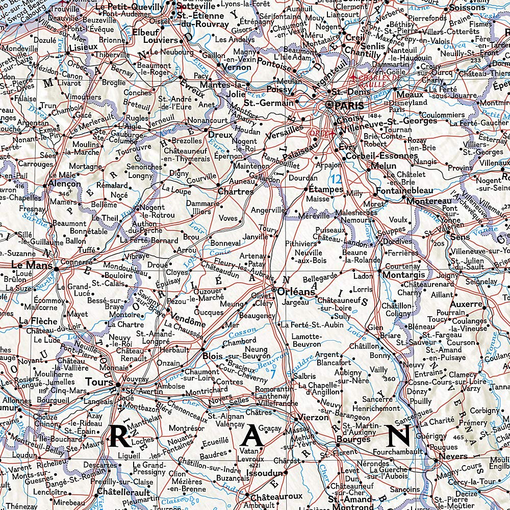
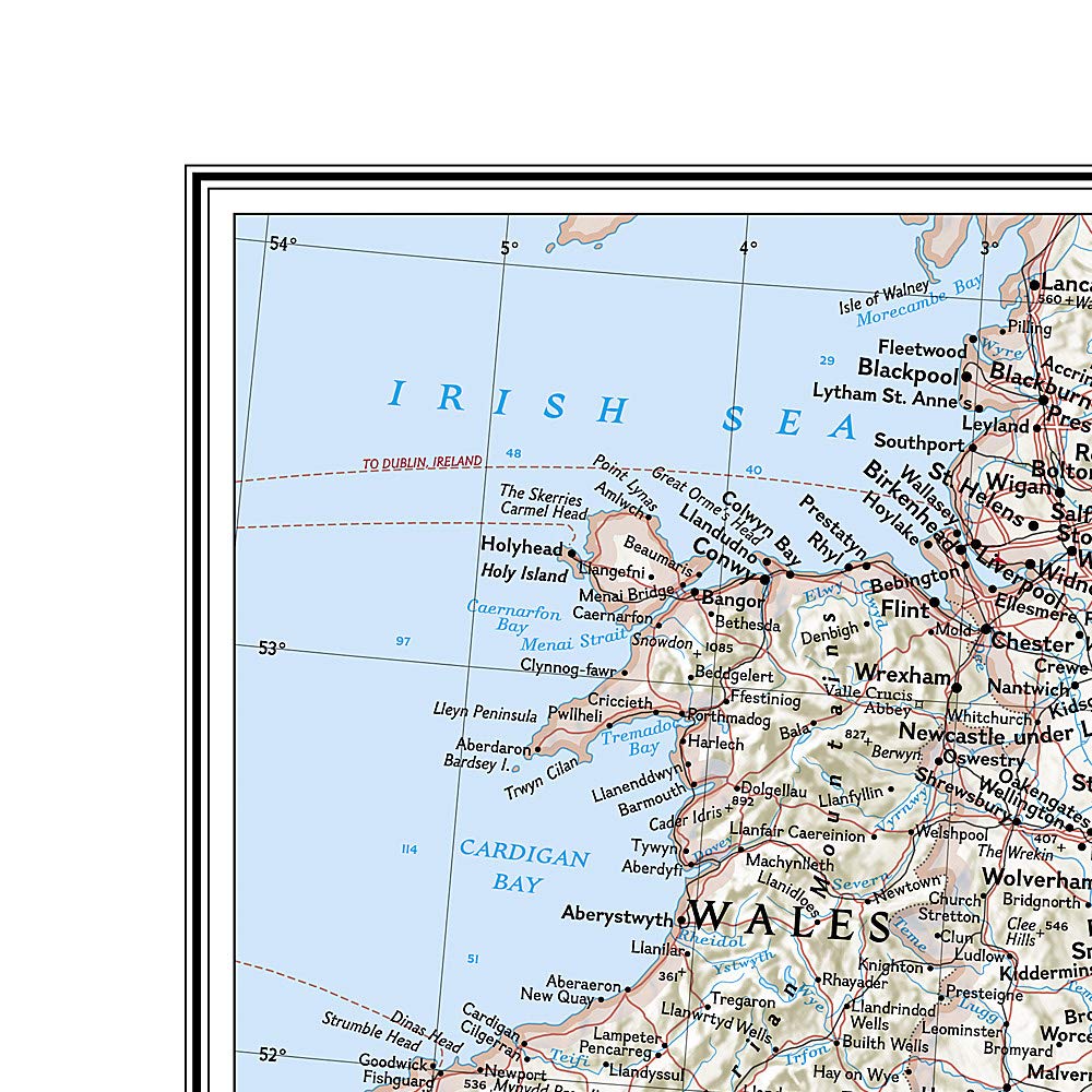
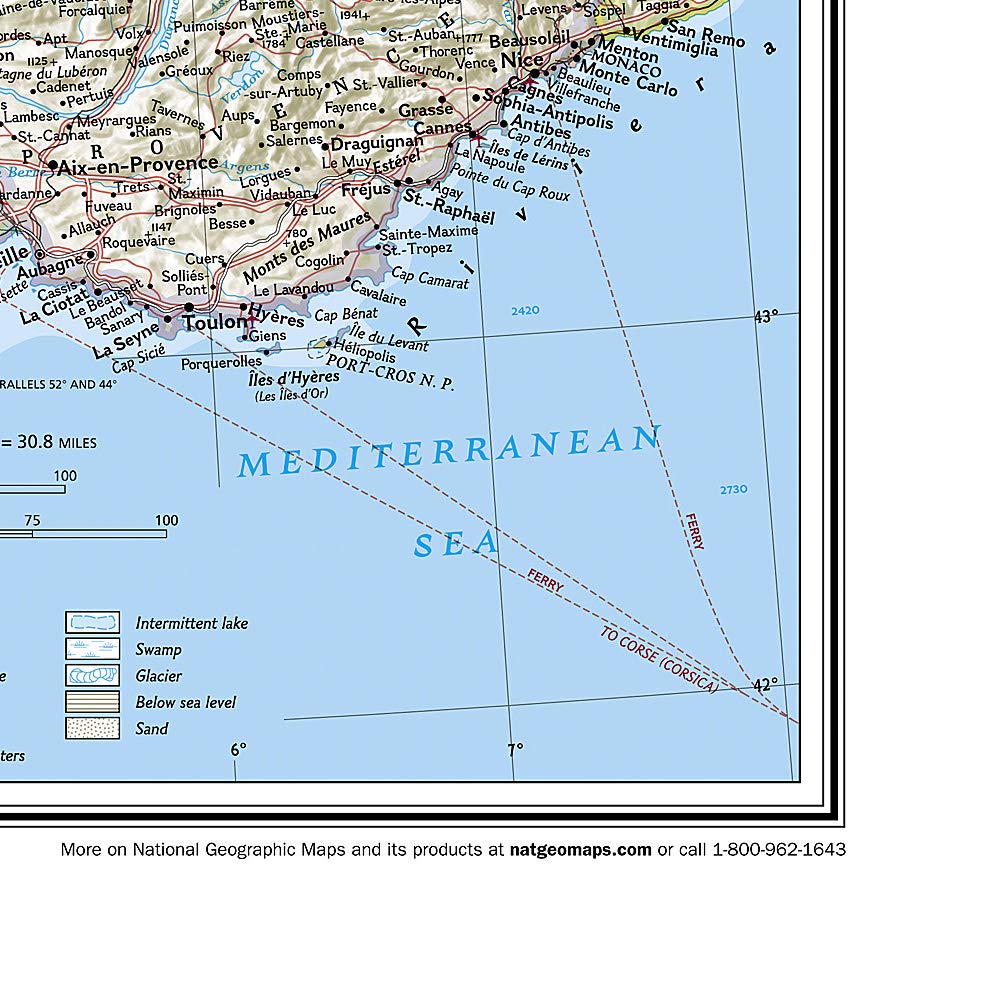
>Our classic wall map of France, Belgium, and the Netherlands shows political boundaries, major highways and roads, cities and towns, and a wealth of other incredibly accurate geographic detail.
France the map shows the division of the country into regions, with a list of their names and regional capitals (curiously, Corsica is not included on the map – what would Napoleon think of that?). The map also provides plenty of names of both geographical features (Pyrenees, Cevennes, etc) and the country’s traditional historical regions (Gascony, Maine, Bourbonais, etc). National parks are highlighted.
Within Belgium the map indicates the division into Flanders, Wallonia and the Brussels Region and in the Netherlands boundaries of the country’s administrative provinces are marked.
Topography is shown by relief shading and within the Netherlands the areas below the sea level are also indicated. The map shows the network of main road and rail connections, local airports, as well as ferry links.
Dit product heeft meerdere varianten:

Reviews
Geen reviews gevonden voor dit product.
Schrijf een review
Graag horen wij wat u van dit artikel vindt. Vindt u het goed, leuk, mooi, slecht, lelijk, onbruikbaar of erg handig: schrijf gerust alles op! Het is niet alleen leuk om te doen maar u informeert andere klanten er ook nog mee!
Ook interessant voor europa/belgie
-

Wandelgids 131 Brugse Ommeland - Iep
€ 22,50Wandelgidsen ♦ West-Vlaanderen (Provincie) -

Fietsgids Europaradweg R1 deel 3: L
€ 20,50Fietsgidsen Nordrhein-Westfalen -

Wegenkaart - landkaart 2 België en L
€ 12,99Wegenkaarten België -

Fietskaart 12 Luxemburg & Moezel | A
€ 17,95Fietskaarten ♦ Luxemburg BE (Provincie) -

Wandelkaart 172 Tussen Maas en Rijn
€ 10,95Wandelkaarten ♦ Luxemburg BE (Provincie)
Contactgegevens
T: +31 (0)50 - 3 12 69 50
E: info@dezwerver.nl
![]()
![]()
![]()
![]()
![]()
Bankgegevens
IBAN: NL11 RABO 0140 1961 88
BIC: RABONL2U
Kamer van Koophandel
Kvk: 75240440
BTW-nummer
NL 860203633 B01
BE 0541 545 456
Openingstijden klantenservice
- Maandag10.00 - 12.30 en 13.30 - 17.00
- Dinsdag10.00 - 12.30 en 13.30 - 17.00
- Woensdag10.00 - 12.30 en 13.30 - 17.00
- Donderdag10.00 - 12.30 en 13.30 - 17.00
- Vrijdag10.00 - 12.30 en 13.30 - 17.00
- Zaterdaggesloten
- Zondaggesloten
Nieuwsbrief
Op de hoogte blijven van nieuwe reisgidsen, travelgadgets en kaarten? Geef u op voor onze nieuwsbrief. U ontvangt de nieuwsbrief 1x per maand.
Bekijk hier onze laatste nieuwsbrief:
Onze laatste Nieuwsbrief